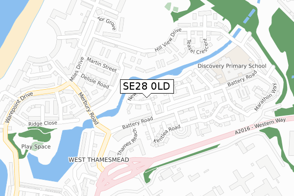
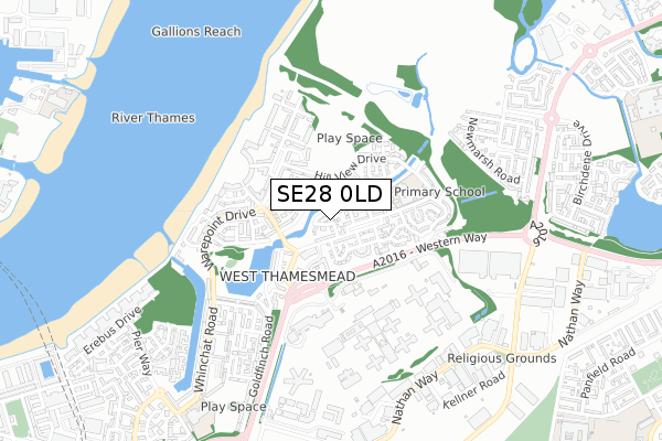
SE28 0LD lies on New Acres Road in London. SE28 0LD is located in the West Thamesmead electoral ward, within the London borough of Greenwich and the English Parliamentary constituency of Erith and Thamesmead. The Sub Integrated Care Board (ICB) Location is NHS South East London ICB - 72Q and the police force is Metropolitan Police. This postcode has been in use since December 2000.


GetTheData
Source: OS Open Zoomstack (Ordnance Survey)
Licence: Open Government Licence (requires attribution)
Attribution: Contains OS data © Crown copyright and database right 2024
Source: Open Postcode Geo
Licence: Open Government Licence (requires attribution)
Attribution: Contains OS data © Crown copyright and database right 2024; Contains Royal Mail data © Royal Mail copyright and database right 2024; Source: Office for National Statistics licensed under the Open Government Licence v.3.0
| Easting | 545246 |
| Northing | 179963 |
| Latitude | 51.499949 |
| Longitude | 0.091146 |
GetTheData
Source: Open Postcode Geo
Licence: Open Government Licence
| Street | New Acres Road |
| Town/City | London |
| Country | England |
| Postcode District | SE28 |
| ➜ SE28 open data dashboard ➜ See where SE28 is on a map ➜ Where is London? | |
GetTheData
Source: Land Registry Price Paid Data
Licence: Open Government Licence
Elevation or altitude of SE28 0LD as distance above sea level:
| Metres | Feet | |
|---|---|---|
| Elevation | 10m | 33ft |
Elevation is measured from the approximate centre of the postcode, to the nearest point on an OS contour line from OS Terrain 50, which has contour spacing of ten vertical metres.
➜ How high above sea level am I? Find the elevation of your current position using your device's GPS.
GetTheData
Source: Open Postcode Elevation
Licence: Open Government Licence
| Ward | West Thamesmead |
| Constituency | Erith And Thamesmead |
GetTheData
Source: ONS Postcode Database
Licence: Open Government Licence
24, NEW ACRES ROAD, LONDON, SE28 0LD 2016 17 OCT £420,000 |
2, NEW ACRES ROAD, LONDON, SE28 0LD 2007 11 DEC £276,000 |
27, NEW ACRES ROAD, LONDON, SE28 0LD 2006 23 OCT £249,995 |
25, NEW ACRES ROAD, LONDON, SE28 0LD 2004 30 NOV £229,995 |
24, NEW ACRES ROAD, LONDON, SE28 0LD 2002 30 SEP £195,000 |
2, NEW ACRES ROAD, LONDON, SE28 0LD 2001 17 DEC £174,995 |
1, NEW ACRES ROAD, LONDON, SE28 0LD 2001 14 DEC £176,995 |
32, NEW ACRES ROAD, LONDON, SE28 0LD 2001 30 APR £132,500 |
27, NEW ACRES ROAD, LONDON, SE28 0LD 2001 23 MAR £169,995 |
24, NEW ACRES ROAD, LONDON, SE28 0LD 2001 19 JAN £169,995 |
GetTheData
Source: HM Land Registry Price Paid Data
Licence: Contains HM Land Registry data © Crown copyright and database right 2024. This data is licensed under the Open Government Licence v3.0.
| January 2024 | Public order | On or near Nuthatch Gardens | 490m |
| November 2023 | Vehicle crime | On or near Nuthatch Gardens | 490m |
| November 2023 | Violence and sexual offences | On or near Nuthatch Gardens | 490m |
| ➜ Get more crime data in our Crime section | |||
GetTheData
Source: data.police.uk
Licence: Open Government Licence
| New Acres Road | Thamesmead Central | 114m |
| Kentlea Road | Thamesmead Central | 139m |
| Merbury Road | Thamesmead West | 198m |
| Merbury Road | Thamesmead West | 208m |
| Princess Alice (Western Way) | Thamesmead West | 231m |
| Gallions Reach Dlr Station (Royal Docks Road) | Gallions Reach | 1,688m |
| Woolwich Arsenal Dlr Station (Woolwich New Road) | Woolwich | 1,887m |
| Plumstead Station | 1.2km |
| Woolwich Arsenal Station | 1.9km |
| Abbey Wood (London) Station | 2.3km |
GetTheData
Source: NaPTAN
Licence: Open Government Licence
➜ Broadband speed and availability dashboard for SE28 0LD
| Percentage of properties with Next Generation Access | 100.0% |
| Percentage of properties with Superfast Broadband | 100.0% |
| Percentage of properties with Ultrafast Broadband | 0.0% |
| Percentage of properties with Full Fibre Broadband | 0.0% |
Superfast Broadband is between 30Mbps and 300Mbps
Ultrafast Broadband is > 300Mbps
| Median download speed | 38.2Mbps |
| Average download speed | 30.1Mbps |
| Maximum download speed | 68.51Mbps |
| Median upload speed | 9.5Mbps |
| Average upload speed | 7.6Mbps |
| Maximum upload speed | 18.44Mbps |
| Percentage of properties unable to receive 2Mbps | 0.0% |
| Percentage of properties unable to receive 5Mbps | 0.0% |
| Percentage of properties unable to receive 10Mbps | 0.0% |
| Percentage of properties unable to receive 30Mbps | 0.0% |
➜ Broadband speed and availability dashboard for SE28 0LD
GetTheData
Source: Ofcom
Licence: Ofcom Terms of Use (requires attribution)
Estimated total energy consumption in SE28 0LD by fuel type, 2015.
| Consumption (kWh) | 469,264 |
|---|---|
| Meter count | 37 |
| Mean (kWh/meter) | 12,683 |
| Median (kWh/meter) | 11,792 |
| Consumption (kWh) | 140,811 |
|---|---|
| Meter count | 38 |
| Mean (kWh/meter) | 3,706 |
| Median (kWh/meter) | 3,256 |
GetTheData
Source: Postcode level gas estimates: 2015 (experimental)
Source: Postcode level electricity estimates: 2015 (experimental)
Licence: Open Government Licence
GetTheData
Source: ONS Postcode Database
Licence: Open Government Licence


➜ Get more ratings from the Food Standards Agency
GetTheData
Source: Food Standards Agency
Licence: FSA terms & conditions
| Last Collection | |||
|---|---|---|---|
| Location | Mon-Fri | Sat | Distance |
| Warepoint Drive | 17:30 | 12:00 | 292m |
| Goldfinch Road | 17:30 | 12:00 | 437m |
| 113 Nathan Way | 17:30 | 12:00 | 707m |
GetTheData
Source: Dracos
Licence: Creative Commons Attribution-ShareAlike
| Facility | Distance |
|---|---|
| Hmp Belmarsh Belmarsh Road, London Artificial Grass Pitch | 362m |
| Hmp Thameside Griffin Manor Way, London Artificial Grass Pitch | 766m |
| Woolwich Polytechnic School For Girls Birchdene Drive, Birchdene Drive, London Sports Hall | 1km |
GetTheData
Source: Active Places
Licence: Open Government Licence
| School | Phase of Education | Distance |
|---|---|---|
| Discovery Primary School Battery Road, Thamesmead, London, SE28 0JN | Primary | 244m |
| Heronsgate Primary School Whinchat Road, London, SE28 0EA | Primary | 877m |
| Woolwich Polytechnic School Hutchins Road, Thamesmead, London, SE28 8AT | Secondary | 1.3km |
GetTheData
Source: Edubase
Licence: Open Government Licence
| Risk of SE28 0LD flooding from rivers and sea | Very Low |
| ➜ SE28 0LD flood map | |
GetTheData
Source: Open Flood Risk by Postcode
Licence: Open Government Licence
The below table lists the International Territorial Level (ITL) codes (formerly Nomenclature of Territorial Units for Statistics (NUTS) codes) and Local Administrative Units (LAU) codes for SE28 0LD:
| ITL 1 Code | Name |
|---|---|
| TLI | London |
| ITL 2 Code | Name |
| TLI5 | Outer London - East and North East |
| ITL 3 Code | Name |
| TLI51 | Bexley and Greenwich |
| LAU 1 Code | Name |
| E09000011 | Greenwich |
GetTheData
Source: ONS Postcode Directory
Licence: Open Government Licence
The below table lists the Census Output Area (OA), Lower Layer Super Output Area (LSOA), and Middle Layer Super Output Area (MSOA) for SE28 0LD:
| Code | Name | |
|---|---|---|
| OA | E00176528 | |
| LSOA | E01033741 | Greenwich 002G |
| MSOA | E02000314 | Greenwich 002 |
GetTheData
Source: ONS Postcode Directory
Licence: Open Government Licence
| SE28 0JL | Battery Road | 61m |
| SE28 0JS | Battery Road | 86m |
| SE28 0JR | Kentlea Road | 116m |
| SE28 0LT | Crowfoot Close | 120m |
| SE28 0LQ | Shepherds Lane | 122m |
| SE28 0LB | New Acres Road | 127m |
| SE28 0LR | Foxglove Path | 139m |
| SE28 0LG | Martins Place | 141m |
| SE28 0JP | Kentlea Road | 145m |
| SE28 0JT | Battery Road | 145m |
GetTheData
Source: Open Postcode Geo; Land Registry Price Paid Data
Licence: Open Government Licence