Hmp Belmarsh - London
Hmp Belmarsh is located in London (SE28), and offers Artificial Grass Pitch.
| Address | BELMARSH, 1, Belmarsh Road, London, SE28 0EB |
| Car Park | Yes |
| Car Park Capacity | 100 |
| Management Type | Other |
| Management Group | Others |
| Owner Type | Government |
| Owner Group | Others |
| Education Phase | Not applicable |
Aliases
Hmp Belmarsh is also known as:
Facilities
| Closure Date | 2nd May 2009 |
| Closure Reason | Strategic Review - facility/site to be replaced at existing site |
| Opening Date | 2nd Apr 1991 |
| Accessibility | Private Use |
| Management Type | Other |
| Year Built | 1991 |
| Changing Rooms | Yes |
| Date Record Created | 12th Apr 2018 |
| Date Record Checked | 20th Sep 2023 |
| Opening Times | Dawn To Dusk |
Facility specifics
| Area | 6111m² |
| Floodlit | No |
| Indoor | No |
| Length | 97m |
| Width | 63m |
| WR22 Compliant Pitch | No |
| Accessibility | Private Use |
| Management Type | Other |
| Year Built | 2008 |
| Changing Rooms | Yes |
| Date Record Created | 12th Apr 2018 |
| Date Record Checked | 20th Sep 2023 |
| Opening Times | Dawn To Dusk |
Facility specifics
| Area | 875m² |
| Fill | Yes - Rubber |
| Floodlit | No |
| Indoor | No |
| Length | 35m |
| Pile Length | 45mm |
| Width | 25m |
| WR22 Compliant Pitch | No |
| Accessibility | Private Use |
| Management Type | Other |
| Year Built | 2010 |
| Changing Rooms | Yes |
| Date Record Created | 12th Apr 2018 |
| Date Record Checked | 20th Sep 2023 |
| Opening Times | Dawn To Dusk |
Facility specifics
| Area | 1763m² |
| Fill | Yes - Rubber |
| Floodlit | No |
| Indoor | No |
| Length | 43m |
| Pile Length | 45mm |
| Width | 41m |
| WR22 Compliant Pitch | No |
Contact
| Contact Type | Enquiries |
| Telephone | 020 8331 4400 |
8192:str_replace(): Passing null to parameter #3 ($subject) of type array|string is deprecated
Where is Hmp Belmarsh?
8192:htmlspecialchars(): Passing null to parameter #1 ($string) of type string is deprecated
| Sub Building Name | |
| Building Name | BELMARSH |
| Building Number | 1 |
8192:htmlspecialchars(): Passing null to parameter #1 ($string) of type string is deprecated
| Dependent Thoroughfare | |
| Thoroughfare Name | BELMARSH ROAD |
8192:htmlspecialchars(): Passing null to parameter #1 ($string) of type string is deprecated
| Double Dependent Locality | |
8192:htmlspecialchars(): Passing null to parameter #1 ($string) of type string is deprecated
| Dependent Locality | |
| PostTown | LONDON |
| Postcode | SE28 0EB |
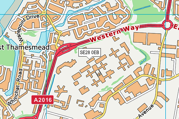
Hmp Belmarsh on a map

Hmp Belmarsh geodata
| Easting | 545364 |
| Northing | 179621 |
| Latitude | 51.496846 |
| Longitude | 0.092704 |
| Local Authority Name | Greenwich |
| Local Authority Code | E09000011 |
| Parliamentary Constituency Name | Erith and Thamesmead |
| Parliamentary Constituency Code | E14000696 |
| Region Name | London |
| Region Code | E15000007 |
| Ward Name | West Thamesmead |
| Ward Code | E05014091 |
| Output Area Code | E00176530 |
About this data
This data is open data sourced from Active Places Power and licenced under the Active Places Open Data Licence.
| toid | osgb1000001771848366 |
| Created On | 12th Apr 2018 |
| Audited On | 20th Sep 2023 |
| Checked On | 20th Sep 2023 |
