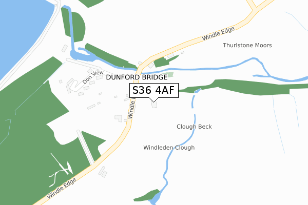
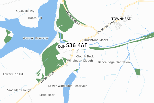
S36 4AF is located in the Penistone West electoral ward, within the metropolitan district of Barnsley and the English Parliamentary constituency of Penistone and Stocksbridge. The Sub Integrated Care Board (ICB) Location is NHS South Yorkshire ICB - 02P and the police force is South Yorkshire. This postcode has been in use since March 2019.


GetTheData
Source: OS Open Zoomstack (Ordnance Survey)
Licence: Open Government Licence (requires attribution)
Attribution: Contains OS data © Crown copyright and database right 2024
Source: Open Postcode Geo
Licence: Open Government Licence (requires attribution)
Attribution: Contains OS data © Crown copyright and database right 2024; Contains Royal Mail data © Royal Mail copyright and database right 2024; Source: Office for National Statistics licensed under the Open Government Licence v.3.0
| Easting | 415828 |
| Northing | 402320 |
| Latitude | 53.517336 |
| Longitude | -1.762763 |
GetTheData
Source: Open Postcode Geo
Licence: Open Government Licence
| Country | England |
| Postcode District | S36 |
| ➜ S36 open data dashboard ➜ See where S36 is on a map ➜ Where is Dunford Bridge? | |
GetTheData
Source: Land Registry Price Paid Data
Licence: Open Government Licence
| Ward | Penistone West |
| Constituency | Penistone And Stocksbridge |
GetTheData
Source: ONS Postcode Database
Licence: Open Government Licence
| May 2022 | Bicycle theft | On or near Parking Area | 78m |
| April 2022 | Anti-social behaviour | On or near Don View | 178m |
| April 2022 | Anti-social behaviour | On or near Don View | 178m |
| ➜ Get more crime data in our Crime section | |||
GetTheData
Source: data.police.uk
Licence: Open Government Licence
| Dunford Road (Dunford Bridge Car Park) | Dunford Bridge | 73m |
| Bridge Hill Road (Windle Edge) | Dunford Bridge | 153m |
| Townhead (Brook Hill Lane) | Townhead | 876m |
| Brook Hill Lane | Townhead | 876m |
| Harden Reservoir (Dunford Road) | Harden | 1,594m |
GetTheData
Source: NaPTAN
Licence: Open Government Licence
GetTheData
Source: ONS Postcode Database
Licence: Open Government Licence
| Last Collection | |||
|---|---|---|---|
| Location | Mon-Fri | Sat | Distance |
| South View Cottage | 17:30 | 10:15 | 234m |
| Townhead | 17:30 | 10:15 | 921m |
| Carlecotes | 17:30 | 09:30 | 2,167m |
GetTheData
Source: Dracos
Licence: Creative Commons Attribution-ShareAlike
| Facility | Distance |
|---|---|
| Flowery Fields Snittle Road, Hade Edge, Holmfirth Grass Pitches | 3km |
| Hepworth United Fc Far Lane, Hepworth, Holmfirth Grass Pitches | 3.8km |
| Hepworth Village Hall Town Gate, Hepworth, Holmfirth Sports Hall | 4.5km |
GetTheData
Source: Active Places
Licence: Open Government Licence
| School | Phase of Education | Distance |
|---|---|---|
| Hade Edge Junior, Infant and Nursery School Greave Road, Hade Edge, Holmfirth, HD9 2DF | Primary | 3.5km |
| Hepworth Junior and Infant School Maingate, Hepworth, Holmfirth, HD9 1TJ | Primary | 4.3km |
| Hinchliffe Mill Junior and Infant School Waterside Lane, Holmbridge, Holmfirth, HD9 2PF | Primary | 5.6km |
GetTheData
Source: Edubase
Licence: Open Government Licence
The below table lists the International Territorial Level (ITL) codes (formerly Nomenclature of Territorial Units for Statistics (NUTS) codes) and Local Administrative Units (LAU) codes for S36 4AF:
| ITL 1 Code | Name |
|---|---|
| TLE | Yorkshire and The Humber |
| ITL 2 Code | Name |
| TLE3 | South Yorkshire |
| ITL 3 Code | Name |
| TLE31 | Barnsley, Doncaster and Rotherham |
| LAU 1 Code | Name |
| E08000016 | Barnsley |
GetTheData
Source: ONS Postcode Directory
Licence: Open Government Licence
The below table lists the Census Output Area (OA), Lower Layer Super Output Area (LSOA), and Middle Layer Super Output Area (MSOA) for S36 4AF:
| Code | Name | |
|---|---|---|
| OA | E00037628 | |
| LSOA | E01007426 | Barnsley 027D |
| MSOA | E02001535 | Barnsley 027 |
GetTheData
Source: ONS Postcode Directory
Licence: Open Government Licence
| S36 4TF | 134m | |
| S36 4TE | Don View | 224m |
| S36 4TG | Townhead | 1044m |
| HD9 2RZ | Dunford Road | 1627m |
| HD9 2DE | Dunford Road | 2157m |
| S36 4TD | 2174m | |
| S36 4TB | Brook Hill | 2229m |
| HD9 2TB | Guinea Gate | 2580m |
| HD9 2TR | Penistone Road | 2675m |
| HD9 2SZ | Dunford Road | 2788m |
GetTheData
Source: Open Postcode Geo; Land Registry Price Paid Data
Licence: Open Government Licence