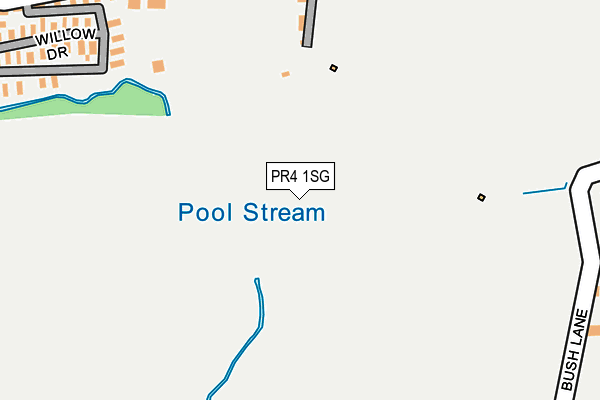
PR4 1SG is located in the Freckleton Village electoral ward, within the local authority district of Fylde and the English Parliamentary constituency of Fylde. The Sub Integrated Care Board (ICB) Location is NHS Lancashire and South Cumbria ICB - 02M and the police force is Lancashire. This postcode has been in use since July 2017.


GetTheData
Source: OS OpenMap – Local (Ordnance Survey)
Source: OS VectorMap District (Ordnance Survey)
Licence: Open Government Licence (requires attribution)
| Easting | 342519 |
| Northing | 427189 |
| Latitude | 53.737917 |
| Longitude | -2.872905 |
GetTheData
Source: Open Postcode Geo
Licence: Open Government Licence
| Country | England |
| Postcode District | PR4 |
| ➜ PR4 open data dashboard ➜ See where PR4 is on a map | |
GetTheData
Source: Land Registry Price Paid Data
Licence: Open Government Licence
| Ward | Freckleton Village |
| Constituency | Fylde |
GetTheData
Source: ONS Postcode Database
Licence: Open Government Licence
| Lamaleach Caravan Park (Larch Close) | Freckleton | 1,229m |
| Mill Lane (Lytham Road) | Warton | 1,685m |
| Mill Lane (Lytham Road) | Warton | 1,711m |
| Church Road (Lytham Road) | Warton | 1,896m |
| Church Road (Lytham Road) | Warton | 1,926m |
| Moss Side Station | 5.5km |
| Salwick Station | 6.1km |
GetTheData
Source: NaPTAN
Licence: Open Government Licence
GetTheData
Source: ONS Postcode Database
Licence: Open Government Licence


➜ Get more ratings from the Food Standards Agency
GetTheData
Source: Food Standards Agency
Licence: FSA terms & conditions
| Last Collection | |||
|---|---|---|---|
| Location | Mon-Fri | Sat | Distance |
| Harbour Lane | 16:30 | 09:00 | 2,066m |
| Dowbridge | 17:30 | 09:30 | 4,713m |
| 51 Kirkham Road, Freckleton | 16:00 | 09:45 | 4,750m |
GetTheData
Source: Dracos
Licence: Creative Commons Attribution-ShareAlike
| Facility | Distance |
|---|---|
| Bush Lane Playing Fields Bush Lane, Freckleton, Preston Grass Pitches | 1.4km |
| Bactive Fitness Centre Mill Lane, Warton, Preston Health and Fitness Gym, Sports Hall, Studio, Squash Courts, Artificial Grass Pitch | 1.4km |
| Holy Family Catholic Primary School Lytham Road, Warton, Preston Grass Pitches | 1.7km |
GetTheData
Source: Active Places
Licence: Open Government Licence
| School | Phase of Education | Distance |
|---|---|---|
| Holy Family Catholic Primary School, Warton Lytham Road, Warton, Preston, PR4 1AD | Primary | 1.7km |
| Warton St Paul's Church of England Primary Academy Lytham Road, Warton, Preston, PR4 1AH | Primary | 2km |
| Freckleton Church of England Primary School School Lane, Freckleton, Preston, PR4 1PJ | Primary | 2km |
GetTheData
Source: Edubase
Licence: Open Government Licence
The below table lists the International Territorial Level (ITL) codes (formerly Nomenclature of Territorial Units for Statistics (NUTS) codes) and Local Administrative Units (LAU) codes for PR4 1SG:
| ITL 1 Code | Name |
|---|---|
| TLD | North West (England) |
| ITL 2 Code | Name |
| TLD4 | Lancashire |
| ITL 3 Code | Name |
| TLD45 | Mid Lancashire |
| LAU 1 Code | Name |
| E07000119 | Fylde |
GetTheData
Source: ONS Postcode Directory
Licence: Open Government Licence
The below table lists the Census Output Area (OA), Lower Layer Super Output Area (LSOA), and Middle Layer Super Output Area (MSOA) for PR4 1SG:
| Code | Name | |
|---|---|---|
| OA | E00126893 | |
| LSOA | E01024999 | Fylde 007B |
| MSOA | E02005209 | Fylde 007 |
GetTheData
Source: ONS Postcode Directory
Licence: Open Government Licence
| PR4 1UN | Naze Lane East | 839m |
| PR4 1UL | The Crescent | 1042m |
| PR4 1SL | Green Lane West | 1259m |
| PR4 1SQ | Hodgson Avenue | 1289m |
| PR4 1SJ | Delany Drive | 1327m |
| PR4 1DJ | Rydal Avenue | 1331m |
| PR4 1DN | Calder Avenue | 1342m |
| PR4 1SP | Sedgley Avenue | 1362m |
| PR4 1RN | Green Lane | 1363m |
| PR4 1SN | Kimberley Close | 1389m |
GetTheData
Source: Open Postcode Geo; Land Registry Price Paid Data
Licence: Open Government Licence