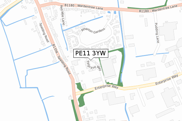
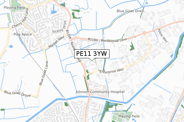
PE11 3YW is located in the Pinchbeck and Surfleet electoral ward, within the local authority district of South Holland and the English Parliamentary constituency of South Holland and The Deepings. The Sub Integrated Care Board (ICB) Location is NHS Lincolnshire ICB - 71E and the police force is Lincolnshire. This postcode has been in use since June 2018.


GetTheData
Source: OS Open Zoomstack (Ordnance Survey)
Licence: Open Government Licence (requires attribution)
Attribution: Contains OS data © Crown copyright and database right 2024
Source: Open Postcode Geo
Licence: Open Government Licence (requires attribution)
Attribution: Contains OS data © Crown copyright and database right 2024; Contains Royal Mail data © Royal Mail copyright and database right 2024; Source: Office for National Statistics licensed under the Open Government Licence v.3.0
| Easting | 524654 |
| Northing | 324715 |
| Latitude | 52.805612 |
| Longitude | -0.152247 |
GetTheData
Source: Open Postcode Geo
Licence: Open Government Licence
| Country | England |
| Postcode District | PE11 |
| ➜ PE11 open data dashboard ➜ See where PE11 is on a map ➜ Where is Pinchbeck? | |
GetTheData
Source: Land Registry Price Paid Data
Licence: Open Government Licence
Elevation or altitude of PE11 3YW as distance above sea level:
| Metres | Feet | |
|---|---|---|
| Elevation | 0m | 0ft |
Elevation is measured from the approximate centre of the postcode, to the nearest point on an OS contour line from OS Terrain 50, which has contour spacing of ten vertical metres.
➜ How high above sea level am I? Find the elevation of your current position using your device's GPS.
GetTheData
Source: Open Postcode Elevation
Licence: Open Government Licence
| Ward | Pinchbeck And Surfleet |
| Constituency | South Holland And The Deepings |
GetTheData
Source: ONS Postcode Database
Licence: Open Government Licence
2022 14 APR £251,000 |
1, PALGRAVE WAY, PINCHBECK, SPALDING, PE11 3YW 2020 31 JAN £199,995 |
23, PALGRAVE WAY, PINCHBECK, SPALDING, PE11 3YW 2019 28 FEB £249,995 |
2018 21 DEC £184,995 |
28, PALGRAVE WAY, PINCHBECK, SPALDING, PE11 3YW 2018 21 DEC £181,995 |
GetTheData
Source: HM Land Registry Price Paid Data
Licence: Contains HM Land Registry data © Crown copyright and database right 2024. This data is licensed under the Open Government Licence v3.0.
| June 2022 | Burglary | On or near Red Mile Lane | 296m |
| June 2022 | Criminal damage and arson | On or near Red Mile Lane | 296m |
| June 2022 | Anti-social behaviour | On or near Stapleton Way | 337m |
| ➜ Get more crime data in our Crime section | |||
GetTheData
Source: data.police.uk
Licence: Open Government Licence
| Wardentree Lane (Spalding Road) | Pinchbeck | 298m |
| Johnson Hospital (Pinchbeck Road) | Spalding | 402m |
| Wardentree Lane (Spalding Road) | Pinchbeck | 437m |
| Simmons Nursery (Market Way) | Pinchbeck | 558m |
| Simmons Nursery (Market Way) | Pinchbeck | 567m |
| Spalding Station | 1.9km |
GetTheData
Source: NaPTAN
Licence: Open Government Licence
| Percentage of properties with Next Generation Access | 100.0% |
| Percentage of properties with Superfast Broadband | 100.0% |
| Percentage of properties with Ultrafast Broadband | 100.0% |
| Percentage of properties with Full Fibre Broadband | 100.0% |
Superfast Broadband is between 30Mbps and 300Mbps
Ultrafast Broadband is > 300Mbps
| Percentage of properties unable to receive 2Mbps | 0.0% |
| Percentage of properties unable to receive 5Mbps | 0.0% |
| Percentage of properties unable to receive 10Mbps | 0.0% |
| Percentage of properties unable to receive 30Mbps | 0.0% |
GetTheData
Source: Ofcom
Licence: Ofcom Terms of Use (requires attribution)
GetTheData
Source: ONS Postcode Database
Licence: Open Government Licence


➜ Get more ratings from the Food Standards Agency
GetTheData
Source: Food Standards Agency
Licence: FSA terms & conditions
| Last Collection | |||
|---|---|---|---|
| Location | Mon-Fri | Sat | Distance |
| Fern Drive | 17:30 | 12:00 | 964m |
| Springfields | 17:40 | 12:00 | 1,765m |
| Spalding Delivery Office | 18:15 | 12:00 | 1,783m |
GetTheData
Source: Dracos
Licence: Creative Commons Attribution-ShareAlike
| Facility | Distance |
|---|---|
| Heroes Gym Edison Court, Pinchbeck, Spalding Health and Fitness Gym | 447m |
| Snap Fitness (Spalding) Wardentree Lane, Pinchbeck, Spalding Health and Fitness Gym | 1.3km |
| Pinchbeck East C Of E Primary Academy Fennell Road, Pinchbeck, Spalding Grass Pitches | 1.3km |
GetTheData
Source: Active Places
Licence: Open Government Licence
| School | Phase of Education | Distance |
|---|---|---|
| The Pinchbeck East Church of England Primary Academy Fennell Road, Pinchbeck, Spalding, PE11 3RP | Primary | 1.3km |
| Spalding Primary Academy Woolram Wygate, Spalding Primary Academy, Spalding, PE11 1PB | Primary | 1.5km |
| St Paul's Community Primary and Nursery School, Spalding Queens Road, Spalding, PE11 2JQ | Primary | 1.8km |
GetTheData
Source: Edubase
Licence: Open Government Licence
| Risk of PE11 3YW flooding from rivers and sea | Low |
| ➜ PE11 3YW flood map | |
GetTheData
Source: Open Flood Risk by Postcode
Licence: Open Government Licence
The below table lists the International Territorial Level (ITL) codes (formerly Nomenclature of Territorial Units for Statistics (NUTS) codes) and Local Administrative Units (LAU) codes for PE11 3YW:
| ITL 1 Code | Name |
|---|---|
| TLF | East Midlands (England) |
| ITL 2 Code | Name |
| TLF3 | Lincolnshire |
| ITL 3 Code | Name |
| TLF30 | Lincolnshire CC |
| LAU 1 Code | Name |
| E07000140 | South Holland |
GetTheData
Source: ONS Postcode Directory
Licence: Open Government Licence
The below table lists the Census Output Area (OA), Lower Layer Super Output Area (LSOA), and Middle Layer Super Output Area (MSOA) for PE11 3YW:
| Code | Name | |
|---|---|---|
| OA | E00133375 | |
| LSOA | E01026258 | South Holland 005B |
| MSOA | E02005469 | South Holland 005 |
GetTheData
Source: ONS Postcode Directory
Licence: Open Government Licence
| PE11 3UE | Spalding Road | 221m |
| PE11 3UF | Wardentree Lane | 272m |
| PE11 3UQ | Redmile Lane | 273m |
| PE11 3PB | Spalding Road | 325m |
| PE11 3UT | Redmile Close | 330m |
| PE11 3FX | Edison Court | 447m |
| PE11 3YR | Enterprise Way | 551m |
| PE11 3PE | Market Way | 562m |
| PE11 1GP | Springfield Walk | 569m |
| PE11 1GR | Gorse Way | 602m |
GetTheData
Source: Open Postcode Geo; Land Registry Price Paid Data
Licence: Open Government Licence