OX4 9QF open data databoard
OX4 9QF is located in the Littlemore electoral ward, within the local authority district of Oxford and the English Parliamentary constituency of Oxford East. The Sub Integrated Care Board (ICB) Location is NHS Buckinghamshire, Oxfordshire and Berkshire West ICB - 10Q and the police force is Thames Valley. This postcode has been in use since July 2023.
OX4 9QF geodata
| Easting | 454431 |
| Northing | 202947 |
| Latitude | 51.722617 |
| Longitude | -1.213389 |
Where is OX4 9QF?
| Country | England |
| Postcode District | OX4 |
Politics
| Ward | Littlemore |
|---|
| Constituency | Oxford East |
|---|
Transport
Nearest bus stops to OX4 9QF
| Sheldon Way (Herschel Crescent) | Littlemore | 245m |
| Sheldon Way (Herschel Crescent) | Littlemore | 264m |
| Herschel Crescent (Bodley Road) | Littlemore | 347m |
| Herschel Crescent (Bodley Road) | Littlemore | 347m |
| Long Lane | Littlemore | 356m |
Nearest railway stations to OX4 9QF
| Radley Station | 4.5km |
| Oxford Station | 5.2km |
Deprivation
44.4% of English postcodes are less deprived than
OX4 9QF:
Food Standards Agency
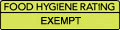
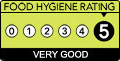
Three nearest food hygiene ratings to OX4 9QF (metres)
Salon Services Ltd
3 Nuffield Industrial Estate
77m
The Oxford Academy
Littlemore Pre School
Littlemore Community Centre
430m
➜ Get more ratings from the Food Standards Agency
Nearest post box to OX4 9QF
| | Last Collection | |
|---|
| Location | Mon-Fri | Sat | Distance |
|---|
| Sandy Lane West | 17:15 | 11:30 | 155m |
| St Nicholas Road | 17:00 | 11:30 | 462m |
| Brambling Way | 17:00 | 12:00 | 467m |
OX4 9QF ITL and OX4 9QF LAU
The below table lists the International Territorial Level (ITL) codes (formerly Nomenclature of Territorial Units for Statistics (NUTS) codes) and Local Administrative Units (LAU) codes for OX4 9QF:
| ITL 1 Code | Name |
|---|
| TLJ | South East (England) |
| ITL 2 Code | Name |
|---|
| TLJ1 | Berkshire, Buckinghamshire and Oxfordshire |
| ITL 3 Code | Name |
|---|
| TLJ14 | Oxfordshire CC |
| LAU 1 Code | Name |
|---|
| E07000178 | Oxford |
OX4 9QF census areas
The below table lists the Census Output Area (OA), Lower Layer Super Output Area (LSOA), and Middle Layer Super Output Area (MSOA) for OX4 9QF:
| Code | Name |
|---|
| OA | E00145471 | |
|---|
| LSOA | E01028555 | Oxford 016D |
|---|
| MSOA | E02005955 | Oxford 016 |
|---|
Nearest postcodes to OX4 9QF