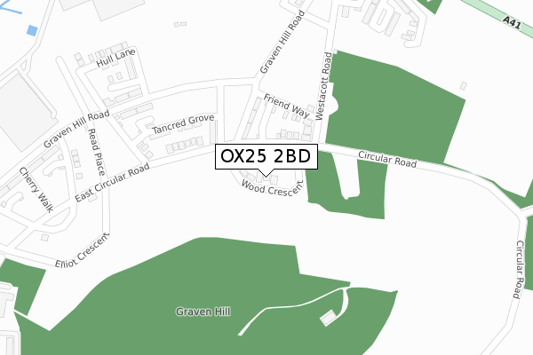
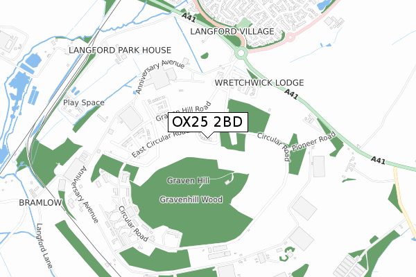
OX25 2BD is located in the Bicester South and Ambrosden electoral ward, within the local authority district of Cherwell and the English Parliamentary constituency of Banbury. The Sub Integrated Care Board (ICB) Location is NHS Buckinghamshire, Oxfordshire and Berkshire West ICB - 10Q and the police force is Thames Valley. This postcode has been in use since June 2018.


GetTheData
Source: OS Open Zoomstack (Ordnance Survey)
Licence: Open Government Licence (requires attribution)
Attribution: Contains OS data © Crown copyright and database right 2024
Source: Open Postcode Geo
Licence: Open Government Licence (requires attribution)
Attribution: Contains OS data © Crown copyright and database right 2024; Contains Royal Mail data © Royal Mail copyright and database right 2024; Source: Office for National Statistics licensed under the Open Government Licence v.3.0
| Easting | 458923 |
| Northing | 220706 |
| Latitude | 51.881820 |
| Longitude | -1.145353 |
GetTheData
Source: Open Postcode Geo
Licence: Open Government Licence
| Country | England |
| Postcode District | OX25 |
| ➜ OX25 open data dashboard ➜ See where OX25 is on a map | |
GetTheData
Source: Land Registry Price Paid Data
Licence: Open Government Licence
| Ward | Bicester South And Ambrosden |
| Constituency | Banbury |
GetTheData
Source: ONS Postcode Database
Licence: Open Government Licence
| Rodney House (London Road) | Graven Hill | 644m |
| Rodney House (London Road) | Graven Hill | 660m |
| Ravencroft (Peregrine Way) | Langford Village | 855m |
| Ravencroft (Peregrine Way) | Langford Village | 872m |
| Bicester Village Station (London Road) | Bicester | 1,198m |
| Bicester Village Station | 1.3km |
| Bicester North Station | 2.4km |
GetTheData
Source: NaPTAN
Licence: Open Government Licence
➜ Broadband speed and availability dashboard for OX25 2BD
| Percentage of properties with Next Generation Access | 100.0% |
| Percentage of properties with Superfast Broadband | 100.0% |
| Percentage of properties with Ultrafast Broadband | 100.0% |
| Percentage of properties with Full Fibre Broadband | 100.0% |
Superfast Broadband is between 30Mbps and 300Mbps
Ultrafast Broadband is > 300Mbps
| Median download speed | 360.0Mbps |
| Average download speed | 360.0Mbps |
| Maximum download speed | 360.00Mbps |
| Median upload speed | 360.0Mbps |
| Average upload speed | 360.0Mbps |
| Maximum upload speed | 360.00Mbps |
| Percentage of properties unable to receive 2Mbps | 0.0% |
| Percentage of properties unable to receive 5Mbps | 0.0% |
| Percentage of properties unable to receive 10Mbps | 0.0% |
| Percentage of properties unable to receive 30Mbps | 0.0% |
➜ Broadband speed and availability dashboard for OX25 2BD
GetTheData
Source: Ofcom
Licence: Ofcom Terms of Use (requires attribution)
GetTheData
Source: ONS Postcode Database
Licence: Open Government Licence


➜ Get more ratings from the Food Standards Agency
GetTheData
Source: Food Standards Agency
Licence: FSA terms & conditions
| Last Collection | |||
|---|---|---|---|
| Location | Mon-Fri | Sat | Distance |
| Kingfisher Way | 16:00 | 10:30 | 1,029m |
| Perigrine Way | 16:00 | 10:30 | 1,160m |
| Mallards Way Jct Corncrake Way | 16:00 | 10:30 | 1,504m |
GetTheData
Source: Dracos
Licence: Creative Commons Attribution-ShareAlike
| Facility | Distance |
|---|---|
| The Fitness Company (Closed) Mckay Trading Estate, Station Approach, Bicester Health and Fitness Gym, Studio | 1.3km |
| Bicester Fields Chaffinch Road, Bicester Grass Pitches | 1.4km |
| Pingle Field Oxford Road, Bicester Grass Pitches | 1.5km |
GetTheData
Source: Active Places
Licence: Open Government Licence
| School | Phase of Education | Distance |
|---|---|---|
| Langford Village Community Primary School Peregrine Way, Bicester, OX26 6SX | Primary | 1.1km |
| Whitelands Academy Hexham Road, Bicester, OX26 1AY | Secondary | 1.7km |
| St Edburg's Church of England (VA) School Pioneer Way, Bicester, OX26 1BF | Primary | 1.9km |
GetTheData
Source: Edubase
Licence: Open Government Licence
The below table lists the International Territorial Level (ITL) codes (formerly Nomenclature of Territorial Units for Statistics (NUTS) codes) and Local Administrative Units (LAU) codes for OX25 2BD:
| ITL 1 Code | Name |
|---|---|
| TLJ | South East (England) |
| ITL 2 Code | Name |
| TLJ1 | Berkshire, Buckinghamshire and Oxfordshire |
| ITL 3 Code | Name |
| TLJ14 | Oxfordshire CC |
| LAU 1 Code | Name |
| E07000177 | Cherwell |
GetTheData
Source: ONS Postcode Directory
Licence: Open Government Licence
The below table lists the Census Output Area (OA), Lower Layer Super Output Area (LSOA), and Middle Layer Super Output Area (MSOA) for OX25 2BD:
| Code | Name | |
|---|---|---|
| OA | E00169028 | |
| LSOA | E01028425 | Cherwell 011A |
| MSOA | E02005931 | Cherwell 011 |
GetTheData
Source: ONS Postcode Directory
Licence: Open Government Licence
| OX26 6YA | Kestrel Way | 677m |
| OX26 6XJ | Robins Way | 738m |
| OX26 6XD | Goldcrest Way | 760m |
| OX26 6XZ | Kestrel Way | 760m |
| OX26 6XL | Goldcrest Way | 786m |
| OX26 6YX | Swansfield | 793m |
| OX26 6HD | London Road | 807m |
| OX26 6XA | Martin Close | 833m |
| OX26 6XN | Jay Close | 836m |
| OX25 2JS | Ploughley Road | 877m |
GetTheData
Source: Open Postcode Geo; Land Registry Price Paid Data
Licence: Open Government Licence