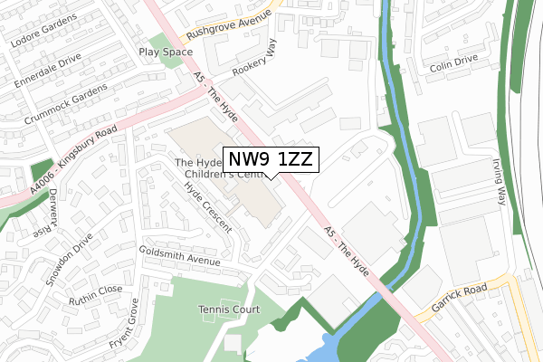
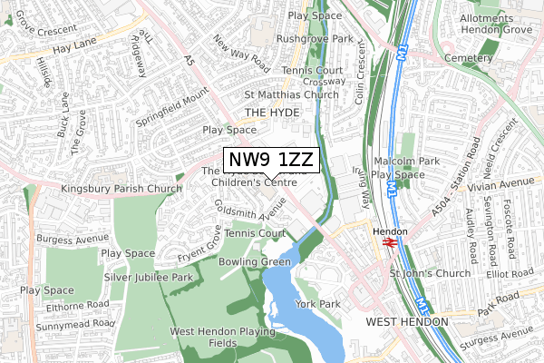
NW9 1ZZ is located in the West Hendon electoral ward, within the London borough of Barnet and the English Parliamentary constituency of Hendon. The Sub Integrated Care Board (ICB) Location is NHS North Central London ICB - 93C and the police force is Metropolitan Police. This postcode has been in use since September 2019.


GetTheData
Source: OS Open Zoomstack (Ordnance Survey)
Licence: Open Government Licence (requires attribution)
Attribution: Contains OS data © Crown copyright and database right 2024
Source: Open Postcode Geo
Licence: Open Government Licence (requires attribution)
Attribution: Contains OS data © Crown copyright and database right 2024; Contains Royal Mail data © Royal Mail copyright and database right 2024; Source: Office for National Statistics licensed under the Open Government Licence v.3.0
| Easting | 521584 |
| Northing | 188555 |
| Latitude | 51.582751 |
| Longitude | -0.246570 |
GetTheData
Source: Open Postcode Geo
Licence: Open Government Licence
| Country | England |
| Postcode District | NW9 |
| ➜ NW9 open data dashboard ➜ See where NW9 is on a map | |
GetTheData
Source: Land Registry Price Paid Data
Licence: Open Government Licence
| Ward | West Hendon |
| Constituency | Hendon |
GetTheData
Source: ONS Postcode Database
Licence: Open Government Licence
| June 2022 | Burglary | On or near Nightclub | 92m |
| June 2022 | Drugs | On or near Nightclub | 92m |
| June 2022 | Public order | On or near Nightclub | 92m |
| ➜ Get more crime data in our Crime section | |||
GetTheData
Source: data.police.uk
Licence: Open Government Licence
| Hendon Magistrates Court (Broadway) | The Hyde | 120m |
| Kingsbury Road (Broadway) | The Hyde | 148m |
| Hendon Magistrates Court (The Hyde) | The Hyde | 198m |
| Edgware Road The Hyde (Kingsbury Road) | The Hyde | 211m |
| Edgware Road The Hyde | The Hyde | 246m |
| Hendon Central Underground Station | Hendon Central | 1,399m |
| Colindale Underground Station | Colindale | 1,429m |
| Hendon Station | 0.6km |
| Mill Hill Broadway Station | 3.4km |
| Cricklewood Station | 3.6km |
GetTheData
Source: NaPTAN
Licence: Open Government Licence
GetTheData
Source: ONS Postcode Database
Licence: Open Government Licence


➜ Get more ratings from the Food Standards Agency
GetTheData
Source: Food Standards Agency
Licence: FSA terms & conditions
| Last Collection | |||
|---|---|---|---|
| Location | Mon-Fri | Sat | Distance |
| The Hyde Delivery Office | 18:00 | 12:00 | 25m |
| Goldsmith Avenue | 17:30 | 12:00 | 271m |
| 136 Colin Gardens | 17:30 | 12:00 | 398m |
GetTheData
Source: Dracos
Licence: Creative Commons Attribution-ShareAlike
| Facility | Distance |
|---|---|
| The Hyde (Closed) Hyde Crescent, London Grass Pitches | 47m |
| The Hyde School Hyde Crescent, London Grass Pitches, Artificial Grass Pitch | 84m |
| Fit Lady Gym (Closed) Goldsmith Avenue, London Health and Fitness Gym | 146m |
GetTheData
Source: Active Places
Licence: Open Government Licence
| School | Phase of Education | Distance |
|---|---|---|
| The Hyde School Hyde Crescent, London, NW9 7EY | Primary | 117m |
| Beis Medrash Elyon 233 West Hendon Broadway, West Hendon, London, NW9 7DH | Not applicable | 540m |
| Beis Soroh Schneirer Arbiter House, Wilberforce Road, West Hendon, NW9 6AX | Not applicable | 573m |
GetTheData
Source: Edubase
Licence: Open Government Licence
The below table lists the International Territorial Level (ITL) codes (formerly Nomenclature of Territorial Units for Statistics (NUTS) codes) and Local Administrative Units (LAU) codes for NW9 1ZZ:
| ITL 1 Code | Name |
|---|---|
| TLI | London |
| ITL 2 Code | Name |
| TLI7 | Outer London - West and North West |
| ITL 3 Code | Name |
| TLI71 | Barnet |
| LAU 1 Code | Name |
| E09000003 | Barnet |
GetTheData
Source: ONS Postcode Directory
Licence: Open Government Licence
The below table lists the Census Output Area (OA), Lower Layer Super Output Area (LSOA), and Middle Layer Super Output Area (MSOA) for NW9 1ZZ:
| Code | Name | |
|---|---|---|
| OA | E00001504 | |
| LSOA | E01000308 | Barnet 036D |
| MSOA | E02000059 | Barnet 036 |
GetTheData
Source: ONS Postcode Directory
Licence: Open Government Licence
| NW9 7ET | Goldsmith Avenue | 110m |
| NW9 7EY | Hyde Crescent | 117m |
| NW9 7HA | Hyde Crescent | 149m |
| NW9 7EU | Goldsmith Avenue | 155m |
| NW9 6LE | The Hyde | 170m |
| NW9 7HN | Reets Farm Close | 182m |
| NW9 7EX | Goldsmith Avenue | 184m |
| NW9 7HD | Goldsmith Avenue | 201m |
| NW9 7EZ | Gadsbury Close | 208m |
| NW9 7HY | Kingsbury Road | 220m |
GetTheData
Source: Open Postcode Geo; Land Registry Price Paid Data
Licence: Open Government Licence