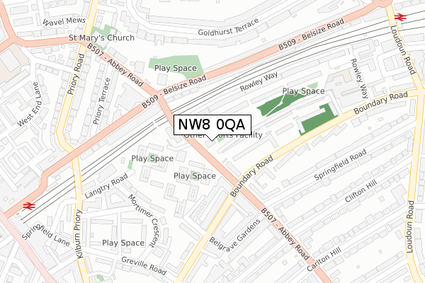
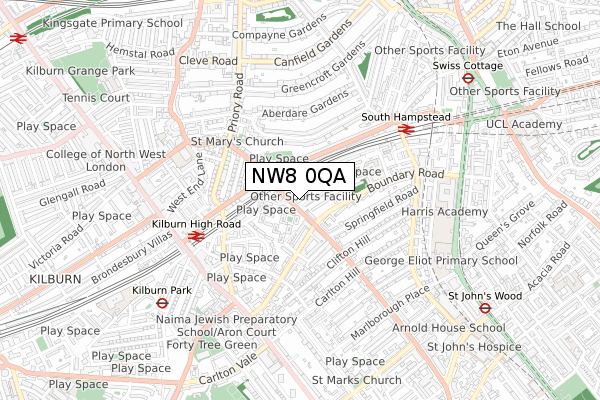
NW8 0QA is located in the Kilburn electoral ward, within the London borough of Camden and the English Parliamentary constituency of Hampstead and Kilburn. The Sub Integrated Care Board (ICB) Location is NHS North Central London ICB - 93C and the police force is Metropolitan Police. This postcode has been in use since February 2019.


GetTheData
Source: OS Open Zoomstack (Ordnance Survey)
Licence: Open Government Licence (requires attribution)
Attribution: Contains OS data © Crown copyright and database right 2024
Source: Open Postcode Geo
Licence: Open Government Licence (requires attribution)
Attribution: Contains OS data © Crown copyright and database right 2024; Contains Royal Mail data © Royal Mail copyright and database right 2024; Source: Office for National Statistics licensed under the Open Government Licence v.3.0
| Easting | 525936 |
| Northing | 183778 |
| Latitude | 51.538865 |
| Longitude | -0.185502 |
GetTheData
Source: Open Postcode Geo
Licence: Open Government Licence
| Country | England |
| Postcode District | NW8 |
| ➜ NW8 open data dashboard ➜ See where NW8 is on a map ➜ Where is Hampstead? | |
GetTheData
Source: Land Registry Price Paid Data
Licence: Open Government Licence
| Ward | Kilburn |
| Constituency | Hampstead And Kilburn |
GetTheData
Source: ONS Postcode Database
Licence: Open Government Licence
| January 2024 | Burglary | On or near Greville Road | 392m |
| December 2023 | Anti-social behaviour | On or near Greville Road | 392m |
| December 2023 | Anti-social behaviour | On or near Greville Road | 392m |
| ➜ Get more crime data in our Crime section | |||
GetTheData
Source: data.police.uk
Licence: Open Government Licence
| Belsize Road South Hampstead | South Hampstead | 67m |
| Boundary Road South Hampstead (Abbey Road) | South Hampstead | 82m |
| Abbey Road South Hampstead | South Hampstead | 147m |
| Boundary Road South Hampstead (Abbey Road) | South Hampstead | 168m |
| Abbey Road South Hampstead | South Hampstead | 184m |
| Kilburn Park Underground Station | Kilburn Park | 743m |
| Swiss Cottage Underground Station | Swiss Cottage | 912m |
| St. John's Wood Underground Station | St Johns Wood | 937m |
| West Hampstead Underground Station | West Hampstead | 946m |
| Finchley Road Underground Station | Finchley Road | 969m |
| Kilburn High Road Station | 0.5km |
| South Hampstead Station | 0.5km |
| West Hampstead Station | 1km |
GetTheData
Source: NaPTAN
Licence: Open Government Licence
GetTheData
Source: ONS Postcode Database
Licence: Open Government Licence


➜ Get more ratings from the Food Standards Agency
GetTheData
Source: Food Standards Agency
Licence: FSA terms & conditions
| Last Collection | |||
|---|---|---|---|
| Location | Mon-Fri | Sat | Distance |
| Abbey Road | 17:30 | 12:00 | 37m |
| 108 Boundary Road | 17:30 | 12:00 | 161m |
| Mortimer Crescent | 17:30 | 12:00 | 222m |
GetTheData
Source: Dracos
Licence: Creative Commons Attribution-ShareAlike
| Facility | Distance |
|---|---|
| Jack Taylor School (Closed) Ainsworth Way, London Sports Hall | 324m |
| Bannatyne Health Club (Maida Vale) Greville Road, London Health and Fitness Gym, Swimming Pool, Studio | 482m |
| Energie Fitness (Kilburn) Kilburn High Road, London Health and Fitness Gym | 495m |
GetTheData
Source: Active Places
Licence: Open Government Licence
| School | Phase of Education | Distance |
|---|---|---|
| St Mary's Kilburn Church of England Primary School Quex Road, Kilburn, London, NW6 4PG | Primary | 568m |
| Naima Jewish Preparatory School 21 Andover Place, London, NW6 5ED | Not applicable | 595m |
| George Eliot Primary School Marlborough Hill, St John's Wood, London, NW8 0NH | Primary | 599m |
GetTheData
Source: Edubase
Licence: Open Government Licence
The below table lists the International Territorial Level (ITL) codes (formerly Nomenclature of Territorial Units for Statistics (NUTS) codes) and Local Administrative Units (LAU) codes for NW8 0QA:
| ITL 1 Code | Name |
|---|---|
| TLI | London |
| ITL 2 Code | Name |
| TLI3 | Inner London - West |
| ITL 3 Code | Name |
| TLI31 | Camden and City of London |
| LAU 1 Code | Name |
| E09000007 | Camden |
GetTheData
Source: ONS Postcode Directory
Licence: Open Government Licence
The below table lists the Census Output Area (OA), Lower Layer Super Output Area (LSOA), and Middle Layer Super Output Area (MSOA) for NW8 0QA:
| Code | Name | |
|---|---|---|
| OA | E00004633 | |
| LSOA | E01000934 | Camden 020D |
| MSOA | E02000185 | Camden 020 |
GetTheData
Source: ONS Postcode Directory
Licence: Open Government Licence
| NW8 0BL | Abbey Road | 60m |
| NW8 0HY | Boundary Road | 63m |
| NW8 0SF | Rowley Way | 74m |
| NW8 0BS | Abbey Road | 81m |
| NW8 0SQ | Rowley Way | 86m |
| NW8 0BB | Abbey Road | 95m |
| NW8 0BD | Abbey Road | 95m |
| NW8 0AH | Abbey Road | 99m |
| NW8 0HX | Boundary Road | 104m |
| NW8 0AG | Abbey Road | 108m |
GetTheData
Source: Open Postcode Geo; Land Registry Price Paid Data
Licence: Open Government Licence