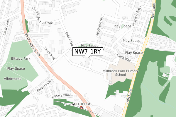
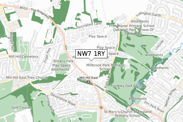
NW7 1RY is located in the Totteridge & Woodside electoral ward, within the London borough of Barnet and the English Parliamentary constituency of Hendon. The Sub Integrated Care Board (ICB) Location is NHS North Central London ICB - 93C and the police force is Metropolitan Police. This postcode has been in use since March 2019.


GetTheData
Source: OS Open Zoomstack (Ordnance Survey)
Licence: Open Government Licence (requires attribution)
Attribution: Contains OS data © Crown copyright and database right 2024
Source: Open Postcode Geo
Licence: Open Government Licence (requires attribution)
Attribution: Contains OS data © Crown copyright and database right 2024; Contains Royal Mail data © Royal Mail copyright and database right 2024; Source: Office for National Statistics licensed under the Open Government Licence v.3.0
| Easting | 524090 |
| Northing | 191728 |
| Latitude | 51.610721 |
| Longitude | -0.209299 |
GetTheData
Source: Open Postcode Geo
Licence: Open Government Licence
| Country | England |
| Postcode District | NW7 |
| ➜ NW7 open data dashboard ➜ See where NW7 is on a map ➜ Where is London? | |
GetTheData
Source: Land Registry Price Paid Data
Licence: Open Government Licence
| Ward | Totteridge & Woodside |
| Constituency | Hendon |
GetTheData
Source: ONS Postcode Database
Licence: Open Government Licence
| January 2024 | Violence and sexual offences | On or near Westlinton Close | 395m |
| October 2023 | Anti-social behaviour | On or near Westlinton Close | 395m |
| August 2023 | Criminal damage and arson | On or near Westlinton Close | 395m |
| ➜ Get more crime data in our Crime section | |||
GetTheData
Source: data.police.uk
Licence: Open Government Licence
| Inglis Way | Mill Hill East | 132m |
| Inglis Way | Mill Hill East | 143m |
| Royal Engineers Way | Mill Hill East | 160m |
| Millbrook Park | Mill Hill East | 171m |
| Sanders Lane | Mill Hill East | 209m |
| Mill Hill East Underground Station | Mill Hill East | 281m |
| West Finchley Underground Station | West Finchley | 1,459m |
| Finchley Central Underground Station | Finchley Central | 1,594m |
| Mill Hill Broadway Station | 2.8km |
| Hendon Station | 4km |
| Oakleigh Park Station | 4.2km |
GetTheData
Source: NaPTAN
Licence: Open Government Licence
| Percentage of properties with Next Generation Access | 90.0% |
| Percentage of properties with Superfast Broadband | 90.0% |
| Percentage of properties with Ultrafast Broadband | 87.1% |
| Percentage of properties with Full Fibre Broadband | 87.1% |
Superfast Broadband is between 30Mbps and 300Mbps
Ultrafast Broadband is > 300Mbps
| Percentage of properties unable to receive 2Mbps | 0.0% |
| Percentage of properties unable to receive 5Mbps | 0.0% |
| Percentage of properties unable to receive 10Mbps | 0.0% |
| Percentage of properties unable to receive 30Mbps | 0.0% |
GetTheData
Source: Ofcom
Licence: Ofcom Terms of Use (requires attribution)
GetTheData
Source: ONS Postcode Database
Licence: Open Government Licence


➜ Get more ratings from the Food Standards Agency
GetTheData
Source: Food Standards Agency
Licence: FSA terms & conditions
| Last Collection | |||
|---|---|---|---|
| Location | Mon-Fri | Sat | Distance |
| Barracks | 17:30 | 12:00 | 114m |
| Mill Hill East Station | 17:30 | 12:00 | 240m |
| Bittacy Hill | 17:30 | 12:00 | 593m |
GetTheData
Source: Dracos
Licence: Creative Commons Attribution-ShareAlike
| Facility | Distance |
|---|---|
| Millbrook Park C Of E Primary School School House Lane, London Artificial Grass Pitch | 153m |
| Virgin Active (Mill Hill) Langstone Way, Mill Hill East, London Health and Fitness Gym, Swimming Pool, Studio | 326m |
| Bittacy Hill Park Bittacy Close, London Outdoor Tennis Courts | 383m |
GetTheData
Source: Active Places
Licence: Open Government Licence
| School | Phase of Education | Distance |
|---|---|---|
| Millbrook Park Primary School School House Lane, London, NW7 1JF | Primary | 237m |
| Frith Manor Primary School Lullington Garth, Woodside Park, London, N12 7BN | Primary | 694m |
| St Mary's CofE Primary School Dollis Park, Finchley, London, N3 1BT | Primary | 1km |
GetTheData
Source: Edubase
Licence: Open Government Licence
The below table lists the International Territorial Level (ITL) codes (formerly Nomenclature of Territorial Units for Statistics (NUTS) codes) and Local Administrative Units (LAU) codes for NW7 1RY:
| ITL 1 Code | Name |
|---|---|
| TLI | London |
| ITL 2 Code | Name |
| TLI7 | Outer London - West and North West |
| ITL 3 Code | Name |
| TLI71 | Barnet |
| LAU 1 Code | Name |
| E09000003 | Barnet |
GetTheData
Source: ONS Postcode Directory
Licence: Open Government Licence
The below table lists the Census Output Area (OA), Lower Layer Super Output Area (LSOA), and Middle Layer Super Output Area (MSOA) for NW7 1RY:
| Code | Name | |
|---|---|---|
| OA | E00001260 | |
| LSOA | E01000257 | Barnet 017B |
| MSOA | E02000040 | Barnet 017 |
GetTheData
Source: ONS Postcode Directory
Licence: Open Government Licence
| NW7 1FJ | Inglis Way | 152m |
| NW7 1SL | Bray Road | 206m |
| NW7 1BW | Bittacy Hill | 217m |
| NW7 1BG | Morphou Road | 243m |
| NW7 1BZ | Maurice Browne Avenue | 245m |
| NW7 1BP | Bittacy Road | 254m |
| NW7 1FH | David Wildman Lane | 261m |
| NW7 1BB | Bittacy Hill | 268m |
| NW7 1FE | Wilkes Close | 271m |
| NW7 1FP | Wilkes Close | 310m |
GetTheData
Source: Open Postcode Geo; Land Registry Price Paid Data
Licence: Open Government Licence