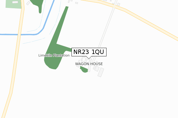
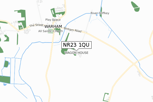
NR23 1QU is located in the Priory electoral ward, within the local authority district of North Norfolk and the English Parliamentary constituency of North Norfolk. The Sub Integrated Care Board (ICB) Location is NHS Norfolk and Waveney ICB - 26A and the police force is Norfolk. This postcode has been in use since January 2018.


GetTheData
Source: OS Open Zoomstack (Ordnance Survey)
Licence: Open Government Licence (requires attribution)
Attribution: Contains OS data © Crown copyright and database right 2024
Source: Open Postcode Geo
Licence: Open Government Licence (requires attribution)
Attribution: Contains OS data © Crown copyright and database right 2024; Contains Royal Mail data © Royal Mail copyright and database right 2024; Source: Office for National Statistics licensed under the Open Government Licence v.3.0
| Easting | 595201 |
| Northing | 341284 |
| Latitude | 52.933481 |
| Longitude | 0.903015 |
GetTheData
Source: Open Postcode Geo
Licence: Open Government Licence
| Country | England |
| Postcode District | NR23 |
| ➜ NR23 open data dashboard ➜ See where NR23 is on a map | |
GetTheData
Source: Land Registry Price Paid Data
Licence: Open Government Licence
| Ward | Priory |
| Constituency | North Norfolk |
GetTheData
Source: ONS Postcode Database
Licence: Open Government Licence
| April 2022 | Criminal damage and arson | On or near Binham Road | 390m |
| ➜ Get more crime data in our Crime section | |||
GetTheData
Source: data.police.uk
Licence: Open Government Licence
| Three Horseshoes (Binham Road) | Warham | 548m |
| Three Horseshoes (Binham Road) | Warham | 549m |
| High Street (Wells Road) | Wighton | 1,847m |
| High Street (Wells Road) | Wighton | 1,859m |
GetTheData
Source: NaPTAN
Licence: Open Government Licence
➜ Broadband speed and availability dashboard for NR23 1QU
| Percentage of properties with Next Generation Access | 100.0% |
| Percentage of properties with Superfast Broadband | 0.0% |
| Percentage of properties with Ultrafast Broadband | 0.0% |
| Percentage of properties with Full Fibre Broadband | 0.0% |
Superfast Broadband is between 30Mbps and 300Mbps
Ultrafast Broadband is > 300Mbps
| Median download speed | 3.1Mbps |
| Average download speed | 3.3Mbps |
| Maximum download speed | 4.86Mbps |
| Median upload speed | 0.4Mbps |
| Average upload speed | 0.5Mbps |
| Maximum upload speed | 0.84Mbps |
| Percentage of properties unable to receive 2Mbps | 0.0% |
| Percentage of properties unable to receive 5Mbps | 100.0% |
| Percentage of properties unable to receive 10Mbps | 100.0% |
| Percentage of properties unable to receive 30Mbps | 100.0% |
➜ Broadband speed and availability dashboard for NR23 1QU
GetTheData
Source: Ofcom
Licence: Ofcom Terms of Use (requires attribution)
GetTheData
Source: ONS Postcode Database
Licence: Open Government Licence


➜ Get more ratings from the Food Standards Agency
GetTheData
Source: Food Standards Agency
Licence: FSA terms & conditions
| Last Collection | |||
|---|---|---|---|
| Location | Mon-Fri | Sat | Distance |
| Warham All Saints | 16:45 | 07:00 | 1,014m |
| High Street | 16:45 | 09:15 | 1,825m |
| Copys Green | 16:45 | 08:00 | 1,945m |
GetTheData
Source: Dracos
Licence: Creative Commons Attribution-ShareAlike
| Facility | Distance |
|---|---|
| Hollow Lane Playing Field Hollow Lane, Stiffkey, Wells-next-the-sea Grass Pitches | 2.8km |
| Binham Village Hall Warham Road, Binham Grass Pitches | 3.3km |
| Alderman Peel High School Market Lane, Wells-next-the-sea Health and Fitness Gym, Grass Pitches, Sports Hall, Swimming Pool, Artificial Grass Pitch, Outdoor Tennis Courts | 3.9km |
GetTheData
Source: Active Places
Licence: Open Government Licence
| School | Phase of Education | Distance |
|---|---|---|
| Wells-Next-the-Sea Primary and Nursery School Polka Road, Wells-Next-the-Sea, NR23 1JG | Primary | 3.7km |
| Alderman Peel High School Market Lane, Wells-next-the-Sea, NR23 1RB | Secondary | 3.9km |
| Walsingham CE VA Primary School Wells Road, WALSINGHAM, NR22 6DU | Primary | 4.3km |
GetTheData
Source: Edubase
Licence: Open Government Licence
The below table lists the International Territorial Level (ITL) codes (formerly Nomenclature of Territorial Units for Statistics (NUTS) codes) and Local Administrative Units (LAU) codes for NR23 1QU:
| ITL 1 Code | Name |
|---|---|
| TLH | East |
| ITL 2 Code | Name |
| TLH1 | East Anglia |
| ITL 3 Code | Name |
| TLH16 | North and West Norfolk |
| LAU 1 Code | Name |
| E07000147 | North Norfolk |
GetTheData
Source: ONS Postcode Directory
Licence: Open Government Licence
The below table lists the Census Output Area (OA), Lower Layer Super Output Area (LSOA), and Middle Layer Super Output Area (MSOA) for NR23 1QU:
| Code | Name | |
|---|---|---|
| OA | E00136074 | |
| LSOA | E01026763 | North Norfolk 002B |
| MSOA | E02005571 | North Norfolk 002 |
GetTheData
Source: ONS Postcode Directory
Licence: Open Government Licence
| NR23 1NR | Wighton Road | 481m |
| NR23 1NL | The Street | 519m |
| NR23 1NN | Chapel Street | 628m |
| NR23 1NW | Park Road | 731m |
| NR23 1NH | The Street | 739m |
| NR23 1NP | Stiffkey Road | 789m |
| NR23 1NG | Wells Road | 1164m |
| NR23 1PL | Kirkgate Lane | 1562m |
| NR23 1GB | Chalk Loke | 1797m |
| NR23 1AL | High Street | 1835m |
GetTheData
Source: Open Postcode Geo; Land Registry Price Paid Data
Licence: Open Government Licence