Property/Postcode Data Search:
NP44 7BE maps, stats, and open data
NP44 7BE is located in the Llantarnam electoral ward, within the unitary authority of Torfaen and the Welsh Parliamentary constituency of Torfaen. The Local Health Board is Aneurin Bevan University and the police force is Gwent. This postcode has been in use since May 2018.
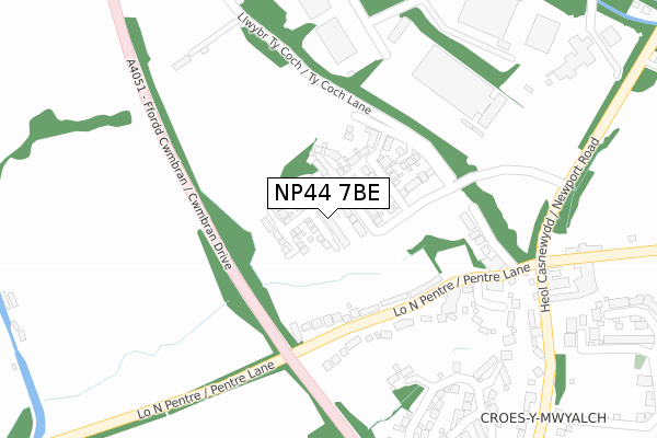
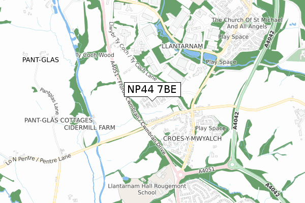
NP44 7BE maps


Source: OS Open Zoomstack (Ordnance Survey)
Licence: Open Government Licence (requires attribution)
Attribution: Contains OS data © Crown copyright and database right 2025
Source: Open Postcode Geo
Licence: Open Government Licence (requires attribution)
Attribution: Contains OS data © Crown copyright and database right 2025; Contains Royal Mail data © Royal Mail copyright and database right 2025; Source: Office for National Statistics licensed under the Open Government Licence v.3.0
Licence: Open Government Licence (requires attribution)
Attribution: Contains OS data © Crown copyright and database right 2025
Source: Open Postcode Geo
Licence: Open Government Licence (requires attribution)
Attribution: Contains OS data © Crown copyright and database right 2025; Contains Royal Mail data © Royal Mail copyright and database right 2025; Source: Office for National Statistics licensed under the Open Government Licence v.3.0
NP44 7BE geodata
| Easting | 329921 |
| Northing | 192517 |
| Latitude | 51.627089 |
| Longitude | -3.013803 |
Where is NP44 7BE?
| Country | Wales |
| Postcode District | NP44 |
Politics
| Ward | Llantarnam |
|---|---|
| Constituency | Torfaen |
House Prices
Sales of detached houses in NP44 7BE
93, THE MALTINGS, LLANTARNAM, CWMBRAN, NP44 7BE 2024 28 JUN £357,000 |
60, THE MALTINGS, LLANTARNAM, CWMBRAN, NP44 7BE 2023 28 JUL £347,500 |
70, THE MALTINGS, LLANTARNAM, CWMBRAN, NP44 7BE 2023 17 FEB £315,000 |
73, THE MALTINGS, LLANTARNAM, CWMBRAN, NP44 7BE 2021 12 MAR £290,000 |
71, THE MALTINGS, LLANTARNAM, CWMBRAN, NP44 7BE 2021 29 JAN £285,000 |
85, THE MALTINGS, LLANTARNAM, CWMBRAN, NP44 7BE 2020 18 DEC £332,000 |
75, THE MALTINGS, LLANTARNAM, CWMBRAN, NP44 7BE 2019 22 NOV £306,995 |
80, THE MALTINGS, LLANTARNAM, CWMBRAN, NP44 7BE 2019 22 NOV £323,995 |
78, THE MALTINGS, LLANTARNAM, CWMBRAN, NP44 7BE 2019 22 NOV £374,995 |
84, THE MALTINGS, LLANTARNAM, CWMBRAN, NP44 7BE 2019 22 NOV £332,995 |
Source: HM Land Registry Price Paid Data
Licence: Contains HM Land Registry data © Crown copyright and database right 2025. This data is licensed under the Open Government Licence v3.0.
Licence: Contains HM Land Registry data © Crown copyright and database right 2025. This data is licensed under the Open Government Licence v3.0.
Transport
Nearest bus stops to NP44 7BE
| Blackbirds (Newport Road) | Croes-y-mwyalch | 423m |
| Blackbirds (Newport Road) | Croes-y-mwyalch | 440m |
| Abbey Gates (Newport Road) | Llantarnam | 528m |
| Abbey Gates (Newport Road) | Llantarnam | 530m |
| William Brown Close (Llantarnam Park Way) | Llantarnam | 548m |
Nearest railway stations to NP44 7BE
| Cwmbran Station | 3.3km |
| Newport (S Wales) Station | 4.4km |
| Rogerstone Station | 5.1km |
Broadband
Broadband access in NP44 7BE (2020 data)
| Percentage of properties with Next Generation Access | 100.0% |
| Percentage of properties with Superfast Broadband | 100.0% |
| Percentage of properties with Ultrafast Broadband | 0.0% |
| Percentage of properties with Full Fibre Broadband | 0.0% |
Superfast Broadband is between 30Mbps and 300Mbps
Ultrafast Broadband is > 300Mbps
Broadband speed in NP44 7BE (2019 data)
Download
| Median download speed | 55.0Mbps |
| Average download speed | 49.3Mbps |
| Maximum download speed | 80.00Mbps |
Upload
| Median upload speed | 10.0Mbps |
| Average upload speed | 11.1Mbps |
| Maximum upload speed | 20.00Mbps |
Broadband limitations in NP44 7BE (2020 data)
| Percentage of properties unable to receive 2Mbps | 0.0% |
| Percentage of properties unable to receive 5Mbps | 0.0% |
| Percentage of properties unable to receive 10Mbps | 0.0% |
| Percentage of properties unable to receive 30Mbps | 0.0% |
Deprivation
24.6% of Welsh postcodes are less deprived than NP44 7BE:Food Standards Agency
Three nearest food hygiene ratings to NP44 7BE (metres)
Mayflower Residential Home

Mayflower Residential Home
196m
Llantarnam Lodge

Pentre Lane
196m
Three Blackbirds

Pentre Lane
260m
➜ Get more ratings from the Food Standards Agency
Nearest post box to NP44 7BE
| Last Collection | |||
|---|---|---|---|
| Location | Mon-Fri | Sat | Distance |
| Llantarnam Road | 17:30 | 11:00 | 1,776m |
| Bettws Post Office | 17:30 | 12:00 | 1,946m |
| Yewberry Lane | 17:30 | 11:45 | 2,034m |
NP44 7BE ITL and NP44 7BE LAU
The below table lists the International Territorial Level (ITL) codes (formerly Nomenclature of Territorial Units for Statistics (NUTS) codes) and Local Administrative Units (LAU) codes for NP44 7BE:
| ITL 1 Code | Name |
|---|---|
| TLL | Wales |
| ITL 2 Code | Name |
| TLL1 | West Wales and The Valleys |
| ITL 3 Code | Name |
| TLL16 | Gwent Valleys |
| LAU 1 Code | Name |
| W06000020 | Torfaen |
NP44 7BE census areas
The below table lists the Census Output Area (OA), Lower Layer Super Output Area (LSOA), and Middle Layer Super Output Area (MSOA) for NP44 7BE:
| Code | Name | |
|---|---|---|
| OA | W00007858 | |
| LSOA | W01001505 | Torfaen 013B |
| MSOA | W02000335 | Torfaen 013 |
Nearest postcodes to NP44 7BE
| NP44 3AP | Pentre Lane | 197m |
| NP44 7AX | Ty Coch Close | 224m |
| NP44 3AQ | The Manor | 367m |
| NP44 3AF | Newport Road | 440m |
| NP44 3GB | Lansdowne Gardens | 509m |
| NP44 3AE | Newport Road | 530m |
| NP44 3AB | William Browne Close | 742m |
| NP20 6QY | Malpas Road | 759m |
| NP20 6QH | Alanbrooke Avenue | 770m |
| NP44 3DJ | Newport Road | 780m |