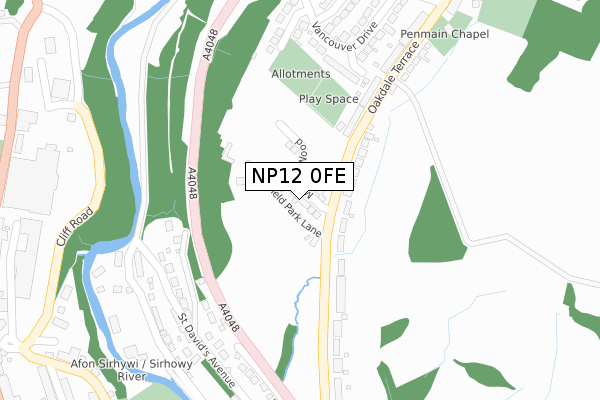
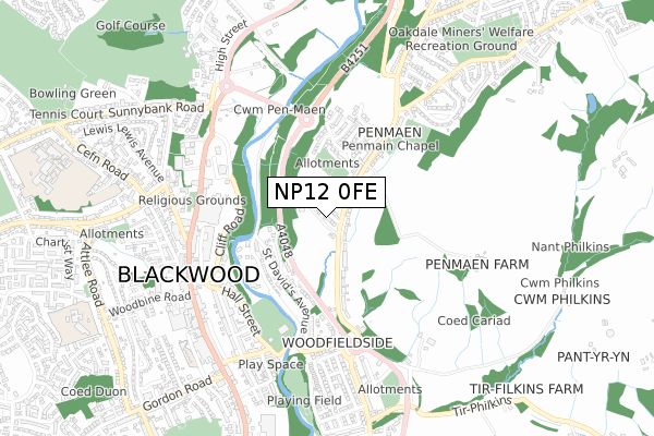
NP12 0FE is located in the Penmaen electoral ward, within the unitary authority of Caerphilly and the Welsh Parliamentary constituency of Islwyn. The Local Health Board is Aneurin Bevan University and the police force is Gwent. This postcode has been in use since September 2019.


GetTheData
Source: OS Open Zoomstack (Ordnance Survey)
Licence: Open Government Licence (requires attribution)
Attribution: Contains OS data © Crown copyright and database right 2024
Source: Open Postcode Geo
Licence: Open Government Licence (requires attribution)
Attribution: Contains OS data © Crown copyright and database right 2024; Contains Royal Mail data © Royal Mail copyright and database right 2024; Source: Office for National Statistics licensed under the Open Government Licence v.3.0
| Easting | 317924 |
| Northing | 197517 |
| Latitude | 51.670410 |
| Longitude | -3.188258 |
GetTheData
Source: Open Postcode Geo
Licence: Open Government Licence
| Country | Wales |
| Postcode District | NP12 |
| ➜ NP12 open data dashboard ➜ See where NP12 is on a map ➜ Where is Oakdale? | |
GetTheData
Source: Land Registry Price Paid Data
Licence: Open Government Licence
| Ward | Penmaen |
| Constituency | Islwyn |
GetTheData
Source: ONS Postcode Database
Licence: Open Government Licence
22, MILLERS WOOD, PENMAEN, BLACKWOOD, NP12 0FE 2021 12 FEB £325,000 |
23, MILLERS WOOD, PENMAEN, BLACKWOOD, NP12 0FE 2020 18 DEC £315,000 |
25, MILLERS WOOD, PENMAEN, BLACKWOOD, NP12 0FE 2020 13 NOV £250,000 |
15, MILLERS WOOD, PENMAEN, BLACKWOOD, NP12 0FE 2020 2 NOV £320,000 |
8, MILLERS WOOD, PENMAEN, BLACKWOOD, NP12 0FE 2020 2 NOV £335,000 |
17, MILLERS WOOD, PENMAEN, BLACKWOOD, NP12 0FE 2020 2 NOV £315,000 |
3, MILLERS WOOD, PENMAEN, BLACKWOOD, NP12 0FE 2020 21 AUG £317,500 |
10, MILLERS WOOD, PENMAEN, BLACKWOOD, NP12 0FE 2020 17 AUG £250,000 |
13, MILLERS WOOD, PENMAEN, BLACKWOOD, NP12 0FE 2020 29 JUL £250,000 |
11, MILLERS WOOD, PENMAEN, BLACKWOOD, NP12 0FE 2020 28 JUL £315,000 |
GetTheData
Source: HM Land Registry Price Paid Data
Licence: Contains HM Land Registry data © Crown copyright and database right 2024. This data is licensed under the Open Government Licence v3.0.
| June 2022 | Violence and sexual offences | On or near Christchurch Road | 198m |
| June 2022 | Violence and sexual offences | On or near Riverside Court | 331m |
| June 2022 | Anti-social behaviour | On or near Park Terrace | 456m |
| ➜ Get more crime data in our Crime section | |||
GetTheData
Source: data.police.uk
Licence: Open Government Licence
| Oakdale Terrace | Penmaen | 207m |
| Chapel (Oakdale Terrace) | Penmaen | 218m |
| Park View Bungalows (Oakdale Terrace) | Penmaen | 238m |
| Park View Bungalows (Oakdale Terrace) | Penmaen | 253m |
| Asda Car Park (Grounds) | Blackwood | 410m |
| Pengam Station | 2.9km |
| Gilfach Fargoed Station | 3.1km |
| Newbridge Station | 3.2km |
GetTheData
Source: NaPTAN
Licence: Open Government Licence
GetTheData
Source: ONS Postcode Database
Licence: Open Government Licence


➜ Get more ratings from the Food Standards Agency
GetTheData
Source: Food Standards Agency
Licence: FSA terms & conditions
| Last Collection | |||
|---|---|---|---|
| Location | Mon-Fri | Sat | Distance |
| Blackwood Post Office | 18:00 | 12:30 | 708m |
| Bloomfield Road Post Office | 16:00 | 11:45 | 800m |
| Cefn Fforest Post Office | 17:00 | 12:00 | 1,730m |
GetTheData
Source: Dracos
Licence: Creative Commons Attribution-ShareAlike
| School | Phase of Education | Distance |
|---|---|---|
| Blackwood Comprehensive School Ty Isha Terrace, Cen Fforest, Blackwood, NP12 1ER | Not applicable | 1.1km |
| Blackwood Primary School Apollo Way, Blackwood, NP12 1WA | Not applicable | 1.1km |
| Libanus Primary School Libanus Rd, Blackwood, Caerphilly, NP12 1EH | Not applicable | 1.1km |
GetTheData
Source: Edubase
Licence: Open Government Licence
The below table lists the International Territorial Level (ITL) codes (formerly Nomenclature of Territorial Units for Statistics (NUTS) codes) and Local Administrative Units (LAU) codes for NP12 0FE:
| ITL 1 Code | Name |
|---|---|
| TLL | Wales |
| ITL 2 Code | Name |
| TLL1 | West Wales and The Valleys |
| ITL 3 Code | Name |
| TLL16 | Gwent Valleys |
| LAU 1 Code | Name |
| W06000018 | Caerphilly |
GetTheData
Source: ONS Postcode Directory
Licence: Open Government Licence
The below table lists the Census Output Area (OA), Lower Layer Super Output Area (LSOA), and Middle Layer Super Output Area (MSOA) for NP12 0FE:
| Code | Name | |
|---|---|---|
| OA | W00007291 | |
| LSOA | W01001392 | Caerphilly 009D |
| MSOA | W02000298 | Caerphilly 009 |
GetTheData
Source: ONS Postcode Directory
Licence: Open Government Licence
| NP12 0DF | Oakdale Terrace | 131m |
| NP12 0UW | Auckland Close | 155m |
| NP12 0UX | Christchurch Road | 235m |
| NP12 0UQ | Vancouver Drive | 248m |
| NP12 0DG | Oakdale Terrace | 253m |
| NP12 0DE | Park View Bungalows | 263m |
| NP12 0UT | Canberra Close | 267m |
| NP12 0UY | Toronto Close | 308m |
| NP12 0PB | Riverside Court | 323m |
| NP12 0US | Vancouver Drive | 350m |
GetTheData
Source: Open Postcode Geo; Land Registry Price Paid Data
Licence: Open Government Licence