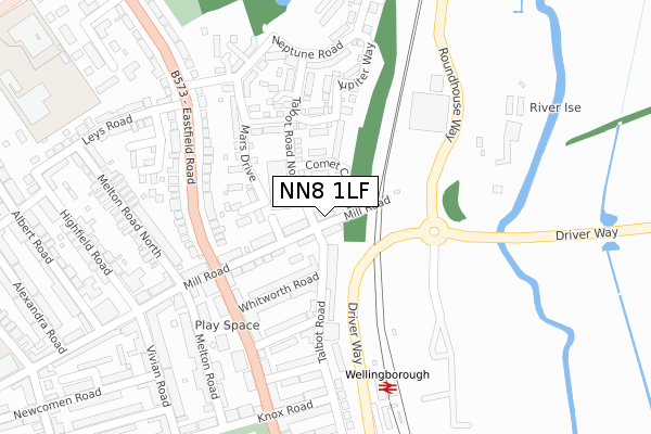
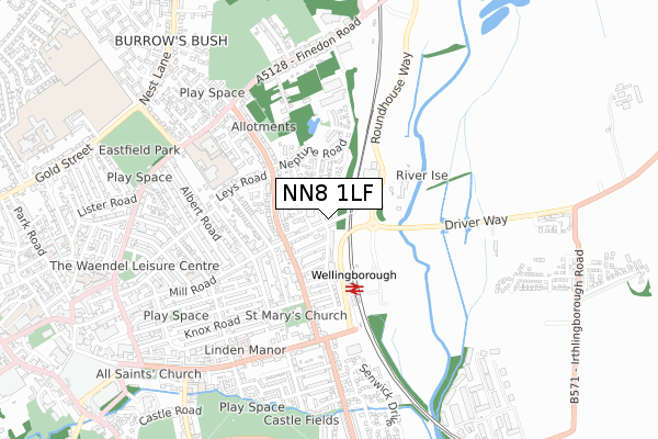
NN8 1LF is located in the Finedon electoral ward, within the unitary authority of North Northamptonshire and the English Parliamentary constituency of Wellingborough. The Sub Integrated Care Board (ICB) Location is NHS Northamptonshire ICB - 78H and the police force is Northamptonshire. This postcode has been in use since May 2018.


GetTheData
Source: OS Open Zoomstack (Ordnance Survey)
Licence: Open Government Licence (requires attribution)
Attribution: Contains OS data © Crown copyright and database right 2024
Source: Open Postcode Geo
Licence: Open Government Licence (requires attribution)
Attribution: Contains OS data © Crown copyright and database right 2024; Contains Royal Mail data © Royal Mail copyright and database right 2024; Source: Office for National Statistics licensed under the Open Government Licence v.3.0
| Easting | 490249 |
| Northing | 268392 |
| Latitude | 52.306253 |
| Longitude | -0.677749 |
GetTheData
Source: Open Postcode Geo
Licence: Open Government Licence
| Country | England |
| Postcode District | NN8 |
| ➜ NN8 open data dashboard ➜ See where NN8 is on a map ➜ Where is Wellingborough? | |
GetTheData
Source: Land Registry Price Paid Data
Licence: Open Government Licence
| Ward | Finedon |
| Constituency | Wellingborough |
GetTheData
Source: ONS Postcode Database
Licence: Open Government Licence
| June 2022 | Vehicle crime | On or near Talbot Road North | 64m |
| June 2022 | Other crime | On or near Talbot Road North | 64m |
| June 2022 | Anti-social behaviour | On or near Talbot Road North | 64m |
| ➜ Get more crime data in our Crime section | |||
GetTheData
Source: data.police.uk
Licence: Open Government Licence
| 129 Eastfield Road (Eastfield Road) | Wellingborough | 183m |
| Whitworth Road (Elsden Road) | Wellingborough | 191m |
| Whitworth Road (Elsden Road) | Wellingborough | 196m |
| Leys Road (Eastfield Road) | Wellingborough | 220m |
| Leys Road (Eastfield Road) | Wellingborough | 254m |
| Wellingborough Station | 0.3km |
GetTheData
Source: NaPTAN
Licence: Open Government Licence
| Percentage of properties with Next Generation Access | 100.0% |
| Percentage of properties with Superfast Broadband | 100.0% |
| Percentage of properties with Ultrafast Broadband | 100.0% |
| Percentage of properties with Full Fibre Broadband | 100.0% |
Superfast Broadband is between 30Mbps and 300Mbps
Ultrafast Broadband is > 300Mbps
| Percentage of properties unable to receive 2Mbps | 0.0% |
| Percentage of properties unable to receive 5Mbps | 0.0% |
| Percentage of properties unable to receive 10Mbps | 0.0% |
| Percentage of properties unable to receive 30Mbps | 0.0% |
GetTheData
Source: Ofcom
Licence: Ofcom Terms of Use (requires attribution)
GetTheData
Source: ONS Postcode Database
Licence: Open Government Licence


➜ Get more ratings from the Food Standards Agency
GetTheData
Source: Food Standards Agency
Licence: FSA terms & conditions
| Last Collection | |||
|---|---|---|---|
| Location | Mon-Fri | Sat | Distance |
| Royal Mail Wellingborough | 18:30 | 11:00 | 434m |
| Eastfield Road | 17:00 | 11:00 | 713m |
| Castle Street | 16:15 | 11:00 | 796m |
GetTheData
Source: Dracos
Licence: Creative Commons Attribution-ShareAlike
| Facility | Distance |
|---|---|
| Eastfield Park Finedon Road, Wellingborough Grass Pitches | 712m |
| Waendel Leisure Centre Thomas Street, Wellingborough Swimming Pool, Health and Fitness Gym, Studio | 740m |
| Diana's Health And Fitness Finedon Road, Wellingborough Swimming Pool, Health and Fitness Gym, Studio, Squash Courts | 764m |
GetTheData
Source: Active Places
Licence: Open Government Licence
| School | Phase of Education | Distance |
|---|---|---|
| Victoria Primary Academy Finedon Road, Wellingborough, NN8 4NT | Primary | 490m |
| Highfield Nursery School Finedon Road, Wellingborough, NN8 4AB | Nursery | 528m |
| Rowan Gate Primary School -Two Sites and Two Satellites Rowan Gate Primary School, Finedon Road, Wellingborough, NN8 4NS | Not applicable | 530m |
GetTheData
Source: Edubase
Licence: Open Government Licence
The below table lists the International Territorial Level (ITL) codes (formerly Nomenclature of Territorial Units for Statistics (NUTS) codes) and Local Administrative Units (LAU) codes for NN8 1LF:
| ITL 1 Code | Name |
|---|---|
| TLF | East Midlands (England) |
| ITL 2 Code | Name |
| TLF2 | Leicestershire, Rutland and Northamptonshire |
| ITL 3 Code | Name |
| TLF25 | North Northamptonshire |
| LAU 1 Code | Name |
| E07000156 | Wellingborough |
GetTheData
Source: ONS Postcode Directory
Licence: Open Government Licence
The below table lists the Census Output Area (OA), Lower Layer Super Output Area (LSOA), and Middle Layer Super Output Area (MSOA) for NN8 1LF:
| Code | Name | |
|---|---|---|
| OA | E00138969 | |
| LSOA | E01027316 | Wellingborough 004D |
| MSOA | E02005695 | Wellingborough 004 |
GetTheData
Source: ONS Postcode Directory
Licence: Open Government Licence
| NN8 1QN | Mill Road | 25m |
| NN8 1QS | Talbot Road North | 88m |
| NN8 1QT | Mill Road | 101m |
| NN8 1QH | Talbot Road | 102m |
| NN8 1SF | Talbot Road North | 108m |
| NN8 1QQ | Whitworth Road | 125m |
| NN8 1RJ | Mars Drive | 149m |
| NN8 1SG | Talbot Road North | 183m |
| NN8 1QE | Elsden Road | 187m |
| NN8 1PT | Eastfield Road | 194m |
GetTheData
Source: Open Postcode Geo; Land Registry Price Paid Data
Licence: Open Government Licence