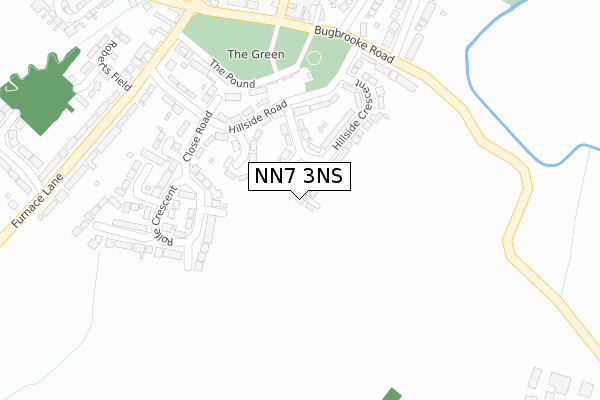
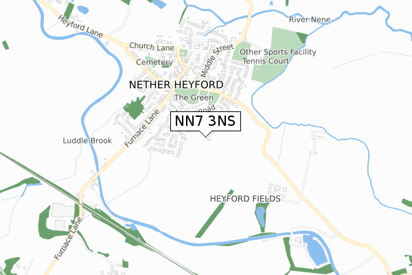
NN7 3NS is located in the Bugbrooke electoral ward, within the unitary authority of West Northamptonshire and the English Parliamentary constituency of Daventry. The Sub Integrated Care Board (ICB) Location is NHS Northamptonshire ICB - 78H and the police force is Northamptonshire. This postcode has been in use since December 2019.


GetTheData
Source: OS Open Zoomstack (Ordnance Survey)
Licence: Open Government Licence (requires attribution)
Attribution: Contains OS data © Crown copyright and database right 2024
Source: Open Postcode Geo
Licence: Open Government Licence (requires attribution)
Attribution: Contains OS data © Crown copyright and database right 2024; Contains Royal Mail data © Royal Mail copyright and database right 2024; Source: Office for National Statistics licensed under the Open Government Licence v.3.0
| Easting | 466123 |
| Northing | 258196 |
| Latitude | 52.218032 |
| Longitude | -1.033529 |
GetTheData
Source: Open Postcode Geo
Licence: Open Government Licence
| Country | England |
| Postcode District | NN7 |
| ➜ NN7 open data dashboard ➜ See where NN7 is on a map ➜ Where is Nether Heyford? | |
GetTheData
Source: Land Registry Price Paid Data
Licence: Open Government Licence
| Ward | Bugbrooke |
| Constituency | Daventry |
GetTheData
Source: ONS Postcode Database
Licence: Open Government Licence
| December 2023 | Public order | On or near Church Street | 492m |
| September 2023 | Anti-social behaviour | On or near Church Street | 492m |
| July 2023 | Anti-social behaviour | On or near The Pound | 262m |
| ➜ Get more crime data in our Crime section | |||
GetTheData
Source: data.police.uk
Licence: Open Government Licence
| Close Road (Hillside Road) | Nether Heyford | 247m |
| Close Road (Hillside Road) | Nether Heyford | 248m |
| Wakefield Way (Bugbrooke Road) | Nether Heyford | 277m |
| Wakefield Way (Bugbrooke Road) | Nether Heyford | 286m |
| Foresters Arms Ph (Bugbrooke Road) | Nether Heyford | 346m |
GetTheData
Source: NaPTAN
Licence: Open Government Licence
GetTheData
Source: ONS Postcode Database
Licence: Open Government Licence


➜ Get more ratings from the Food Standards Agency
GetTheData
Source: Food Standards Agency
Licence: FSA terms & conditions
| Last Collection | |||
|---|---|---|---|
| Location | Mon-Fri | Sat | Distance |
| Nether Heyford Tso | 16:00 | 11:00 | 385m |
| Heyford Road | 16:00 | 09:45 | 1,384m |
| Bugbrooke Tso | 16:00 | 09:45 | 1,807m |
GetTheData
Source: Dracos
Licence: Creative Commons Attribution-ShareAlike
| Facility | Distance |
|---|---|
| Heyford Playing Fields Middle Street, Nether Heyford Grass Pitches, Outdoor Tennis Courts | 612m |
| Bugbrooke Cricket Club High Street, Bugbrooke Grass Pitches | 1.9km |
| Bugbrooke Rugby Union Football Club Camp Close, Bugbrooke Grass Pitches, Sports Hall | 2.3km |
GetTheData
Source: Active Places
Licence: Open Government Licence
| School | Phase of Education | Distance |
|---|---|---|
| The Bliss Charity School The Green, Nether Heyford, Northampton, NN7 3LE | Primary | 345m |
| Bugbrooke Community Primary School High Street, Bugbrooke, Northampton, NN7 3PA | Primary | 1.8km |
| Campion School Bugbrooke, Northampton, NN7 3QG | Secondary | 2.4km |
GetTheData
Source: Edubase
Licence: Open Government Licence
The below table lists the International Territorial Level (ITL) codes (formerly Nomenclature of Territorial Units for Statistics (NUTS) codes) and Local Administrative Units (LAU) codes for NN7 3NS:
| ITL 1 Code | Name |
|---|---|
| TLF | East Midlands (England) |
| ITL 2 Code | Name |
| TLF2 | Leicestershire, Rutland and Northamptonshire |
| ITL 3 Code | Name |
| TLF24 | West Northamptonshire |
| LAU 1 Code | Name |
| E07000155 | South Northamptonshire |
GetTheData
Source: ONS Postcode Directory
Licence: Open Government Licence
The below table lists the Census Output Area (OA), Lower Layer Super Output Area (LSOA), and Middle Layer Super Output Area (MSOA) for NN7 3NS:
| Code | Name | |
|---|---|---|
| OA | E00138814 | |
| LSOA | E01027287 | South Northamptonshire 001E |
| MSOA | E02005681 | South Northamptonshire 001 |
GetTheData
Source: ONS Postcode Directory
Licence: Open Government Licence
| NN7 3LS | Hillside Crescent | 116m |
| NN7 3LP | The Peak | 122m |
| NN7 3LR | Hillside Road | 159m |
| NN7 3NG | Rolfe Crescent | 196m |
| NN7 3NW | The Pound | 210m |
| NN7 3LW | Close Road | 241m |
| NN7 3LT | Bugbrooke Road | 262m |
| NN7 3JU | Hillside Road | 284m |
| NN7 3NQ | Western Avenue | 305m |
| NN7 3NH | South View | 323m |
GetTheData
Source: Open Postcode Geo; Land Registry Price Paid Data
Licence: Open Government Licence