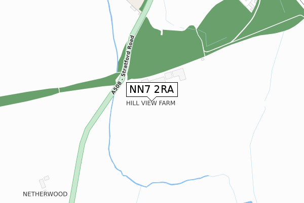
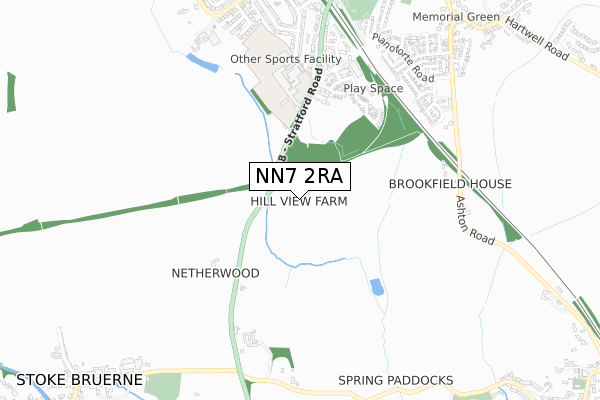
NN7 2RA is located in the Towcester and Roade electoral ward, within the unitary authority of West Northamptonshire and the English Parliamentary constituency of South Northamptonshire. The Sub Integrated Care Board (ICB) Location is NHS Northamptonshire ICB - 78H and the police force is Northamptonshire. This postcode has been in use since November 2018.


GetTheData
Source: OS Open Zoomstack (Ordnance Survey)
Licence: Open Government Licence (requires attribution)
Attribution: Contains OS data © Crown copyright and database right 2024
Source: Open Postcode Geo
Licence: Open Government Licence (requires attribution)
Attribution: Contains OS data © Crown copyright and database right 2024; Contains Royal Mail data © Royal Mail copyright and database right 2024; Source: Office for National Statistics licensed under the Open Government Licence v.3.0
| Easting | 475369 |
| Northing | 250752 |
| Latitude | 52.149933 |
| Longitude | -0.899867 |
GetTheData
Source: Open Postcode Geo
Licence: Open Government Licence
| Country | England |
| Postcode District | NN7 |
| ➜ NN7 open data dashboard ➜ See where NN7 is on a map | |
GetTheData
Source: Land Registry Price Paid Data
Licence: Open Government Licence
| Ward | Towcester And Roade |
| Constituency | South Northamptonshire |
GetTheData
Source: ONS Postcode Database
Licence: Open Government Licence
| Elizabeth Woodville School (Stratford Road) | Roade | 555m |
| Elizabeth Woodville School (Stratford Road) | Roade | 597m |
| Walkers Way (Stratford Road) | Roade | 708m |
| The George (High Street) | Roade | 930m |
| The George (High Street) | Roade | 949m |
GetTheData
Source: NaPTAN
Licence: Open Government Licence
| Percentage of properties with Next Generation Access | 0.0% |
| Percentage of properties with Superfast Broadband | 0.0% |
| Percentage of properties with Ultrafast Broadband | 0.0% |
| Percentage of properties with Full Fibre Broadband | 0.0% |
Superfast Broadband is between 30Mbps and 300Mbps
Ultrafast Broadband is > 300Mbps
| Percentage of properties unable to receive 2Mbps | 0.0% |
| Percentage of properties unable to receive 5Mbps | 0.0% |
| Percentage of properties unable to receive 10Mbps | 0.0% |
| Percentage of properties unable to receive 30Mbps | 100.0% |
GetTheData
Source: Ofcom
Licence: Ofcom Terms of Use (requires attribution)
GetTheData
Source: ONS Postcode Database
Licence: Open Government Licence


➜ Get more ratings from the Food Standards Agency
GetTheData
Source: Food Standards Agency
Licence: FSA terms & conditions
| Last Collection | |||
|---|---|---|---|
| Location | Mon-Fri | Sat | Distance |
| Hyde Road | 16:00 | 10:00 | 918m |
| Station Road | 16:00 | 10:00 | 943m |
| Roade Tso | 16:45 | 09:45 | 1,062m |
GetTheData
Source: Dracos
Licence: Creative Commons Attribution-ShareAlike
| Facility | Distance |
|---|---|
| Willison Sports Centre (Roade) Stratford Road, Roade, Northampton Sports Hall, Swimming Pool, Health and Fitness Gym, Artificial Grass Pitch, Grass Pitches, Studio, Outdoor Tennis Courts | 525m |
| Roade Recreation Ground London Road, Roade, Northampton Grass Pitches | 873m |
| Spencer Bruerne Cricket Club Rookery Lane, Stoke Bruerne, Towcester Grass Pitches | 979m |
GetTheData
Source: Active Places
Licence: Open Government Licence
| School | Phase of Education | Distance |
|---|---|---|
| Roade Primary School Hartwell Road, Roade, Northampton, NN7 2NT | Primary | 1.1km |
| Ashton CofE Primary School Roade Hill, Ashton, Northampton, NN7 2JH | Primary | 1.4km |
| Stoke Bruerne Church of England Primary School Bridge Road, Stoke Bruerne, Towcester, NN12 7SD | Primary | 1.4km |
GetTheData
Source: Edubase
Licence: Open Government Licence
The below table lists the International Territorial Level (ITL) codes (formerly Nomenclature of Territorial Units for Statistics (NUTS) codes) and Local Administrative Units (LAU) codes for NN7 2RA:
| ITL 1 Code | Name |
|---|---|
| TLF | East Midlands (England) |
| ITL 2 Code | Name |
| TLF2 | Leicestershire, Rutland and Northamptonshire |
| ITL 3 Code | Name |
| TLF24 | West Northamptonshire |
| LAU 1 Code | Name |
| E07000155 | South Northamptonshire |
GetTheData
Source: ONS Postcode Directory
Licence: Open Government Licence
The below table lists the Census Output Area (OA), Lower Layer Super Output Area (LSOA), and Middle Layer Super Output Area (MSOA) for NN7 2RA:
| Code | Name | |
|---|---|---|
| OA | E00138768 | |
| LSOA | E01027279 | South Northamptonshire 003C |
| MSOA | E02005683 | South Northamptonshire 003 |
GetTheData
Source: ONS Postcode Directory
Licence: Open Government Licence
| NN7 2PZ | Sturgess Way | 484m |
| NN7 2QH | Glebe Road | 502m |
| NN7 2PX | Chaplins Drive | 504m |
| NN12 7SN | Northampton Road | 600m |
| NN7 2GB | Walkers Way | 612m |
| NN7 2LQ | Ashton Road | 626m |
| NN7 2NJ | Stratford Road | 628m |
| NN12 7SL | Ashton Road | 645m |
| NN7 2GA | Walkers Way | 682m |
| NN7 2GD | Stratford Road | 702m |
GetTheData
Source: Open Postcode Geo; Land Registry Price Paid Data
Licence: Open Government Licence