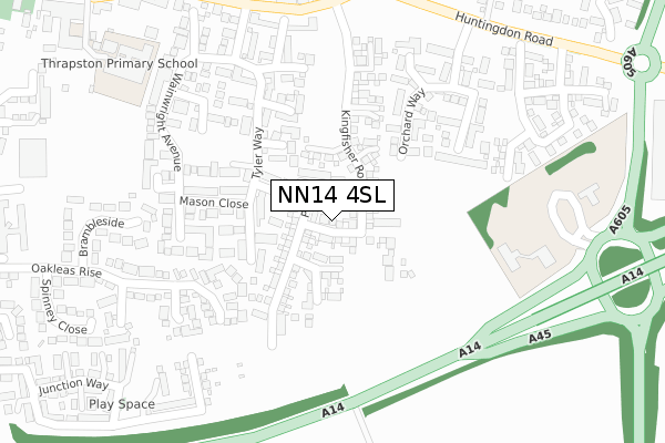
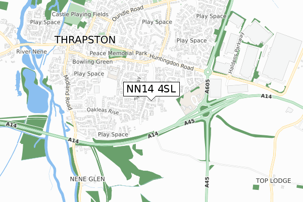
NN14 4SL is located in the Thrapston electoral ward, within the unitary authority of North Northamptonshire and the English Parliamentary constituency of Corby. The Sub Integrated Care Board (ICB) Location is NHS Northamptonshire ICB - 78H and the police force is Northamptonshire. This postcode has been in use since June 2019.


GetTheData
Source: OS Open Zoomstack (Ordnance Survey)
Licence: Open Government Licence (requires attribution)
Attribution: Contains OS data © Crown copyright and database right 2024
Source: Open Postcode Geo
Licence: Open Government Licence (requires attribution)
Attribution: Contains OS data © Crown copyright and database right 2024; Contains Royal Mail data © Royal Mail copyright and database right 2024; Source: Office for National Statistics licensed under the Open Government Licence v.3.0
| Easting | 500114 |
| Northing | 278134 |
| Latitude | 52.392100 |
| Longitude | -0.530210 |
GetTheData
Source: Open Postcode Geo
Licence: Open Government Licence
| Country | England |
| Postcode District | NN14 |
| ➜ NN14 open data dashboard ➜ See where NN14 is on a map ➜ Where is Thrapston? | |
GetTheData
Source: Land Registry Price Paid Data
Licence: Open Government Licence
| Ward | Thrapston |
| Constituency | Corby |
GetTheData
Source: ONS Postcode Database
Licence: Open Government Licence
2022 20 DEC £450,000 |
2022 10 FEB £425,000 |
2020 2 OCT £380,000 |
4, MOORHEN STREET, THRAPSTON, KETTERING, NN14 4SL 2019 16 AUG £382,995 |
2, MOORHEN STREET, THRAPSTON, KETTERING, NN14 4SL 2019 19 JUL £319,995 |
3, MOORHEN STREET, THRAPSTON, KETTERING, NN14 4SL 2019 28 JUN £331,995 |
2019 28 JUN £379,995 |
1, MOORHEN STREET, THRAPSTON, KETTERING, NN14 4SL 2019 28 JUN £331,995 |
2019 27 JUN £379,995 |
2019 26 JUN £364,995 |
GetTheData
Source: HM Land Registry Price Paid Data
Licence: Contains HM Land Registry data © Crown copyright and database right 2024. This data is licensed under the Open Government Licence v3.0.
| April 2023 | Vehicle crime | On or near Crab Apple Way | 309m |
| March 2023 | Criminal damage and arson | On or near Crab Apple Way | 309m |
| January 2023 | Anti-social behaviour | On or near Crab Apple Way | 309m |
| ➜ Get more crime data in our Crime section | |||
GetTheData
Source: data.police.uk
Licence: Open Government Licence
| Orchard Way (Huntingdon Road) | Thrapston | 377m |
| Nene Leisure Centre (Cedar Drive) | Thrapston | 480m |
| Faraday Court (Highfield Road) | Thrapston | 493m |
| Thrapston House (Huntingdon Road) | Thrapston | 505m |
| Thrapston House (Huntingdon Road) | Thrapston | 522m |
GetTheData
Source: NaPTAN
Licence: Open Government Licence
| Percentage of properties with Next Generation Access | 100.0% |
| Percentage of properties with Superfast Broadband | 100.0% |
| Percentage of properties with Ultrafast Broadband | 100.0% |
| Percentage of properties with Full Fibre Broadband | 100.0% |
Superfast Broadband is between 30Mbps and 300Mbps
Ultrafast Broadband is > 300Mbps
| Percentage of properties unable to receive 2Mbps | 0.0% |
| Percentage of properties unable to receive 5Mbps | 0.0% |
| Percentage of properties unable to receive 10Mbps | 0.0% |
| Percentage of properties unable to receive 30Mbps | 0.0% |
GetTheData
Source: Ofcom
Licence: Ofcom Terms of Use (requires attribution)
GetTheData
Source: ONS Postcode Database
Licence: Open Government Licence


➜ Get more ratings from the Food Standards Agency
GetTheData
Source: Food Standards Agency
Licence: FSA terms & conditions
| Last Collection | |||
|---|---|---|---|
| Location | Mon-Fri | Sat | Distance |
| Thrapston Tso | 17:15 | 10:30 | 482m |
| Mallows Drive | 16:45 | 08:30 | 4,731m |
| Keyston | 16:15 | 10:00 | 5,051m |
GetTheData
Source: Dracos
Licence: Creative Commons Attribution-ShareAlike
| Facility | Distance |
|---|---|
| Thrapston Primary School Market Road, Thrapston Sports Hall, Grass Pitches | 408m |
| The Nene Centre Cedar Drive, Thrapston, Kettering Swimming Pool, Health and Fitness Gym, Studio | 462m |
| Thrapston Swimming Pool (Closed) Market Road, Thrapston, Kettering Swimming Pool | 533m |
GetTheData
Source: Active Places
Licence: Open Government Licence
| School | Phase of Education | Distance |
|---|---|---|
| Thrapston Primary School Market Road, Thrapston, Kettering, NN14 4JU | Primary | 413m |
| Progress Schools - Thrapston Cedar Drive, Thrapston, Northampton, NN14 4LZ | Not applicable | 466m |
| Titchmarsh Church of England Primary School School Lane, Titchmarsh, Kettering, NN14 3DR | Primary | 2.7km |
GetTheData
Source: Edubase
Licence: Open Government Licence
The below table lists the International Territorial Level (ITL) codes (formerly Nomenclature of Territorial Units for Statistics (NUTS) codes) and Local Administrative Units (LAU) codes for NN14 4SL:
| ITL 1 Code | Name |
|---|---|
| TLF | East Midlands (England) |
| ITL 2 Code | Name |
| TLF2 | Leicestershire, Rutland and Northamptonshire |
| ITL 3 Code | Name |
| TLF25 | North Northamptonshire |
| LAU 1 Code | Name |
| E07000152 | East Northamptonshire |
GetTheData
Source: ONS Postcode Directory
Licence: Open Government Licence
The below table lists the Census Output Area (OA), Lower Layer Super Output Area (LSOA), and Middle Layer Super Output Area (MSOA) for NN14 4SL:
| Code | Name | |
|---|---|---|
| OA | E00137728 | |
| LSOA | E01027077 | East Northamptonshire 003E |
| MSOA | E02005631 | East Northamptonshire 003 |
GetTheData
Source: ONS Postcode Directory
Licence: Open Government Licence
| NN14 4XF | Miller Close | 121m |
| NN14 4UE | Tyler Way | 153m |
| NN14 4UD | Forrester Grove | 154m |
| NN14 4LG | Elm Court | 159m |
| NN14 4XA | Baker Court | 180m |
| NN14 4UQ | Mason Close | 186m |
| NN14 4UB | Fisher Close | 199m |
| NN14 4LP | Ash Court | 244m |
| NN14 4RG | Damson Close | 258m |
| NN14 4RE | Orchard Way | 261m |
GetTheData
Source: Open Postcode Geo; Land Registry Price Paid Data
Licence: Open Government Licence