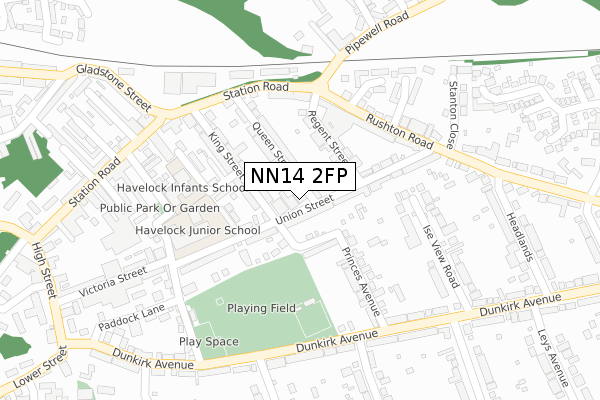
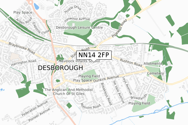
NN14 2FP is located in the Desborough electoral ward, within the unitary authority of North Northamptonshire and the English Parliamentary constituency of Kettering. The Sub Integrated Care Board (ICB) Location is NHS Northamptonshire ICB - 78H and the police force is Northamptonshire. This postcode has been in use since February 2020.


GetTheData
Source: OS Open Zoomstack (Ordnance Survey)
Licence: Open Government Licence (requires attribution)
Attribution: Contains OS data © Crown copyright and database right 2024
Source: Open Postcode Geo
Licence: Open Government Licence (requires attribution)
Attribution: Contains OS data © Crown copyright and database right 2024; Contains Royal Mail data © Royal Mail copyright and database right 2024; Source: Office for National Statistics licensed under the Open Government Licence v.3.0
| Easting | 480665 |
| Northing | 283382 |
| Latitude | 52.442477 |
| Longitude | -0.814682 |
GetTheData
Source: Open Postcode Geo
Licence: Open Government Licence
| Country | England |
| Postcode District | NN14 |
| ➜ NN14 open data dashboard ➜ See where NN14 is on a map ➜ Where is Desborough? | |
GetTheData
Source: Land Registry Price Paid Data
Licence: Open Government Licence
| Ward | Desborough |
| Constituency | Kettering |
GetTheData
Source: ONS Postcode Database
Licence: Open Government Licence
| December 2023 | Drugs | On or near Yaffle Crescent | 426m |
| November 2023 | Other theft | On or near Yaffle Crescent | 426m |
| August 2023 | Criminal damage and arson | On or near Yaffle Crescent | 426m |
| ➜ Get more crime data in our Crime section | |||
GetTheData
Source: data.police.uk
Licence: Open Government Licence
| Queen Street (Station Road) | Desborough | 212m |
| Union Street (Rushton Road) | Desborough | 221m |
| Breakleys Road (Dunkirk Avenue) | Desborough | 238m |
| Breakleys Road (Dunkirk Avenue) | Desborough | 248m |
| 1 Ise Vale Ave (Ise Vale Avenue) | Desborough | 376m |
GetTheData
Source: NaPTAN
Licence: Open Government Licence
GetTheData
Source: ONS Postcode Database
Licence: Open Government Licence


➜ Get more ratings from the Food Standards Agency
GetTheData
Source: Food Standards Agency
Licence: FSA terms & conditions
| Last Collection | |||
|---|---|---|---|
| Location | Mon-Fri | Sat | Distance |
| Braybrooke Road | 16:00 | 08:30 | 556m |
| Harrington Road | 16:00 | 08:45 | 628m |
| Dunkirk Avenue | 16:00 | 08:30 | 1,217m |
GetTheData
Source: Dracos
Licence: Creative Commons Attribution-ShareAlike
| Facility | Distance |
|---|---|
| Desborough Recreation Ground Lower King Street, Desborough, Kettering Grass Pitches | 119m |
| Desborough Northants Indoor Bowls Club High Street, Desborough Indoor Bowls | 299m |
| Desborough Leisure Centre Ironwood Avenue, Desborough, Kettering Sports Hall, Health and Fitness Gym, Grass Pitches, Outdoor Tennis Courts, Artificial Grass Pitch | 575m |
GetTheData
Source: Active Places
Licence: Open Government Licence
| School | Phase of Education | Distance |
|---|---|---|
| Havelock Junior School Havelock Street, Desborough, Kettering, NN14 2LU | Primary | 181m |
| Havelock Infant School Havelock Street, Desborough, Kettering, NN14 2LU | Primary | 194m |
| Loatlands Primary School Harrington Road, Desborough, Kettering, NN14 2NJ | Primary | 1km |
GetTheData
Source: Edubase
Licence: Open Government Licence
The below table lists the International Territorial Level (ITL) codes (formerly Nomenclature of Territorial Units for Statistics (NUTS) codes) and Local Administrative Units (LAU) codes for NN14 2FP:
| ITL 1 Code | Name |
|---|---|
| TLF | East Midlands (England) |
| ITL 2 Code | Name |
| TLF2 | Leicestershire, Rutland and Northamptonshire |
| ITL 3 Code | Name |
| TLF25 | North Northamptonshire |
| LAU 1 Code | Name |
| E07000153 | Kettering |
GetTheData
Source: ONS Postcode Directory
Licence: Open Government Licence
The below table lists the Census Output Area (OA), Lower Layer Super Output Area (LSOA), and Middle Layer Super Output Area (MSOA) for NN14 2FP:
| Code | Name | |
|---|---|---|
| OA | E00169212 | |
| LSOA | E01032971 | Kettering 002I |
| MSOA | E02005640 | Kettering 002 |
GetTheData
Source: ONS Postcode Directory
Licence: Open Government Licence
| NN14 2RE | Queen Street | 89m |
| NN14 2RG | Lower King Street | 90m |
| NN14 2RJ | Union Street | 98m |
| NN14 2RF | Regent Street | 101m |
| NN14 2RD | King Street | 117m |
| NN14 2RH | Union Street | 141m |
| NN14 2EQ | Kings Court | 172m |
| NN14 2RR | Rushton Road | 173m |
| NN14 2RQ | Princes Avenue | 176m |
| NN14 2RP | Rushton Road | 181m |
GetTheData
Source: Open Postcode Geo; Land Registry Price Paid Data
Licence: Open Government Licence