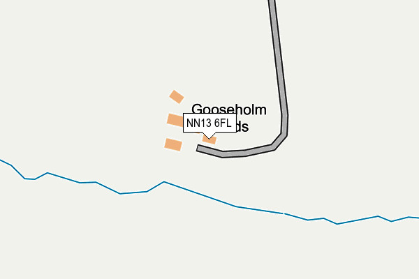
NN13 6FL is located in the Middleton Cheney electoral ward, within the unitary authority of West Northamptonshire and the English Parliamentary constituency of South Northamptonshire. The Sub Integrated Care Board (ICB) Location is NHS Northamptonshire ICB - 78H and the police force is Northamptonshire. This postcode has been in use since February 2017.


GetTheData
Source: OS OpenMap – Local (Ordnance Survey)
Source: OS VectorMap District (Ordnance Survey)
Licence: Open Government Licence (requires attribution)
| Easting | 455628 |
| Northing | 238012 |
| Latitude | 52.037739 |
| Longitude | -1.190424 |
GetTheData
Source: Open Postcode Geo
Licence: Open Government Licence
| Country | England |
| Postcode District | NN13 |
| ➜ NN13 open data dashboard ➜ See where NN13 is on a map | |
GetTheData
Source: Land Registry Price Paid Data
Licence: Open Government Licence
| Ward | Middleton Cheney |
| Constituency | South Northamptonshire |
GetTheData
Source: ONS Postcode Database
Licence: Open Government Licence
| The Green (Croughton Road) | Hinton-in-the-hedges | 1,113m |
| Demand Responsive Area | Hinton-in-the-hedges | 1,117m |
| The Green (Croughton Road) | Hinton-in-the-hedges | 1,124m |
| Airfield (Car Park) | Hinton-in-the-hedges | 1,262m |
GetTheData
Source: NaPTAN
Licence: Open Government Licence
| Percentage of properties with Next Generation Access | 100.0% |
| Percentage of properties with Superfast Broadband | 0.0% |
| Percentage of properties with Ultrafast Broadband | 0.0% |
| Percentage of properties with Full Fibre Broadband | 0.0% |
Superfast Broadband is between 30Mbps and 300Mbps
Ultrafast Broadband is > 300Mbps
| Percentage of properties unable to receive 2Mbps | 0.0% |
| Percentage of properties unable to receive 5Mbps | 100.0% |
| Percentage of properties unable to receive 10Mbps | 100.0% |
| Percentage of properties unable to receive 30Mbps | 100.0% |
GetTheData
Source: Ofcom
Licence: Ofcom Terms of Use (requires attribution)
GetTheData
Source: ONS Postcode Database
Licence: Open Government Licence


➜ Get more ratings from the Food Standards Agency
GetTheData
Source: Food Standards Agency
Licence: FSA terms & conditions
| Last Collection | |||
|---|---|---|---|
| Location | Mon-Fri | Sat | Distance |
| Hinton In The Hedges | 16:00 | 08:00 | 1,084m |
| Pavillion Way Box 2 | 16:30 | 08:00 | 2,158m |
| Pravillion Way No 1 Box | 16:45 | 08:00 | 2,518m |
GetTheData
Source: Dracos
Licence: Creative Commons Attribution-ShareAlike
| Facility | Distance |
|---|---|
| Brackley Leisure Centre Springfield Way, Brackley Sports Hall, Health and Fitness Gym, Grass Pitches, Studio, Swimming Pool | 2.4km |
| Brackley Rugby Union Football Club Nightingale Close, Brackley Grass Pitches | 2.4km |
| Grange Farm Halse, Brackley Grass Pitches | 2.5km |
GetTheData
Source: Active Places
Licence: Open Government Licence
| School | Phase of Education | Distance |
|---|---|---|
| Farthinghoe Primary School Main Road, Farthinghoe, Brackley, NN13 5PA | Primary | 2.6km |
| Bracken Leas Primary School Magdalen Meadows, Brackley, NN13 6LF | Primary | 2.6km |
| Waynflete Infants' School Waynflete Avenue, Brackley, NN13 6AF | Primary | 2.8km |
GetTheData
Source: Edubase
Licence: Open Government Licence
The below table lists the International Territorial Level (ITL) codes (formerly Nomenclature of Territorial Units for Statistics (NUTS) codes) and Local Administrative Units (LAU) codes for NN13 6FL:
| ITL 1 Code | Name |
|---|---|
| TLF | East Midlands (England) |
| ITL 2 Code | Name |
| TLF2 | Leicestershire, Rutland and Northamptonshire |
| ITL 3 Code | Name |
| TLF24 | West Northamptonshire |
| LAU 1 Code | Name |
| E07000155 | South Northamptonshire |
GetTheData
Source: ONS Postcode Directory
Licence: Open Government Licence
The below table lists the Census Output Area (OA), Lower Layer Super Output Area (LSOA), and Middle Layer Super Output Area (MSOA) for NN13 6FL:
| Code | Name | |
|---|---|---|
| OA | E00138865 | |
| LSOA | E01027296 | South Northamptonshire 011C |
| MSOA | E02005691 | South Northamptonshire 011 |
GetTheData
Source: ONS Postcode Directory
Licence: Open Government Licence
| NN13 5LG | Steane Grounds Cottage | 751m |
| NN13 5NG | 1007m | |
| NN13 5NN | Norris Acre | 1080m |
| NN13 5NE | 1146m | |
| NN13 5NF | 1252m | |
| NN13 5NS | 1651m | |
| NN13 5NT | 1785m | |
| NN13 6JF | Johnson Avenue | 1867m |
| NN13 6NJ | Pether Avenue | 1882m |
| NN13 6FA | Halse Road | 1888m |
GetTheData
Source: Open Postcode Geo; Land Registry Price Paid Data
Licence: Open Government Licence