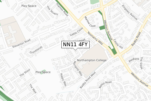
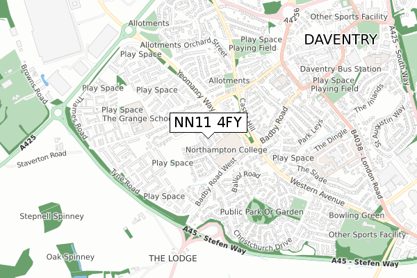
NN11 4FY is located in the Daventry West electoral ward, within the unitary authority of West Northamptonshire and the English Parliamentary constituency of Daventry. The Sub Integrated Care Board (ICB) Location is NHS Northamptonshire ICB - 78H and the police force is Northamptonshire. This postcode has been in use since October 2017.


GetTheData
Source: OS Open Zoomstack (Ordnance Survey)
Licence: Open Government Licence (requires attribution)
Attribution: Contains OS data © Crown copyright and database right 2024
Source: Open Postcode Geo
Licence: Open Government Licence (requires attribution)
Attribution: Contains OS data © Crown copyright and database right 2024; Contains Royal Mail data © Royal Mail copyright and database right 2024; Source: Office for National Statistics licensed under the Open Government Licence v.3.0
| Easting | 456612 |
| Northing | 261977 |
| Latitude | 52.253079 |
| Longitude | -1.172097 |
GetTheData
Source: Open Postcode Geo
Licence: Open Government Licence
| Country | England |
| Postcode District | NN11 |
| ➜ NN11 open data dashboard ➜ See where NN11 is on a map ➜ Where is Daventry? | |
GetTheData
Source: Land Registry Price Paid Data
Licence: Open Government Licence
| Ward | Daventry West |
| Constituency | Daventry |
GetTheData
Source: ONS Postcode Database
Licence: Open Government Licence
2021 22 MAR £356,000 |
6, DAISY ROAD, DAVENTRY, NN11 4FY 2018 30 JUL £375,995 |
8, DAISY ROAD, DAVENTRY, NN11 4FY 2018 30 JUL £375,995 |
10, DAISY ROAD, DAVENTRY, NN11 4FY 2018 30 JUL £285,000 |
4, DAISY ROAD, DAVENTRY, NN11 4FY 2018 27 APR £284,995 |
2, DAISY ROAD, DAVENTRY, NN11 4FY 2018 27 APR £329,950 |
2017 20 DEC £371,000 |
1, DAISY ROAD, DAVENTRY, NN11 4FY 2017 27 OCT £332,000 |
GetTheData
Source: HM Land Registry Price Paid Data
Licence: Contains HM Land Registry data © Crown copyright and database right 2024. This data is licensed under the Open Government Licence v3.0.
| January 2024 | Violence and sexual offences | On or near Somerville Road | 476m |
| January 2024 | Violence and sexual offences | On or near Somerville Road | 476m |
| January 2024 | Anti-social behaviour | On or near Parking Area | 498m |
| ➜ Get more crime data in our Crime section | |||
GetTheData
Source: data.police.uk
Licence: Open Government Licence
| Tertiary College (Badby Road West) | Daventry | 255m |
| Thames Road (Yeomanry Way) | Daventry | 256m |
| Thames Road (Yeomanry Way) | Daventry | 259m |
| Tertiary College (Badby Road West) | Daventry | 266m |
| The Pasture (Badby Road) | Daventry | 433m |
GetTheData
Source: NaPTAN
Licence: Open Government Licence
| Percentage of properties with Next Generation Access | 100.0% |
| Percentage of properties with Superfast Broadband | 100.0% |
| Percentage of properties with Ultrafast Broadband | 100.0% |
| Percentage of properties with Full Fibre Broadband | 100.0% |
Superfast Broadband is between 30Mbps and 300Mbps
Ultrafast Broadband is > 300Mbps
| Percentage of properties unable to receive 2Mbps | 0.0% |
| Percentage of properties unable to receive 5Mbps | 0.0% |
| Percentage of properties unable to receive 10Mbps | 0.0% |
| Percentage of properties unable to receive 30Mbps | 0.0% |
GetTheData
Source: Ofcom
Licence: Ofcom Terms of Use (requires attribution)
GetTheData
Source: ONS Postcode Database
Licence: Open Government Licence


➜ Get more ratings from the Food Standards Agency
GetTheData
Source: Food Standards Agency
Licence: FSA terms & conditions
| Last Collection | |||
|---|---|---|---|
| Location | Mon-Fri | Sat | Distance |
| Prospect Way | 18:30 | 1,480m | |
| Churchill Road | 16:00 | 09:30 | 4,033m |
| Kiln Lane | 16:00 | 09:00 | 4,140m |
GetTheData
Source: Dracos
Licence: Creative Commons Attribution-ShareAlike
| Facility | Distance |
|---|---|
| Northampton College (Daventry Campus) Badby Road West, Daventry Sports Hall, Health and Fitness Gym, Grass Pitches, Studio | 93m |
| The Hollows Football Field Waterloo, Daventry Grass Pitches | 618m |
| Anytime Fitness (Daventry) Bowen Square, Bowen Square, Daventry Health and Fitness Gym | 798m |
GetTheData
Source: Active Places
Licence: Open Government Licence
| School | Phase of Education | Distance |
|---|---|---|
| The Grange School, Daventry Staverton Road, Daventry, NN11 4HW | Primary | 431m |
| The Grange School, Daventry Staverton Road, Daventry, NN11 4HW | Primary | 450m |
| St James Infant School 90 St James Street, Daventry, NN11 4AG | Primary | 538m |
GetTheData
Source: Edubase
Licence: Open Government Licence
The below table lists the International Territorial Level (ITL) codes (formerly Nomenclature of Territorial Units for Statistics (NUTS) codes) and Local Administrative Units (LAU) codes for NN11 4FY:
| ITL 1 Code | Name |
|---|---|
| TLF | East Midlands (England) |
| ITL 2 Code | Name |
| TLF2 | Leicestershire, Rutland and Northamptonshire |
| ITL 3 Code | Name |
| TLF24 | West Northamptonshire |
| LAU 1 Code | Name |
| E07000151 | Daventry |
GetTheData
Source: ONS Postcode Directory
Licence: Open Government Licence
The below table lists the Census Output Area (OA), Lower Layer Super Output Area (LSOA), and Middle Layer Super Output Area (MSOA) for NN11 4FY:
| Code | Name | |
|---|---|---|
| OA | E00137372 | |
| LSOA | E01027010 | Daventry 007E |
| MSOA | E02005625 | Daventry 007 |
GetTheData
Source: ONS Postcode Directory
Licence: Open Government Licence
| NN11 4EX | Gable Close | 104m |
| NN11 4DH | Grovelands | 205m |
| NN11 4TE | Yeomanry Close | 212m |
| NN11 4TG | Yew Tree Grove | 222m |
| NN11 4HL | Staverton Road | 229m |
| NN11 4HN | Marlow Close | 238m |
| NN11 4HJ | Badby Road West | 240m |
| NN11 4RG | Keble Close | 268m |
| NN11 4AQ | Castle Hill | 284m |
| NN11 9HX | Cameron Close | 305m |
GetTheData
Source: Open Postcode Geo; Land Registry Price Paid Data
Licence: Open Government Licence