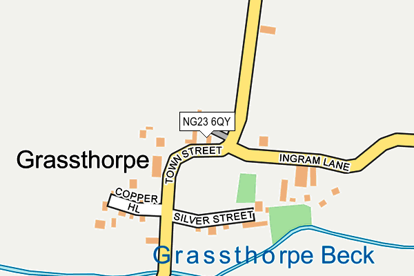
NG23 6QY is located in the Sutton-on-Trent electoral ward, within the local authority district of Newark and Sherwood and the English Parliamentary constituency of Newark. The Sub Integrated Care Board (ICB) Location is NHS Nottingham and Nottinghamshire ICB - 52R and the police force is Nottinghamshire. This postcode has been in use since January 1980.


GetTheData
Source: OS OpenMap – Local (Ordnance Survey)
Source: OS VectorMap District (Ordnance Survey)
Licence: Open Government Licence (requires attribution)
| Easting | 479170 |
| Northing | 367648 |
| Latitude | 53.200046 |
| Longitude | -0.816283 |
GetTheData
Source: Open Postcode Geo
Licence: Open Government Licence
| Country | England |
| Postcode District | NG23 |
| ➜ NG23 open data dashboard ➜ See where NG23 is on a map ➜ Where is Grassthorpe? | |
GetTheData
Source: Land Registry Price Paid Data
Licence: Open Government Licence
Elevation or altitude of NG23 6QY as distance above sea level:
| Metres | Feet | |
|---|---|---|
| Elevation | 10m | 33ft |
Elevation is measured from the approximate centre of the postcode, to the nearest point on an OS contour line from OS Terrain 50, which has contour spacing of ten vertical metres.
➜ How high above sea level am I? Find the elevation of your current position using your device's GPS.
GetTheData
Source: Open Postcode Elevation
Licence: Open Government Licence
| Ward | Sutton-on-trent |
| Constituency | Newark |
GetTheData
Source: ONS Postcode Database
Licence: Open Government Licence
| May 2022 | Other theft | On or near Copper Hill | 323m |
| April 2022 | Other theft | On or near Copper Hill | 323m |
| April 2021 | Other crime | On or near Copper Hill | 323m |
| ➜ Get more crime data in our Crime section | |||
GetTheData
Source: data.police.uk
Licence: Open Government Licence
| Silver Street (Town Street) | Grassthorpe | 363m |
| Silver Street (Town Street) | Grassthorpe | 373m |
| Ingrams Lane (Town Street) | Grassthorpe | 470m |
| Great North Road | Sutton On Trent | 1,367m |
| Great North Road | Sutton On Trent | 1,377m |
GetTheData
Source: NaPTAN
Licence: Open Government Licence
| Percentage of properties with Next Generation Access | 100.0% |
| Percentage of properties with Superfast Broadband | 0.0% |
| Percentage of properties with Ultrafast Broadband | 0.0% |
| Percentage of properties with Full Fibre Broadband | 0.0% |
Superfast Broadband is between 30Mbps and 300Mbps
Ultrafast Broadband is > 300Mbps
| Percentage of properties unable to receive 2Mbps | 0.0% |
| Percentage of properties unable to receive 5Mbps | 0.0% |
| Percentage of properties unable to receive 10Mbps | 100.0% |
| Percentage of properties unable to receive 30Mbps | 100.0% |
GetTheData
Source: Ofcom
Licence: Ofcom Terms of Use (requires attribution)
GetTheData
Source: ONS Postcode Database
Licence: Open Government Licence


➜ Get more ratings from the Food Standards Agency
GetTheData
Source: Food Standards Agency
Licence: FSA terms & conditions
| Last Collection | |||
|---|---|---|---|
| Location | Mon-Fri | Sat | Distance |
| Grassthorpe | 16:30 | 11:00 | 353m |
| Normanton On Trent | 16:30 | 10:00 | 1,373m |
| Crow Park | 16:45 | 11:00 | 1,552m |
GetTheData
Source: Dracos
Licence: Creative Commons Attribution-ShareAlike
| Facility | Distance |
|---|---|
| Sutton-on-trent Village Sports And Community Centre Grassthorpe Road, Sutton-on-trent, Newark Grass Pitches | 844m |
| St Matthews Ce Primary School Mill Lane, Normanton-on-trent, Newark Grass Pitches | 1.7km |
| South Clifton Sports Field Coal Yard Lane, South Clifton Grass Pitches | 3.8km |
GetTheData
Source: Active Places
Licence: Open Government Licence
| School | Phase of Education | Distance |
|---|---|---|
| St Matthew's CofE Primary School Mill Lane, Normanton-on-Trent, Newark, NG23 6RW | Primary | 1.6km |
| Sutton-On-Trent Primary and Nursery School Church Street, Sutton-on-Trent, Newark, NG23 6PD | Primary | 1.9km |
| North Clifton Primary School Church Lane, North Clifton, Newark, NG23 7AP | Primary | 4.8km |
GetTheData
Source: Edubase
Licence: Open Government Licence
| Risk of NG23 6QY flooding from rivers and sea | Medium |
| ➜ NG23 6QY flood map | |
GetTheData
Source: Open Flood Risk by Postcode
Licence: Open Government Licence
The below table lists the International Territorial Level (ITL) codes (formerly Nomenclature of Territorial Units for Statistics (NUTS) codes) and Local Administrative Units (LAU) codes for NG23 6QY:
| ITL 1 Code | Name |
|---|---|
| TLF | East Midlands (England) |
| ITL 2 Code | Name |
| TLF1 | Derbyshire and Nottinghamshire |
| ITL 3 Code | Name |
| TLF15 | North Nottinghamshire |
| LAU 1 Code | Name |
| E07000175 | Newark and Sherwood |
GetTheData
Source: ONS Postcode Directory
Licence: Open Government Licence
The below table lists the Census Output Area (OA), Lower Layer Super Output Area (LSOA), and Middle Layer Super Output Area (MSOA) for NG23 6QY:
| Code | Name | |
|---|---|---|
| OA | E00144462 | |
| LSOA | E01028349 | Newark and Sherwood 003D |
| MSOA | E02005895 | Newark and Sherwood 003 |
GetTheData
Source: ONS Postcode Directory
Licence: Open Government Licence
| NG23 6QZ | 366m | |
| NG23 6RB | Normanton Road | 591m |
| NG23 6RG | Grassthorpe Road | 742m |
| NG23 6RH | South Street | 932m |
| NG23 6QW | Great North Road | 1048m |
| NG23 6RL | Brotts Road | 1098m |
| NG23 6RQ | South Street | 1128m |
| NG23 6RY | Grassthorpe Road | 1128m |
| NG23 6FJ | Manor Grove | 1153m |
| NG23 6RE | Hawthorne Leys | 1245m |
GetTheData
Source: Open Postcode Geo; Land Registry Price Paid Data
Licence: Open Government Licence