South Clifton Sports Field
South Clifton Sports Field is located in South Clifton (NG23), and offers Grass Pitches.
| Address | THE PAVILION, Coal Yard Lane, South Clifton, NG23 7AH |
| Car Park | Yes |
| Car Park Capacity | 20 |
| Management Type | Community Organisation |
| Management Group | Others |
| Owner Type | Community Organisation |
| Owner Group | Community Organisation |
| Education Phase | Not applicable |
Facilities
| Accessibility | Pay and Play |
| Management Type | Community Organisation |
| Year Built | 1956 |
| Changing Rooms | Yes |
| Date Record Checked | 27th Apr 2023 |
| Opening Times | Dawn To Dusk |
Facility specifics
Disabled access
| Disabled Access | Yes |
| Activity Areas | Yes |
| Emergency Exits | Yes |
| Accessibility | Free Public Access |
| Management Type | Community Organisation |
| Changing Rooms | Yes |
| Date Record Created | 27th Sep 2019 |
| Date Record Checked | 27th Apr 2023 |
| Opening Times | Dawn To Dusk |
Facility specifics
Disabled access
| Disabled Access | Yes |
| Finding/Reaching Entrance | Yes |
| Reception Area | Yes |
| Doorways | Yes |
| Activity Areas | Yes |
| Disabled Toilets | Yes |
| Emergency Exits | Yes |
| Notes | No dedicated disabled parking but parking available
No dedicated changing facilities but spaces available for private changing |
Contact
Disabled access
Disabled access for South Clifton Sports Field
| Disabled Access | Yes |
| Finding/Reaching Entrance | Yes |
| Reception Area | Yes |
| Doorways | Yes |
| Activity Areas | Yes |
| Disabled Toilets | Yes |
| Emergency Exits | Yes |
| Notes | No dedicated disabled parking but parking available
No dedicated changing facilities but spaces available for private changing |
Where is South Clifton Sports Field?
| Sub Building Name | |
| Building Name | THE PAVILION |
| Building Number | 0 |
| Dependent Thoroughfare | |
| Thoroughfare Name | COAL YARD LANE |
| Double Dependent Locality | |
| Dependent Locality | |
| PostTown | SOUTH CLIFTON |
| Postcode | NG23 7AH |
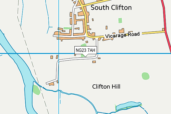
South Clifton Sports Field on a map

South Clifton Sports Field geodata
| Easting | 482142 |
| Northing | 369986 |
| Latitude | 53.220586 |
| Longitude | -0.771204 |
| Local Authority Name | Newark and Sherwood |
| Local Authority Code | E07000175 |
| Parliamentary Constituency Name | Newark |
| Parliamentary Constituency Code | E14000829 |
| Region Name | East Midlands |
| Region Code | E15000004 |
| Ward Name | Collingham |
| Ward Code | E05010070 |
| Output Area Code | E00144281 |
About this data
This data is open data sourced from Active Places Power and licenced under the Active Places Open Data Licence.
| toid | osgb1000002112777010 |
| Created On | 13th Feb 2009 |
| Audited On | 27th Apr 2023 |
| Checked On | 27th Apr 2023 |
