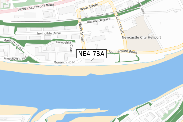
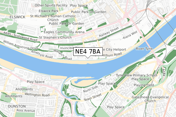
NE4 7BA is located in the Elswick electoral ward, within the metropolitan district of Newcastle upon Tyne and the English Parliamentary constituency of Newcastle upon Tyne Central. The Sub Integrated Care Board (ICB) Location is NHS North East and North Cumbria ICB - 13T and the police force is Northumbria. This postcode has been in use since December 2017.


GetTheData
Source: OS Open Zoomstack (Ordnance Survey)
Licence: Open Government Licence (requires attribution)
Attribution: Contains OS data © Crown copyright and database right 2024
Source: Open Postcode Geo
Licence: Open Government Licence (requires attribution)
Attribution: Contains OS data © Crown copyright and database right 2024; Contains Royal Mail data © Royal Mail copyright and database right 2024; Source: Office for National Statistics licensed under the Open Government Licence v.3.0
| Easting | 423646 |
| Northing | 562927 |
| Latitude | 54.960429 |
| Longitude | -1.632266 |
GetTheData
Source: Open Postcode Geo
Licence: Open Government Licence
| Country | England |
| Postcode District | NE4 |
| ➜ NE4 open data dashboard ➜ See where NE4 is on a map ➜ Where is Newcastle upon Tyne? | |
GetTheData
Source: Land Registry Price Paid Data
Licence: Open Government Licence
| Ward | Elswick |
| Constituency | Newcastle Upon Tyne Central |
GetTheData
Source: ONS Postcode Database
Licence: Open Government Licence
| December 2023 | Violence and sexual offences | On or near Fall Pass | 487m |
| November 2023 | Other theft | On or near Fall Pass | 487m |
| November 2023 | Violence and sexual offences | On or near Fall Pass | 487m |
| ➜ Get more crime data in our Crime section | |||
GetTheData
Source: data.police.uk
Licence: Open Government Licence
| Business Park Monarch Road (Monarch Road) | Elswick | 141m |
| Water Street | Elswick | 189m |
| Water Street | Elswick | 217m |
| Business Park Monarch Road (Monarch Road) | Elswick | 229m |
| Scotswood Road-dunn Street (Scotswood Road) | Elswick | 335m |
| Central Station (Tyne And Wear Metro Station) (Neville Street) | Newcastle Upon Tyne | 1,415m |
| Monument (Tyne And Wear Metro Station) (Blackett Street) | Newcastle Upon Tyne | 1,902m |
| Newcastle Station | 1.3km |
| Dunston Station | 1.3km |
| Metrocentre Station | 2.1km |
GetTheData
Source: NaPTAN
Licence: Open Government Licence
GetTheData
Source: ONS Postcode Database
Licence: Open Government Licence


➜ Get more ratings from the Food Standards Agency
GetTheData
Source: Food Standards Agency
Licence: FSA terms & conditions
| Last Collection | |||
|---|---|---|---|
| Location | Mon-Fri | Sat | Distance |
| Scotswood Road | 17:30 | 11:30 | 526m |
| Cambridge Street | 17:30 | 12:00 | 545m |
| Asama Road | 17:45 | 12:00 | 658m |
GetTheData
Source: Dracos
Licence: Creative Commons Attribution-ShareAlike
| Facility | Distance |
|---|---|
| Vertu Motors Arena Scotswood Road, Newcastle Upon Tyne Sports Hall | 466m |
| Newcastle College Sports Centre Scotswood Road, Newcastle Upon Tyne Health and Fitness Gym, Sports Hall | 742m |
| The Zone @ The Lifestyle Academy Scotswood Road, Newcastle Upon Tyne Health and Fitness Gym, Studio | 752m |
GetTheData
Source: Active Places
Licence: Open Government Licence
| School | Phase of Education | Distance |
|---|---|---|
| St Michael's Catholic Primary School Clumber Street North, Elswick, Newcastle-upon-Tyne, NE4 7RE | Primary | 694m |
| NCG Rye Hill Campus, Scotswood Road, Newcastle-upon-Tyne, NE4 7SA | 16 plus | 745m |
| Riverside Primary Academy Colliery Road, Dunston, Gateshead, NE11 9DX | Primary | 881m |
GetTheData
Source: Edubase
Licence: Open Government Licence
The below table lists the International Territorial Level (ITL) codes (formerly Nomenclature of Territorial Units for Statistics (NUTS) codes) and Local Administrative Units (LAU) codes for NE4 7BA:
| ITL 1 Code | Name |
|---|---|
| TLC | North East (England) |
| ITL 2 Code | Name |
| TLC2 | Northumberland, and Tyne and Wear |
| ITL 3 Code | Name |
| TLC22 | Tyneside |
| LAU 1 Code | Name |
| E08000021 | Newcastle upon Tyne |
GetTheData
Source: ONS Postcode Directory
Licence: Open Government Licence
The below table lists the Census Output Area (OA), Lower Layer Super Output Area (LSOA), and Middle Layer Super Output Area (MSOA) for NE4 7BA:
| Code | Name | |
|---|---|---|
| OA | E00175577 | |
| LSOA | E01008437 | Newcastle upon Tyne 029F |
| MSOA | E02001736 | Newcastle upon Tyne 029 |
GetTheData
Source: ONS Postcode Directory
Licence: Open Government Licence
| NE4 7AR | Skinnerburn Road | 0m |
| NE4 7BG | Penn Street | 284m |
| NE8 2BF | North Side | 372m |
| NE8 2GA | North Side | 383m |
| NE8 2BG | North West Side | 389m |
| NE4 7DX | Park Road | 398m |
| NE8 2BQ | Fall Pass | 416m |
| NE8 2GB | North Side | 418m |
| NE8 2DL | North Side | 427m |
| NE8 2GU | North Side | 435m |
GetTheData
Source: Open Postcode Geo; Land Registry Price Paid Data
Licence: Open Government Licence