NE32 9DT maps, stats, and open data
NE32 9DT is located in the Primrose electoral ward, within the metropolitan district of South Tyneside and the English Parliamentary constituency of Jarrow. The Sub Integrated Care Board (ICB) Location is NHS North East and North Cumbria ICB - 00N and the police force is Northumbria. This postcode has been in use since April 2023.
NE32 9DT geodata
| Easting | 432934 |
| Northing | 565289 |
| Latitude | 54.981129 |
| Longitude | -1.486953 |
Where is NE32 9DT?
| Country | England |
| Postcode District | NE32 |
Politics
| Ward | Primrose |
|---|
| Constituency | Jarrow |
|---|
Transport
Nearest bus stops to NE32 9DT
| Cambrian Street - Morrisons (Cambrian Street) | Jarrow | 53m |
| Howard Street-exchange (Howard Street) | Jarrow | 246m |
| Howard Street-exchange (Howard Street) | Jarrow | 255m |
| St Bedes Rc Jmi School (Howard Street) | Jarrow | 298m |
| Chaytor Street-ferry Street (Chaytor Street) | Jarrow | 312m |
Nearest underground/metro/tram to NE32 9DT
| Jarrow (Tyne And Wear Metro Station) (Grant Street) | Jarrow | 467m |
| Bede (Tyne And Wear Metro Station) (Monksway) | Bede | 1,582m |
Nearest railway stations to NE32 9DT
| Brockley Whins Station | 2.9km |
| Heworth Station | 5.5km |
| East Boldon Station | 5.8km |
Deprivation
93.2% of English postcodes are less deprived than
NE32 9DT:
Food Standards Agency
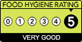
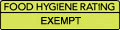
Three nearest food hygiene ratings to NE32 9DT (metres)
Domino's Pizza
New Look
B & M Retail Ltd
➜ Get more ratings from the Food Standards Agency
Nearest post box to NE32 9DT
| | Last Collection | |
|---|
| Location | Mon-Fri | Sat | Distance |
|---|
| Jarrow Post Office | 17:15 | 10:30 | 153m |
| Ellison Street | 17:30 | 10:30 | 270m |
| High Street | 17:00 | 10:30 | 381m |
NE32 9DT ITL and NE32 9DT LAU
The below table lists the International Territorial Level (ITL) codes (formerly Nomenclature of Territorial Units for Statistics (NUTS) codes) and Local Administrative Units (LAU) codes for NE32 9DT:
| ITL 1 Code | Name |
|---|
| TLC | North East (England) |
| ITL 2 Code | Name |
|---|
| TLC2 | Northumberland, and Tyne and Wear |
| ITL 3 Code | Name |
|---|
| TLC22 | Tyneside |
| LAU 1 Code | Name |
|---|
| E08000023 | South Tyneside |
NE32 9DT census areas
The below table lists the Census Output Area (OA), Lower Layer Super Output Area (LSOA), and Middle Layer Super Output Area (MSOA) for NE32 9DT:
| Code | Name |
|---|
| OA | E00043670 | |
|---|
| LSOA | E01008604 | South Tyneside 007B |
|---|
| MSOA | E02001774 | South Tyneside 007 |
|---|
Nearest postcodes to NE32 9DT