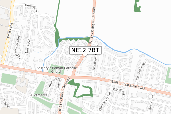
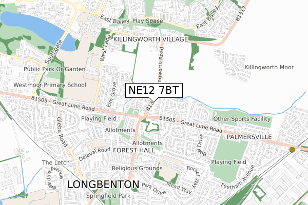
NE12 7BT is located in the Longbenton electoral ward, within the metropolitan district of North Tyneside and the English Parliamentary constituency of North Tyneside. The Sub Integrated Care Board (ICB) Location is NHS North East and North Cumbria ICB - 99C and the police force is Northumbria. This postcode has been in use since October 2018.


GetTheData
Source: OS Open Zoomstack (Ordnance Survey)
Licence: Open Government Licence (requires attribution)
Attribution: Contains OS data © Crown copyright and database right 2024
Source: Open Postcode Geo
Licence: Open Government Licence (requires attribution)
Attribution: Contains OS data © Crown copyright and database right 2024; Contains Royal Mail data © Royal Mail copyright and database right 2024; Source: Office for National Statistics licensed under the Open Government Licence v.3.0
| Easting | 426600 |
| Northing | 571112 |
| Latitude | 55.033831 |
| Longitude | -1.585380 |
GetTheData
Source: Open Postcode Geo
Licence: Open Government Licence
| Country | England |
| Postcode District | NE12 |
| ➜ NE12 open data dashboard ➜ See where NE12 is on a map ➜ Where is Longbenton? | |
GetTheData
Source: Land Registry Price Paid Data
Licence: Open Government Licence
| Ward | Longbenton |
| Constituency | North Tyneside |
GetTheData
Source: ONS Postcode Database
Licence: Open Government Licence
7, ACRES COURT, KILLINGWORTH, NEWCASTLE UPON TYNE, NE12 7BT 2022 25 AUG £449,995 |
6, ACRES COURT, KILLINGWORTH, NEWCASTLE UPON TYNE, NE12 7BT 2022 30 MAY £436,995 |
4, ACRES COURT, KILLINGWORTH, NEWCASTLE UPON TYNE, NE12 7BT 2022 29 APR £499,995 |
5, ACRES COURT, KILLINGWORTH, NEWCASTLE UPON TYNE, NE12 7BT 2022 25 APR £383,995 |
2, ACRES COURT, KILLINGWORTH, NEWCASTLE UPON TYNE, NE12 7BT 2022 31 MAR £329,995 |
1, ACRES COURT, KILLINGWORTH, NEWCASTLE UPON TYNE, NE12 7BT 2022 28 FEB £430,995 |
GetTheData
Source: HM Land Registry Price Paid Data
Licence: Contains HM Land Registry data © Crown copyright and database right 2024. This data is licensed under the Open Government Licence v3.0.
| April 2023 | Anti-social behaviour | On or near Harriot Drive | 398m |
| October 2022 | Anti-social behaviour | On or near Sharon Close | 378m |
| September 2022 | Anti-social behaviour | On or near Sharon Close | 378m |
| ➜ Get more crime data in our Crime section | |||
GetTheData
Source: data.police.uk
Licence: Open Government Licence
| Station Road-old Railway Station (Station Road) | Killingworth | 288m |
| Killingworth Drive | West Moor | 316m |
| Sharon Close (Sharon Close) | West Moor | 382m |
| Northumbrian Way-station Road (Northumbrian Way) | Killingworth | 386m |
| Northumbrian Way-arrow Close (Northumbrian Way) | Killingworth | 404m |
GetTheData
Source: NaPTAN
Licence: Open Government Licence
GetTheData
Source: ONS Postcode Database
Licence: Open Government Licence


➜ Get more ratings from the Food Standards Agency
GetTheData
Source: Food Standards Agency
Licence: FSA terms & conditions
| Last Collection | |||
|---|---|---|---|
| Location | Mon-Fri | Sat | Distance |
| Killingworth Drive | 17:30 | 12:15 | 293m |
| Great Lime Road | 17:30 | 12:15 | 569m |
| Westmoor Post Office | 17:30 | 12:15 | 685m |
GetTheData
Source: Dracos
Licence: Creative Commons Attribution-ShareAlike
| Facility | Distance |
|---|---|
| Newcastle Field Packaging (Closed) Station Road, Newcastle Upon Tyne Grass Pitches | 525m |
| Grasmere Academy Grasmere Court, Killingworth, Newcastle Upon Tyne Grass Pitches | 581m |
| West Moor Community Centre Benton Lane, Newcastle Upon Tyne Sports Hall, Grass Pitches, Artificial Grass Pitch | 708m |
GetTheData
Source: Active Places
Licence: Open Government Licence
| School | Phase of Education | Distance |
|---|---|---|
| Grasmere Academy Grasmere Court, Killingworth, Newcastle-upon-Tyne, NE12 6TS | Primary | 679m |
| Bailey Green Primary School West Bailey, Killingworth, NE12 6QL | Primary | 971m |
| Westmoor Primary School Southgate, Killingworth, Newcastle-upon-Tyne, NE12 6SA | Primary | 978m |
GetTheData
Source: Edubase
Licence: Open Government Licence
The below table lists the International Territorial Level (ITL) codes (formerly Nomenclature of Territorial Units for Statistics (NUTS) codes) and Local Administrative Units (LAU) codes for NE12 7BT:
| ITL 1 Code | Name |
|---|---|
| TLC | North East (England) |
| ITL 2 Code | Name |
| TLC2 | Northumberland, and Tyne and Wear |
| ITL 3 Code | Name |
| TLC22 | Tyneside |
| LAU 1 Code | Name |
| E08000022 | North Tyneside |
GetTheData
Source: ONS Postcode Directory
Licence: Open Government Licence
The below table lists the Census Output Area (OA), Lower Layer Super Output Area (LSOA), and Middle Layer Super Output Area (MSOA) for NE12 7BT:
| Code | Name | |
|---|---|---|
| OA | E00043223 | |
| LSOA | E01008516 | North Tyneside 014D |
| MSOA | E02001751 | North Tyneside 014 |
GetTheData
Source: ONS Postcode Directory
Licence: Open Government Licence
| NE12 7HA | Whitehouse Farm | 153m |
| NE12 7EY | Whitecroft Road | 219m |
| NE12 7ES | Killingworth Drive | 274m |
| NE12 6QQ | Harvey Combe | 338m |
| NE12 7ET | Reynolds Avenue | 350m |
| NE12 7EX | Dene Avenue | 395m |
| NE12 7EU | Harriot Drive | 404m |
| NE12 7ER | Killingworth Drive | 416m |
| NE12 7EE | Northfield Drive | 442m |
| NE12 7EQ | Parkside | 446m |
GetTheData
Source: Open Postcode Geo; Land Registry Price Paid Data
Licence: Open Government Licence