ML3 7DJ maps, stats, and open data
ML3 7DJ is located in the Hamilton North and East electoral ward, within the council area of South Lanarkshire and the Scottish Parliamentary constituency of Lanark and Hamilton East. The Community Health Partnership is South Lanarkshire Community Health Partnership and the police force is Scotland. This postcode has been in use since April 1989.
ML3 7DJ maps
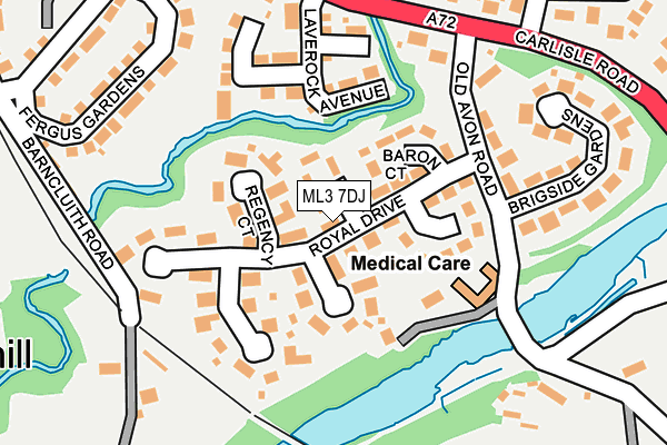
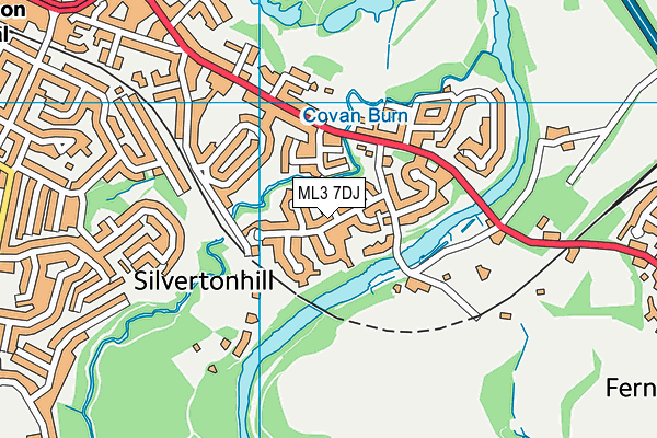
ML3 7DJ geodata
| Easting | 273159 |
| Northing | 654733 |
| Latitude | 55.769251 |
| Longitude | -4.023390 |
Where is ML3 7DJ?
| Country | Scotland |
| Postcode District | ML3 |
Politics
| Ward | Hamilton North And East |
|---|
| Constituency | Lanark And Hamilton East |
|---|
Transport
Nearest bus stops to ML3 7DJ
| Laverlock Avenue (Carlisle Road) | Hamilton | 191m |
| Old Avon Road (Carlisle Road) | Hamilton | 208m |
| Angus Avenue (Carlisle Road) | Hamilton | 278m |
| Angus Avenue (Carlisle Road) | Hamilton | 284m |
| Avonside Grove (Townhead Street) | Hamilton | 544m |
Nearest railway stations to ML3 7DJ
| Hamilton Central Station | 1.1km |
| Chatelherault Station | 1.3km |
| Hamilton West Station | 2.2km |
Broadband
Broadband access in ML3 7DJ (2020 data)
| Percentage of properties with Next Generation Access | 100.0% |
| Percentage of properties with Superfast Broadband | 100.0% |
| Percentage of properties with Ultrafast Broadband | 61.5% |
| Percentage of properties with Full Fibre Broadband | 0.0% |
Superfast Broadband is between 30Mbps and 300Mbps
Ultrafast Broadband is > 300Mbps
Broadband speed in ML3 7DJ (2019 data)
Download
| Median download speed | 33.0Mbps |
| Average download speed | 33.9Mbps |
| Maximum download speed | 100.00Mbps |
Upload
| Median upload speed | 6.3Mbps |
| Average upload speed | 6.0Mbps |
| Maximum upload speed | 19.53Mbps |
Broadband limitations in ML3 7DJ (2020 data)
| Percentage of properties unable to receive 2Mbps | 0.0% |
| Percentage of properties unable to receive 5Mbps | 0.0% |
| Percentage of properties unable to receive 10Mbps | 0.0% |
| Percentage of properties unable to receive 30Mbps | 0.0% |
ML3 7DJ gas and electricity consumption
Estimated total energy consumption in ML3 7DJ by fuel type, 2015.
Gas
| Consumption (kWh) | 560,271 |
|---|
| Meter count | 26 |
|---|
| Mean (kWh/meter) | 21,549 |
|---|
| Median (kWh/meter) | 18,777 |
|---|
Electricity
| Consumption (kWh) | 92,983 |
|---|
| Meter count | 26 |
|---|
| Mean (kWh/meter) | 3,576 |
|---|
| Median (kWh/meter) | 3,584 |
|---|
- Consumption: The estimated total energy consumption, in kWh, across all meters in ML3 7DJ, for 2015.
- Meter count: The total number of meters in ML3 7DJ.
- Mean: The mean average consumption per meter, in kWh.
- Median: The median average consumption per meter, in kWh.
Deprivation
12.3% of Scottish postcodes are less deprived than
ML3 7DJ:
Food Standards Agency
Three nearest food hygiene information scheme ratings to ML3 7DJ (metres)
Avonbridge Care Home
Chatelherault Nursery School
Early Learning Unit
➜ Get more ratings from the Food Standards Agency
Nearest post box to ML3 7DJ
| | Last Collection | |
|---|
| Location | Mon-Fri | Sat | Distance |
|---|
| Asda | 17:30 | 11:00 | 1,170m |
| Cadzow Street | 17:45 | 11:30 | 1,212m |
| Alness Street(10) | 17:45 | 11:30 | 1,303m |
ML3 7DJ ITL and ML3 7DJ LAU
The below table lists the International Territorial Level (ITL) codes (formerly Nomenclature of Territorial Units for Statistics (NUTS) codes) and Local Administrative Units (LAU) codes for ML3 7DJ:
| ITL 1 Code | Name |
|---|
| TLM | Scotland |
| ITL 2 Code | Name |
|---|
| TLM9 | Southern Scotland |
| ITL 3 Code | Name |
|---|
| TLM95 | South Lanarkshire |
| LAU 1 Code | Name |
|---|
| S30000025 | South Lanarkshire |
ML3 7DJ census areas
The below table lists the Census Output Area (OA), Lower Layer Super Output Area (LSOA), and Middle Layer Super Output Area (MSOA) for ML3 7DJ:
| Code | Name |
|---|
| OA | S00131956 | |
|---|
| LSOA | S01012716 | Hamilton Centre and Low Parks - 01 |
|---|
| MSOA | S02002384 | Hamilton Centre and Low Parks |
|---|