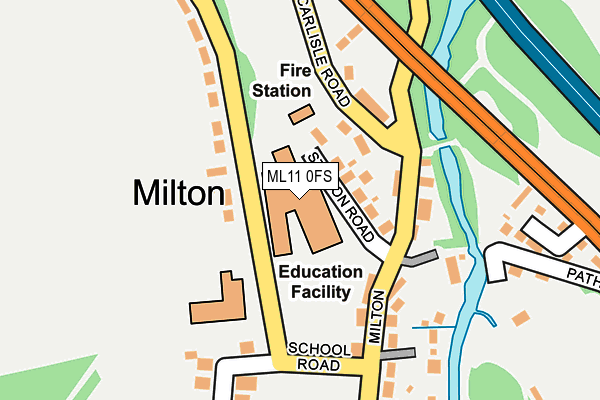
ML11 0FS is located in the Clydesdale South electoral ward, within the council area of South Lanarkshire and the Scottish Parliamentary constituency of East Kilbride, Strathaven and Lesmahagow. The Community Health Partnership is South Lanarkshire Community Health Partnership and the police force is Scotland. This postcode has been in use since September 2007.


GetTheData
Source: OS OpenMap – Local (Ordnance Survey)
Source: OS VectorMap District (Ordnance Survey)
Licence: Open Government Licence (requires attribution)
| Easting | 281316 |
| Northing | 640485 |
| Latitude | 55.643372 |
| Longitude | -3.887272 |
GetTheData
Source: Open Postcode Geo
Licence: Open Government Licence
| Country | Scotland |
| Postcode District | ML11 |
| ➜ ML11 open data dashboard ➜ See where ML11 is on a map | |
GetTheData
Source: Land Registry Price Paid Data
Licence: Open Government Licence
| Ward | Clydesdale South |
| Constituency | East Kilbride, Strathaven And Lesmahagow |
GetTheData
Source: ONS Postcode Database
Licence: Open Government Licence
| Leshmahagow Pr School (School Road) | Lesmahagow | 164m |
| Leshmahagow Pr School (School Road) | Lesmahagow | 168m |
| Nethan Vale Terrace (Strathaven Road) | Lesmahagow | 293m |
| Nethan Vale Terrace (Strathaven Road) | Lesmahagow | 309m |
| Bloomfield Road (Abbeygreen Road) | Lesmahagow | 434m |
GetTheData
Source: NaPTAN
Licence: Open Government Licence
GetTheData
Source: ONS Postcode Database
Licence: Open Government Licence


➜ Get more ratings from the Food Standards Agency
GetTheData
Source: Food Standards Agency
Licence: FSA terms & conditions
| Last Collection | |||
|---|---|---|---|
| Location | Mon-Fri | Sat | Distance |
| Abbeygreen | 16:15 | 10:30 | 563m |
| Post Office | 16:45 | 11:30 | 754m |
| Barr Terrace | 16:45 | 09:30 | 2,879m |
GetTheData
Source: Dracos
Licence: Creative Commons Attribution-ShareAlike
The below table lists the International Territorial Level (ITL) codes (formerly Nomenclature of Territorial Units for Statistics (NUTS) codes) and Local Administrative Units (LAU) codes for ML11 0FS:
| ITL 1 Code | Name |
|---|---|
| TLM | Scotland |
| ITL 2 Code | Name |
| TLM9 | Southern Scotland |
| ITL 3 Code | Name |
| TLM95 | South Lanarkshire |
| LAU 1 Code | Name |
| S30000025 | South Lanarkshire |
GetTheData
Source: ONS Postcode Directory
Licence: Open Government Licence
The below table lists the Census Output Area (OA), Lower Layer Super Output Area (LSOA), and Middle Layer Super Output Area (MSOA) for ML11 0FS:
| Code | Name | |
|---|---|---|
| OA | S00130859 | |
| LSOA | S01012646 | Lesmahagow - 05 |
| MSOA | S02002369 | Lesmahagow |
GetTheData
Source: ONS Postcode Directory
Licence: Open Government Licence