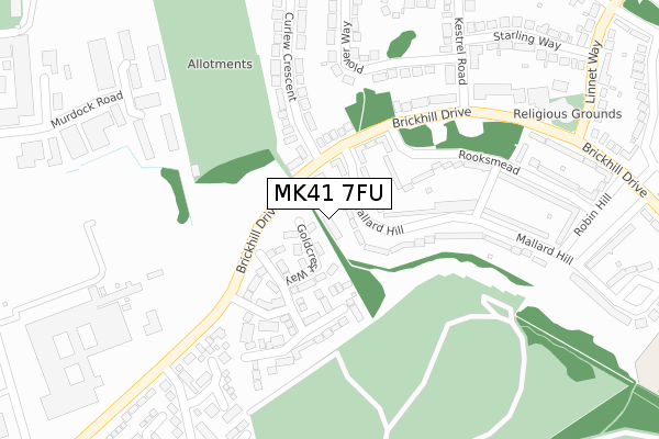
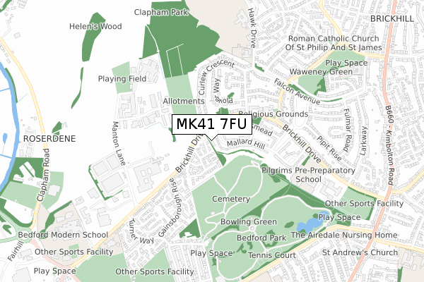
MK41 7FU is located in the De Parys electoral ward, within the unitary authority of Bedford and the English Parliamentary constituency of Bedford. The Sub Integrated Care Board (ICB) Location is NHS Bedfordshire, Luton and Milton Keynes ICB - M1J4Y and the police force is Bedfordshire. This postcode has been in use since May 2018.


GetTheData
Source: OS Open Zoomstack (Ordnance Survey)
Licence: Open Government Licence (requires attribution)
Attribution: Contains OS data © Crown copyright and database right 2024
Source: Open Postcode Geo
Licence: Open Government Licence (requires attribution)
Attribution: Contains OS data © Crown copyright and database right 2024; Contains Royal Mail data © Royal Mail copyright and database right 2024; Source: Office for National Statistics licensed under the Open Government Licence v.3.0
| Easting | 504838 |
| Northing | 251569 |
| Latitude | 52.152473 |
| Longitude | -0.469059 |
GetTheData
Source: Open Postcode Geo
Licence: Open Government Licence
| Country | England |
| Postcode District | MK41 |
| ➜ MK41 open data dashboard ➜ See where MK41 is on a map ➜ Where is Bedford? | |
GetTheData
Source: Land Registry Price Paid Data
Licence: Open Government Licence
| Ward | De Parys |
| Constituency | Bedford |
GetTheData
Source: ONS Postcode Database
Licence: Open Government Licence
| January 2024 | Violence and sexual offences | On or near Goldcrest Way | 49m |
| January 2024 | Vehicle crime | On or near Goldcrest Way | 49m |
| January 2024 | Burglary | On or near Goldcrest Way | 49m |
| ➜ Get more crime data in our Crime section | |||
GetTheData
Source: data.police.uk
Licence: Open Government Licence
| Rooksmead (Brickhill Drive) | Brickhill | 88m |
| Rooksmead (Brickhill Drive) | Brickhill | 175m |
| Eagle Gardens (Brickhill Drive) | Bedford | 256m |
| Brickhill Drive Shops (Brickhill Drive) | Brickhill | 309m |
| Morland Way (Gainsborough Rise) | Bedford | 351m |
| Bedford Station | 1.9km |
| Bedford St Johns Station | 2.6km |
GetTheData
Source: NaPTAN
Licence: Open Government Licence
| Percentage of properties with Next Generation Access | 100.0% |
| Percentage of properties with Superfast Broadband | 100.0% |
| Percentage of properties with Ultrafast Broadband | 0.0% |
| Percentage of properties with Full Fibre Broadband | 0.0% |
Superfast Broadband is between 30Mbps and 300Mbps
Ultrafast Broadband is > 300Mbps
| Percentage of properties unable to receive 2Mbps | 0.0% |
| Percentage of properties unable to receive 5Mbps | 0.0% |
| Percentage of properties unable to receive 10Mbps | 0.0% |
| Percentage of properties unable to receive 30Mbps | 0.0% |
GetTheData
Source: Ofcom
Licence: Ofcom Terms of Use (requires attribution)
GetTheData
Source: ONS Postcode Database
Licence: Open Government Licence


➜ Get more ratings from the Food Standards Agency
GetTheData
Source: Food Standards Agency
Licence: FSA terms & conditions
| Last Collection | |||
|---|---|---|---|
| Location | Mon-Fri | Sat | Distance |
| Post Office Brickhill Drive | 17:30 | 12:00 | 339m |
| Gainsborough Rise | 18:30 | 11:15 | 541m |
| Hawk Drive | 18:30 | 11:30 | 583m |
GetTheData
Source: Dracos
Licence: Creative Commons Attribution-ShareAlike
| Facility | Distance |
|---|---|
| Puregym (Bedford Heights) Brickhill Drive, Bedford Swimming Pool, Health and Fitness Gym, Studio | 428m |
| Scott Primary School Hawk Drive, Bedford Grass Pitches | 558m |
| Mcmullen Park Meadow Lane, Manton Industrial Estate, Bedford Grass Pitches | 567m |
GetTheData
Source: Active Places
Licence: Open Government Licence
| School | Phase of Education | Distance |
|---|---|---|
| Scott Primary School Hawk Drive, Brickhill, Bedford, MK41 7JA | Primary | 559m |
| Pilgrims Pre-Preparatory School Brickhill Drive, Bedford, MK41 7QZ | Not applicable | 645m |
| Edith Cavell Primary School Manton Lane, Bedford, MK41 7NH | Primary | 782m |
GetTheData
Source: Edubase
Licence: Open Government Licence
The below table lists the International Territorial Level (ITL) codes (formerly Nomenclature of Territorial Units for Statistics (NUTS) codes) and Local Administrative Units (LAU) codes for MK41 7FU:
| ITL 1 Code | Name |
|---|---|
| TLH | East |
| ITL 2 Code | Name |
| TLH2 | Bedfordshire and Hertfordshire |
| ITL 3 Code | Name |
| TLH24 | Bedford |
| LAU 1 Code | Name |
| E06000055 | Bedford |
GetTheData
Source: ONS Postcode Directory
Licence: Open Government Licence
The below table lists the Census Output Area (OA), Lower Layer Super Output Area (LSOA), and Middle Layer Super Output Area (MSOA) for MK41 7FU:
| Code | Name | |
|---|---|---|
| OA | E00088141 | |
| LSOA | E01017457 | Bedford 005E |
| MSOA | E02003620 | Bedford 005 |
GetTheData
Source: ONS Postcode Directory
Licence: Open Government Licence
| MK41 7QT | Mallard Hill | 34m |
| MK41 7FF | Goldcrest Way | 70m |
| MK41 7QJ | Brickhill Drive | 78m |
| MK41 7QU | Mallard Hill | 109m |
| MK41 7QQ | Brickhill Drive | 128m |
| MK41 7QL | Brickhill Drive | 141m |
| MK41 7FE | Eagle Gardens | 155m |
| MK41 7QY | Rooksmead | 166m |
| MK41 7QG | Brickhill Drive | 237m |
| MK41 7QS | Mallard Hill | 257m |
GetTheData
Source: Open Postcode Geo; Land Registry Price Paid Data
Licence: Open Government Licence