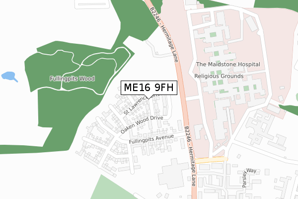
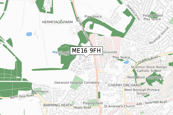
ME16 9FH is located in the Heath electoral ward, within the local authority district of Maidstone and the English Parliamentary constituency of Maidstone and The Weald. The Sub Integrated Care Board (ICB) Location is NHS Kent and Medway ICB - 91Q and the police force is Kent. This postcode has been in use since July 2019.


GetTheData
Source: OS Open Zoomstack (Ordnance Survey)
Licence: Open Government Licence (requires attribution)
Attribution: Contains OS data © Crown copyright and database right 2024
Source: Open Postcode Geo
Licence: Open Government Licence (requires attribution)
Attribution: Contains OS data © Crown copyright and database right 2024; Contains Royal Mail data © Royal Mail copyright and database right 2024; Source: Office for National Statistics licensed under the Open Government Licence v.3.0
| Easting | 573122 |
| Northing | 155703 |
| Latitude | 51.274174 |
| Longitude | 0.480590 |
GetTheData
Source: Open Postcode Geo
Licence: Open Government Licence
| Country | England |
| Postcode District | ME16 |
| ➜ ME16 open data dashboard ➜ See where ME16 is on a map ➜ Where is Maidstone? | |
GetTheData
Source: Land Registry Price Paid Data
Licence: Open Government Licence
| Ward | Heath |
| Constituency | Maidstone And The Weald |
GetTheData
Source: ONS Postcode Database
Licence: Open Government Licence
10, ST LAWRENCE DRIVE, MAIDSTONE, ME16 9FH 2020 23 MAR £594,995 |
16, ST LAWRENCE DRIVE, MAIDSTONE, ME16 9FH 2020 6 MAR £504,995 |
11, ST LAWRENCE DRIVE, MAIDSTONE, ME16 9FH 2020 7 FEB £504,995 |
14, ST LAWRENCE DRIVE, MAIDSTONE, ME16 9FH 2020 31 JAN £499,995 |
3, ST LAWRENCE DRIVE, MAIDSTONE, ME16 9FH 2020 31 JAN £484,995 |
13, ST LAWRENCE DRIVE, MAIDSTONE, ME16 9FH 2019 18 DEC £594,995 |
9, ST LAWRENCE DRIVE, MAIDSTONE, ME16 9FH 2019 16 DEC £504,995 |
1, ST LAWRENCE DRIVE, MAIDSTONE, ME16 9FH 2019 6 NOV £554,995 |
12, ST LAWRENCE DRIVE, MAIDSTONE, ME16 9FH 2019 29 OCT £499,995 |
2, ST LAWRENCE DRIVE, MAIDSTONE, ME16 9FH 2019 27 SEP £584,995 |
GetTheData
Source: HM Land Registry Price Paid Data
Licence: Contains HM Land Registry data © Crown copyright and database right 2024. This data is licensed under the Open Government Licence v3.0.
| November 2023 | Public order | On or near Edmund Close | 457m |
| November 2023 | Criminal damage and arson | On or near Edmund Close | 457m |
| May 2023 | Anti-social behaviour | On or near Edmund Close | 457m |
| ➜ Get more crime data in our Crime section | |||
GetTheData
Source: data.police.uk
Licence: Open Government Licence
| Maidstone Hospital (Maidstone Hospital Grounds) | Barming Heath | 186m |
| Maidstone Hospital (Maidstone Hospital Grounds) | Barming Heath | 192m |
| Maidstone Hospital (Maidstone Hospital Grounds) | Barming Heath | 195m |
| Oakapple Lane (Hermitage Lane) | Barming Heath | 395m |
| Oakapple Lane (Hermitage Lane) | Barming Heath | 408m |
| Barming Station | 1.2km |
| East Farleigh Station | 2.1km |
| Maidstone Barracks Station | 2.4km |
GetTheData
Source: NaPTAN
Licence: Open Government Licence
| Percentage of properties with Next Generation Access | 77.8% |
| Percentage of properties with Superfast Broadband | 77.8% |
| Percentage of properties with Ultrafast Broadband | 77.8% |
| Percentage of properties with Full Fibre Broadband | 0.0% |
Superfast Broadband is between 30Mbps and 300Mbps
Ultrafast Broadband is > 300Mbps
| Percentage of properties unable to receive 2Mbps | 0.0% |
| Percentage of properties unable to receive 5Mbps | 0.0% |
| Percentage of properties unable to receive 10Mbps | 0.0% |
| Percentage of properties unable to receive 30Mbps | 22.2% |
GetTheData
Source: Ofcom
Licence: Ofcom Terms of Use (requires attribution)
GetTheData
Source: ONS Postcode Database
Licence: Open Government Licence


➜ Get more ratings from the Food Standards Agency
GetTheData
Source: Food Standards Agency
Licence: FSA terms & conditions
| Last Collection | |||
|---|---|---|---|
| Location | Mon-Fri | Sat | Distance |
| Marigold Way | 17:45 | 12:15 | 475m |
| Heath Road | 17:00 | 12:15 | 691m |
| Redes Wood | 17:00 | 12:15 | 715m |
GetTheData
Source: Dracos
Licence: Creative Commons Attribution-ShareAlike
| Facility | Distance |
|---|---|
| Beechwood Community Hall Tarragon Road, Maidstone Sports Hall | 432m |
| Barming Heath Springwood Road, Barming, Maidstone Grass Pitches | 667m |
| Bower Grove School Fant Lane, Maidstone Grass Pitches, Sports Hall, Health and Fitness Gym | 1km |
GetTheData
Source: Active Places
Licence: Open Government Licence
| School | Phase of Education | Distance |
|---|---|---|
| West Borough Primary School Greenway, Maidstone, ME16 8TL | Primary | 942m |
| Bower Grove School Fant Lane, Maidstone, ME16 8NL | Not applicable | 1km |
| St Francis' Catholic Primary School, Maidstone Queen's Road, Maidstone, ME16 0LB | Primary | 1km |
GetTheData
Source: Edubase
Licence: Open Government Licence
The below table lists the International Territorial Level (ITL) codes (formerly Nomenclature of Territorial Units for Statistics (NUTS) codes) and Local Administrative Units (LAU) codes for ME16 9FH:
| ITL 1 Code | Name |
|---|---|
| TLJ | South East (England) |
| ITL 2 Code | Name |
| TLJ4 | Kent |
| ITL 3 Code | Name |
| TLJ45 | Mid Kent |
| LAU 1 Code | Name |
| E07000110 | Maidstone |
GetTheData
Source: ONS Postcode Directory
Licence: Open Government Licence
The below table lists the Census Output Area (OA), Lower Layer Super Output Area (LSOA), and Middle Layer Super Output Area (MSOA) for ME16 9FH:
| Code | Name | |
|---|---|---|
| OA | E00170341 | |
| LSOA | E01033088 | Maidstone 008F |
| MSOA | E02005075 | Maidstone 008 |
GetTheData
Source: ONS Postcode Directory
Licence: Open Government Licence
| ME16 0ZG | Sandlewood Court | 316m |
| ME16 0ZD | Coriander Drive | 350m |
| ME16 0UF | Tarragon Road | 357m |
| ME16 0ZQ | Sage Court | 377m |
| ME16 0ZE | Marigold Way | 386m |
| ME16 9NR | Hermitage Lane | 398m |
| ME16 0FP | Tarragon Road | 398m |
| ME16 9NW | Oakapple Lane | 412m |
| ME16 0ZL | Marigold Way | 415m |
| ME16 0FS | Parsley Way | 420m |
GetTheData
Source: Open Postcode Geo; Land Registry Price Paid Data
Licence: Open Government Licence