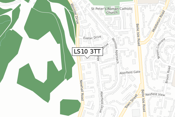
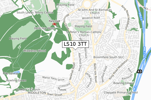
LS10 3TT is located in the Middleton Park electoral ward, within the metropolitan district of Leeds and the English Parliamentary constituency of Leeds Central. The Sub Integrated Care Board (ICB) Location is NHS West Yorkshire ICB - 15F and the police force is West Yorkshire. This postcode has been in use since April 2018.


GetTheData
Source: OS Open Zoomstack (Ordnance Survey)
Licence: Open Government Licence (requires attribution)
Attribution: Contains OS data © Crown copyright and database right 2024
Source: Open Postcode Geo
Licence: Open Government Licence (requires attribution)
Attribution: Contains OS data © Crown copyright and database right 2024; Contains Royal Mail data © Royal Mail copyright and database right 2024; Source: Office for National Statistics licensed under the Open Government Licence v.3.0
| Easting | 431002 |
| Northing | 429133 |
| Latitude | 53.757656 |
| Longitude | -1.531268 |
GetTheData
Source: Open Postcode Geo
Licence: Open Government Licence
| Country | England |
| Postcode District | LS10 |
| ➜ LS10 open data dashboard ➜ See where LS10 is on a map ➜ Where is Leeds? | |
GetTheData
Source: Land Registry Price Paid Data
Licence: Open Government Licence
| Ward | Middleton Park |
| Constituency | Leeds Central |
GetTheData
Source: ONS Postcode Database
Licence: Open Government Licence
| June 2022 | Burglary | On or near Newhall Gate | 17m |
| June 2022 | Criminal damage and arson | On or near Newhall Gate | 17m |
| June 2022 | Criminal damage and arson | On or near Winrose Drive | 60m |
| ➜ Get more crime data in our Crime section | |||
GetTheData
Source: data.police.uk
Licence: Open Government Licence
| Winrose Drive Newhall Gate (Newhall Road) | Belle Isle | 71m |
| Winrose Drive Newhall Gate (Winrose Drive) | Belle Isle | 75m |
| Winrose Drive Elmton Close (Winrose Drive) | Belle Isle | 177m |
| Winrose Drive Elmton Close (Winrose Drive) | Belle Isle | 246m |
| Belle Isle Rd Middleton Road (Belle Isle Road) | Belle Isle | 298m |
| Cottingley Station | 3.9km |
| Morley Station | 4km |
| Leeds Station | 4.4km |
GetTheData
Source: NaPTAN
Licence: Open Government Licence
| Percentage of properties with Next Generation Access | 100.0% |
| Percentage of properties with Superfast Broadband | 100.0% |
| Percentage of properties with Ultrafast Broadband | 100.0% |
| Percentage of properties with Full Fibre Broadband | 0.0% |
Superfast Broadband is between 30Mbps and 300Mbps
Ultrafast Broadband is > 300Mbps
| Percentage of properties unable to receive 2Mbps | 0.0% |
| Percentage of properties unable to receive 5Mbps | 0.0% |
| Percentage of properties unable to receive 10Mbps | 0.0% |
| Percentage of properties unable to receive 30Mbps | 0.0% |
GetTheData
Source: Ofcom
Licence: Ofcom Terms of Use (requires attribution)
GetTheData
Source: ONS Postcode Database
Licence: Open Government Licence


➜ Get more ratings from the Food Standards Agency
GetTheData
Source: Food Standards Agency
Licence: FSA terms & conditions
| Last Collection | |||
|---|---|---|---|
| Location | Mon-Fri | Sat | Distance |
| Winrose Drive | 17:45 | 12:45 | 90m |
| Aberfield Gate/Belle Isle Road | 17:45 | 11:15 | 293m |
| Manor Farm Drive | 17:45 | 11:15 | 579m |
GetTheData
Source: Dracos
Licence: Creative Commons Attribution-ShareAlike
| Facility | Distance |
|---|---|
| Hunslet Club Parkside Amateur Rugby League Club Belle Isle Road, Leeds Grass Pitches | 383m |
| South Leeds High School (Belleisle Campus) (Closed) Middleton Road, Leeds Sports Hall, Studio | 606m |
| South Leeds Youth Hub Middleton Road, Middleton Road, Leeds Artificial Grass Pitch | 634m |
GetTheData
Source: Active Places
Licence: Open Government Licence
| School | Phase of Education | Distance |
|---|---|---|
| Windmill Primary School Windmill Road, Leeds, LS10 3HQ | Primary | 470m |
| Broomfield South SILC Broom Place, Leeds, LS10 3JP | Not applicable | 563m |
| Springwell Leeds Academy Middleton Road, Leeds, LS10 3JA | Not applicable | 573m |
GetTheData
Source: Edubase
Licence: Open Government Licence
The below table lists the International Territorial Level (ITL) codes (formerly Nomenclature of Territorial Units for Statistics (NUTS) codes) and Local Administrative Units (LAU) codes for LS10 3TT:
| ITL 1 Code | Name |
|---|---|
| TLE | Yorkshire and The Humber |
| ITL 2 Code | Name |
| TLE4 | West Yorkshire |
| ITL 3 Code | Name |
| TLE42 | Leeds |
| LAU 1 Code | Name |
| E08000035 | Leeds |
GetTheData
Source: ONS Postcode Directory
Licence: Open Government Licence
The below table lists the Census Output Area (OA), Lower Layer Super Output Area (LSOA), and Middle Layer Super Output Area (MSOA) for LS10 3TT:
| Code | Name | |
|---|---|---|
| OA | E00057817 | |
| LSOA | E01011475 | Leeds 094C |
| MSOA | E02002423 | Leeds 094 |
GetTheData
Source: ONS Postcode Directory
Licence: Open Government Licence
| LS10 3RZ | Newhall Gate | 40m |
| LS10 3RX | Newhall Road | 97m |
| LS10 3QE | Aberfield Drive | 101m |
| LS10 3UE | Exeter Drive | 104m |
| LS10 3QA | Aberfield Drive | 121m |
| LS10 3QD | Aberfield Road | 132m |
| LS10 3RY | Newhall Croft | 139m |
| LS10 3HA | Winrose Drive | 147m |
| LS10 3QQ | Winrose Approach | 156m |
| LS10 3UF | Ingleby Way | 158m |
GetTheData
Source: Open Postcode Geo; Land Registry Price Paid Data
Licence: Open Government Licence