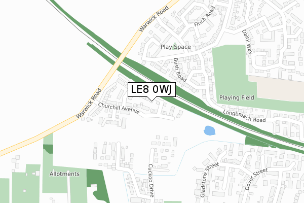
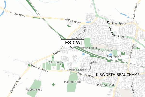
LE8 0WJ is located in the Kibworths electoral ward, within the local authority district of Harborough and the English Parliamentary constituency of Harborough. The Sub Integrated Care Board (ICB) Location is NHS Leicester, Leicestershire and Rutland ICB - 03W and the police force is Leicestershire. This postcode has been in use since January 2020.


GetTheData
Source: OS Open Zoomstack (Ordnance Survey)
Licence: Open Government Licence (requires attribution)
Attribution: Contains OS data © Crown copyright and database right 2024
Source: Open Postcode Geo
Licence: Open Government Licence (requires attribution)
Attribution: Contains OS data © Crown copyright and database right 2024; Contains Royal Mail data © Royal Mail copyright and database right 2024; Source: Office for National Statistics licensed under the Open Government Licence v.3.0
| Easting | 467358 |
| Northing | 294148 |
| Latitude | 52.541050 |
| Longitude | -1.008247 |
GetTheData
Source: Open Postcode Geo
Licence: Open Government Licence
| Country | England |
| Postcode District | LE8 |
| ➜ LE8 open data dashboard ➜ See where LE8 is on a map ➜ Where is Kibworth Beauchamp? | |
GetTheData
Source: Land Registry Price Paid Data
Licence: Open Government Licence
| Ward | Kibworths |
| Constituency | Harborough |
GetTheData
Source: ONS Postcode Database
Licence: Open Government Licence
2, BALFOUR DRIVE, KIBWORTH BEAUCHAMP, LEICESTER, LE8 0WJ 2020 26 JUN £235,000 |
➜ Kibworth Beauchamp house prices
GetTheData
Source: HM Land Registry Price Paid Data
Licence: Contains HM Land Registry data © Crown copyright and database right 2024. This data is licensed under the Open Government Licence v3.0.
| June 2022 | Anti-social behaviour | On or near Melbourne Close | 289m |
| June 2022 | Violence and sexual offences | On or near Melbourne Close | 289m |
| June 2022 | Violence and sexual offences | On or near Melbourne Close | 289m |
| ➜ Get more crime data in our Crime section | |||
GetTheData
Source: data.police.uk
Licence: Open Government Licence
| Finch Road (Polwell Road) | Kibworth Harcourt | 214m |
| Finch Road (Polwell Road) | Kibworth Harcourt | 254m |
| Milday Close (Barnards Way) | Kibworth Harcourt | 454m |
| Millday Close (Barnards Way) | Kibworth Harcourt | 464m |
| Fire Station (Fleckney Road) | Kibworth Beauchamp | 489m |
GetTheData
Source: NaPTAN
Licence: Open Government Licence
GetTheData
Source: ONS Postcode Database
Licence: Open Government Licence


➜ Get more ratings from the Food Standards Agency
GetTheData
Source: Food Standards Agency
Licence: FSA terms & conditions
| Last Collection | |||
|---|---|---|---|
| Location | Mon-Fri | Sat | Distance |
| Buller Street | 17:00 | 08:45 | 637m |
| High Street | 17:30 | 12:30 | 766m |
| Pitt Hill | 17:00 | 09:30 | 1,490m |
GetTheData
Source: Dracos
Licence: Creative Commons Attribution-ShareAlike
| Facility | Distance |
|---|---|
| Warwick Road Recreation Ground Dairy Way, Kibworth Harcourt, Leicester Grass Pitches | 292m |
| Fleckney Road Fleckney Road, Kibworth Beauchamp, Leicester Grass Pitches | 433m |
| Kibworth C Of E Primary School Hillcrest Avenue, Kibworth, Leicester Grass Pitches | 663m |
GetTheData
Source: Active Places
Licence: Open Government Licence
| School | Phase of Education | Distance |
|---|---|---|
| Kibworth Church of England Primary School Hillcrest Avenue, Kibworth, Leicester, LE8 0NH | Primary | 664m |
| Kibworth Mead Academy Smeeton Road, Kibworth, Leicester, LE8 0LG | Secondary | 1.1km |
| The Lady Byron School The Cedars, 11 High Street, Fleckney, LE8 8AJ | Not applicable | 2.5km |
GetTheData
Source: Edubase
Licence: Open Government Licence
The below table lists the International Territorial Level (ITL) codes (formerly Nomenclature of Territorial Units for Statistics (NUTS) codes) and Local Administrative Units (LAU) codes for LE8 0WJ:
| ITL 1 Code | Name |
|---|---|
| TLF | East Midlands (England) |
| ITL 2 Code | Name |
| TLF2 | Leicestershire, Rutland and Northamptonshire |
| ITL 3 Code | Name |
| TLF22 | Leicestershire CC and Rutland |
| LAU 1 Code | Name |
| E07000131 | Harborough |
GetTheData
Source: ONS Postcode Directory
Licence: Open Government Licence
The below table lists the Census Output Area (OA), Lower Layer Super Output Area (LSOA), and Middle Layer Super Output Area (MSOA) for LE8 0WJ:
| Code | Name | |
|---|---|---|
| OA | E00130823 | |
| LSOA | E01025785 | Harborough 003D |
| MSOA | E02005369 | Harborough 003 |
GetTheData
Source: ONS Postcode Directory
Licence: Open Government Licence
| LE8 0SP | Bush Road | 142m |
| LE8 0RS | Barnards Way | 208m |
| LE8 0RW | Polwell Road | 224m |
| LE8 0JP | Melbourne Close | 286m |
| LE8 0WF | Finch Road | 297m |
| LE8 0WH | Ploughed Way | 326m |
| LE8 0HL | Gladstone Street | 326m |
| LE8 0SQ | Longbreach Road | 329m |
| LE8 0EY | Dairy Way | 348m |
| LE8 0WE | Finch Road | 365m |
GetTheData
Source: Open Postcode Geo; Land Registry Price Paid Data
Licence: Open Government Licence