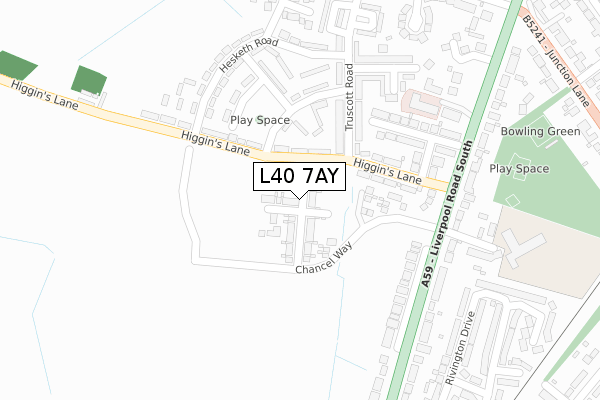
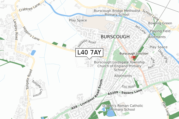
L40 7AY is located in the Burscough Town electoral ward, within the local authority district of West Lancashire and the English Parliamentary constituency of West Lancashire. The Sub Integrated Care Board (ICB) Location is NHS Lancashire and South Cumbria ICB - 02G and the police force is Lancashire. This postcode has been in use since September 2019.


GetTheData
Source: OS Open Zoomstack (Ordnance Survey)
Licence: Open Government Licence (requires attribution)
Attribution: Contains OS data © Crown copyright and database right 2024
Source: Open Postcode Geo
Licence: Open Government Licence (requires attribution)
Attribution: Contains OS data © Crown copyright and database right 2024; Contains Royal Mail data © Royal Mail copyright and database right 2024; Source: Office for National Statistics licensed under the Open Government Licence v.3.0
| Easting | 343900 |
| Northing | 411501 |
| Latitude | 53.597078 |
| Longitude | -2.849132 |
GetTheData
Source: Open Postcode Geo
Licence: Open Government Licence
| Country | England |
| Postcode District | L40 |
| ➜ L40 open data dashboard ➜ See where L40 is on a map ➜ Where is Burscough? | |
GetTheData
Source: Land Registry Price Paid Data
Licence: Open Government Licence
| Ward | Burscough Town |
| Constituency | West Lancashire |
GetTheData
Source: ONS Postcode Database
Licence: Open Government Licence
2, SAWLEY GREEN, BURSCOUGH, ORMSKIRK, L40 7AY 2022 8 JUL £314,995 |
4, SAWLEY GREEN, BURSCOUGH, ORMSKIRK, L40 7AY 2022 8 JUL £338,995 |
6, SAWLEY GREEN, BURSCOUGH, ORMSKIRK, L40 7AY 2022 8 JUL £409,995 |
1, SAWLEY GREEN, BURSCOUGH, ORMSKIRK, L40 7AY 2019 25 OCT £287,995 |
GetTheData
Source: HM Land Registry Price Paid Data
Licence: Contains HM Land Registry data © Crown copyright and database right 2024. This data is licensed under the Open Government Licence v3.0.
| January 2024 | Public order | On or near Clayton Gardens | 346m |
| January 2024 | Violence and sexual offences | On or near Clayton Gardens | 346m |
| January 2024 | Violence and sexual offences | On or near Clayton Gardens | 346m |
| ➜ Get more crime data in our Crime section | |||
GetTheData
Source: data.police.uk
Licence: Open Government Licence
| Higgins Lane | Burscough | 115m |
| Higgins Lane | Burscough | 130m |
| Lordsgate Drive (Liverpool Road) | Burscough | 176m |
| Lordsgate Drive (Liverpool Road South) | Burscough | 199m |
| Hesketh Road (Truscott Road) | Burscough | 261m |
| Burscough Junction Station | 0.6km |
| Burscough Bridge Station | 1.1km |
| New Lane Station | 2km |
GetTheData
Source: NaPTAN
Licence: Open Government Licence
GetTheData
Source: ONS Postcode Database
Licence: Open Government Licence


➜ Get more ratings from the Food Standards Agency
GetTheData
Source: Food Standards Agency
Licence: FSA terms & conditions
| Last Collection | |||
|---|---|---|---|
| Location | Mon-Fri | Sat | Distance |
| Burscough Junction | 17:30 | 12:00 | 612m |
| Rufford Post Office | 16:45 | 11:30 | 2,057m |
| Hall Lane | 13:00 | 08:00 | 2,782m |
GetTheData
Source: Dracos
Licence: Creative Commons Attribution-ShareAlike
| Facility | Distance |
|---|---|
| Richmond Park Junction Lane, Burscough Grass Pitches | 344m |
| Burscough Priory Academy Trevor Road, Burscough, Ormskirk Grass Pitches, Sports Hall, Studio, Outdoor Tennis Courts | 502m |
| T J Fitness Studio (Closed) Mill Lane, Burscough, Ormskirk Health and Fitness Gym | 698m |
GetTheData
Source: Active Places
Licence: Open Government Licence
| School | Phase of Education | Distance |
|---|---|---|
| Burscough Lordsgate Township Church of England Primary School Lordsgate Drive, Burscough, Ormskirk, L40 7RS | Primary | 313m |
| Burscough Priory Academy Trevor Road, Burscough, Ormskirk, L40 7RZ | Secondary | 502m |
| Burscough Bridge Methodist School Orrell Lane, Burscough, Ormskirk, L40 0SG | Primary | 743m |
GetTheData
Source: Edubase
Licence: Open Government Licence
The below table lists the International Territorial Level (ITL) codes (formerly Nomenclature of Territorial Units for Statistics (NUTS) codes) and Local Administrative Units (LAU) codes for L40 7AY:
| ITL 1 Code | Name |
|---|---|
| TLD | North West (England) |
| ITL 2 Code | Name |
| TLD4 | Lancashire |
| ITL 3 Code | Name |
| TLD47 | Chorley and West Lancashire |
| LAU 1 Code | Name |
| E07000127 | West Lancashire |
GetTheData
Source: ONS Postcode Directory
Licence: Open Government Licence
The below table lists the Census Output Area (OA), Lower Layer Super Output Area (LSOA), and Middle Layer Super Output Area (MSOA) for L40 7AY:
| Code | Name | |
|---|---|---|
| OA | E00129337 | |
| LSOA | E01025487 | West Lancashire 004E |
| MSOA | E02005307 | West Lancashire 004 |
GetTheData
Source: ONS Postcode Directory
Licence: Open Government Licence
| L40 7SH | Peters Avenue | 157m |
| L40 7SA | Furnival Drive | 160m |
| L40 7SD | Higgins Lane | 167m |
| L40 7SJ | Christines Crescent | 195m |
| L40 7SF | Truscott Road | 215m |
| L40 7RE | Liverpool Road South | 217m |
| L40 7RT | Alexandra Road | 226m |
| L40 7SE | Truscott Road | 229m |
| L40 7SB | Pickles Drive | 237m |
| L40 7RS | Lordsgate Drive | 259m |
GetTheData
Source: Open Postcode Geo; Land Registry Price Paid Data
Licence: Open Government Licence