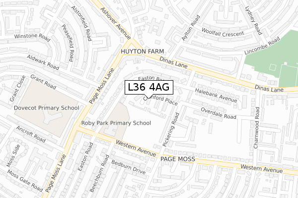
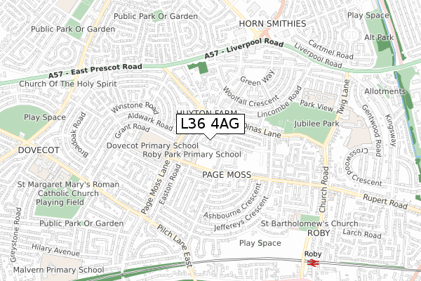
L36 4AG is located in the Page Moss electoral ward, within the metropolitan district of Knowsley and the English Parliamentary constituency of Knowsley. The Sub Integrated Care Board (ICB) Location is NHS Cheshire and Merseyside ICB - 01J and the police force is Merseyside. This postcode has been in use since May 2019.


GetTheData
Source: OS Open Zoomstack (Ordnance Survey)
Licence: Open Government Licence (requires attribution)
Attribution: Contains OS data © Crown copyright and database right 2024
Source: Open Postcode Geo
Licence: Open Government Licence (requires attribution)
Attribution: Contains OS data © Crown copyright and database right 2024; Contains Royal Mail data © Royal Mail copyright and database right 2024; Source: Office for National Statistics licensed under the Open Government Licence v.3.0
| Easting | 342604 |
| Northing | 391422 |
| Latitude | 53.416480 |
| Longitude | -2.865030 |
GetTheData
Source: Open Postcode Geo
Licence: Open Government Licence
| Country | England |
| Postcode District | L36 |
| ➜ L36 open data dashboard ➜ See where L36 is on a map ➜ Where is Huyton with Roby? | |
GetTheData
Source: Land Registry Price Paid Data
Licence: Open Government Licence
| Ward | Page Moss |
| Constituency | Knowsley |
GetTheData
Source: ONS Postcode Database
Licence: Open Government Licence
| January 2024 | Public order | On or near Page Moss Avenue | 420m |
| January 2024 | Drugs | On or near Page Moss Avenue | 420m |
| January 2024 | Vehicle crime | On or near Page Moss Avenue | 420m |
| ➜ Get more crime data in our Crime section | |||
GetTheData
Source: data.police.uk
Licence: Open Government Licence
| Beechburn Road (Western Avenue) | Page Moss | 167m |
| Windsor Road (Western Avenue) | Page Moss | 172m |
| Dinas Lane (Page Moss Lane) | Dovecot | 173m |
| Beechburn Road (Western Avenue) | Page Moss | 185m |
| Easton Road (Dinas Lane) | Page Moss | 199m |
| Roby Station | 0.9km |
| Huyton Station | 1.6km |
| Broad Green Station | 2.2km |
GetTheData
Source: NaPTAN
Licence: Open Government Licence
| Percentage of properties with Next Generation Access | 100.0% |
| Percentage of properties with Superfast Broadband | 100.0% |
| Percentage of properties with Ultrafast Broadband | 100.0% |
| Percentage of properties with Full Fibre Broadband | 88.0% |
Superfast Broadband is between 30Mbps and 300Mbps
Ultrafast Broadband is > 300Mbps
| Percentage of properties unable to receive 2Mbps | 0.0% |
| Percentage of properties unable to receive 5Mbps | 0.0% |
| Percentage of properties unable to receive 10Mbps | 0.0% |
| Percentage of properties unable to receive 30Mbps | 0.0% |
GetTheData
Source: Ofcom
Licence: Ofcom Terms of Use (requires attribution)
GetTheData
Source: ONS Postcode Database
Licence: Open Government Licence


➜ Get more ratings from the Food Standards Agency
GetTheData
Source: Food Standards Agency
Licence: FSA terms & conditions
| Last Collection | |||
|---|---|---|---|
| Location | Mon-Fri | Sat | Distance |
| Pilch Lane East | 17:15 | 12:00 | 341m |
| Lordens Road | 16:00 | 12:00 | 528m |
| Courthey Park | 16:15 | 12:00 | 1,122m |
GetTheData
Source: Dracos
Licence: Creative Commons Attribution-ShareAlike
| Facility | Distance |
|---|---|
| Bowring Community Sports College (Closed) Western Avenue, Huyton, Liverpool Sports Hall, Grass Pitches, Studio | 167m |
| Dovecot Primary School Grant Road, Liverpool Grass Pitches | 344m |
| Croxteth Community Primary School Winstone Road, Liverpool Grass Pitches, Outdoor Tennis Courts | 484m |
GetTheData
Source: Active Places
Licence: Open Government Licence
| School | Phase of Education | Distance |
|---|---|---|
| Roby Park Primary School Easton Road, Huyton, Knowsley, L36 4NY | Primary | 164m |
| Dovecot Primary School Grant Road, Liverpool, L14 0LH | Primary | 344m |
| Park View Academy Park View, Huyton, Liverpool, L36 2LL | Primary | 719m |
GetTheData
Source: Edubase
Licence: Open Government Licence
The below table lists the International Territorial Level (ITL) codes (formerly Nomenclature of Territorial Units for Statistics (NUTS) codes) and Local Administrative Units (LAU) codes for L36 4AG:
| ITL 1 Code | Name |
|---|---|
| TLD | North West (England) |
| ITL 2 Code | Name |
| TLD7 | Merseyside |
| ITL 3 Code | Name |
| TLD71 | East Merseyside |
| LAU 1 Code | Name |
| E08000011 | Knowsley |
GetTheData
Source: ONS Postcode Directory
Licence: Open Government Licence
The below table lists the Census Output Area (OA), Lower Layer Super Output Area (LSOA), and Middle Layer Super Output Area (MSOA) for L36 4AG:
| Code | Name | |
|---|---|---|
| OA | E00032691 | |
| LSOA | E01006450 | Knowsley 012B |
| MSOA | E02001338 | Knowsley 012 |
GetTheData
Source: ONS Postcode Directory
Licence: Open Government Licence
| L36 4NY | Easton Road | 61m |
| L36 4PB | Easton Road | 102m |
| L36 2NR | Dinas Lane | 126m |
| L14 0PQ | Page Moss Lane | 136m |
| L36 2PA | Page Moss Parade | 151m |
| L14 0PG | Page Moss Lane | 184m |
| L36 4PP | Western Avenue | 193m |
| L36 2NN | Dinas Lane | 196m |
| L14 0LX | Page Moss Lane | 218m |
| L36 4NL | Bedburn Drive | 223m |
GetTheData
Source: Open Postcode Geo; Land Registry Price Paid Data
Licence: Open Government Licence