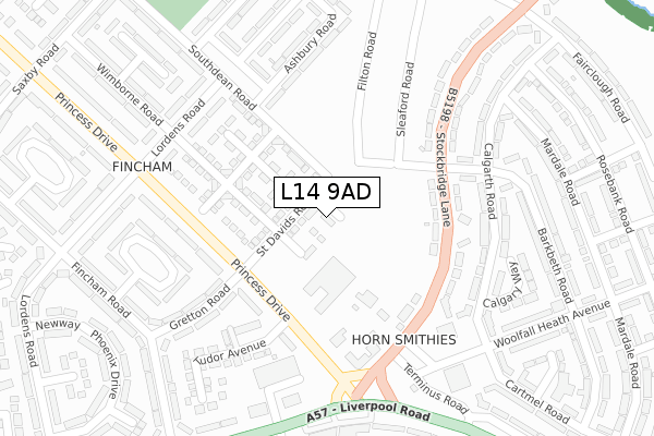
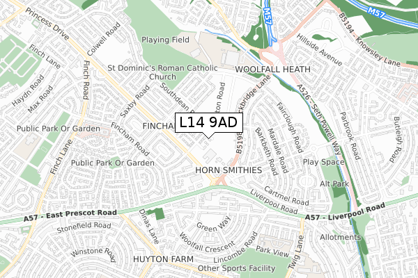
L14 9AD is located in the Page Moss electoral ward, within the metropolitan district of Knowsley and the English Parliamentary constituency of Knowsley. The Sub Integrated Care Board (ICB) Location is NHS Cheshire and Merseyside ICB - 01J and the police force is Merseyside. This postcode has been in use since May 2018.


GetTheData
Source: OS Open Zoomstack (Ordnance Survey)
Licence: Open Government Licence (requires attribution)
Attribution: Contains OS data © Crown copyright and database right 2024
Source: Open Postcode Geo
Licence: Open Government Licence (requires attribution)
Attribution: Contains OS data © Crown copyright and database right 2024; Contains Royal Mail data © Royal Mail copyright and database right 2024; Source: Office for National Statistics licensed under the Open Government Licence v.3.0
| Easting | 342898 |
| Northing | 392307 |
| Latitude | 53.424466 |
| Longitude | -2.860767 |
GetTheData
Source: Open Postcode Geo
Licence: Open Government Licence
| Country | England |
| Postcode District | L14 |
| ➜ L14 open data dashboard ➜ See where L14 is on a map ➜ Where is Huyton with Roby? | |
GetTheData
Source: Land Registry Price Paid Data
Licence: Open Government Licence
| Ward | Page Moss |
| Constituency | Knowsley |
GetTheData
Source: ONS Postcode Database
Licence: Open Government Licence
| January 2024 | Anti-social behaviour | On or near Southdean Road | 291m |
| January 2024 | Burglary | On or near Southdean Road | 291m |
| January 2024 | Violence and sexual offences | On or near Southdean Road | 291m |
| ➜ Get more crime data in our Crime section | |||
GetTheData
Source: data.police.uk
Licence: Open Government Licence
| St David's Road (Stockbridge Lane) | Fincham | 160m |
| Barkbeth Road (Stockbridge Lane) | Woolfall Heath | 181m |
| Heath Road (Stockbridge Lane) | Woolfall Heath | 185m |
| Stockbridge Lane (Princess Drive) | Horn Smithies | 205m |
| Liverpool Road (Princess Drive) | Fincham | 226m |
| Roby Station | 1.6km |
| Huyton Station | 2km |
| Broad Green Station | 3km |
GetTheData
Source: NaPTAN
Licence: Open Government Licence
| Percentage of properties with Next Generation Access | 100.0% |
| Percentage of properties with Superfast Broadband | 100.0% |
| Percentage of properties with Ultrafast Broadband | 100.0% |
| Percentage of properties with Full Fibre Broadband | 100.0% |
Superfast Broadband is between 30Mbps and 300Mbps
Ultrafast Broadband is > 300Mbps
| Percentage of properties unable to receive 2Mbps | 0.0% |
| Percentage of properties unable to receive 5Mbps | 0.0% |
| Percentage of properties unable to receive 10Mbps | 0.0% |
| Percentage of properties unable to receive 30Mbps | 0.0% |
GetTheData
Source: Ofcom
Licence: Ofcom Terms of Use (requires attribution)
GetTheData
Source: ONS Postcode Database
Licence: Open Government Licence


➜ Get more ratings from the Food Standards Agency
GetTheData
Source: Food Standards Agency
Licence: FSA terms & conditions
| Last Collection | |||
|---|---|---|---|
| Location | Mon-Fri | Sat | Distance |
| Lordens Road | 16:00 | 12:00 | 587m |
| Pilch Lane East | 17:15 | 12:00 | 611m |
| Glade Road | 17:00 | 12:00 | 1,307m |
GetTheData
Source: Dracos
Licence: Creative Commons Attribution-ShareAlike
| Facility | Distance |
|---|---|
| St Edmund Of Canterbury Catholic High School (Closed) Southdean Road, Liverpool Grass Pitches, Sports Hall | 483m |
| Knowsley Community College Stockbridge Lane, Liverpool Sports Hall, Artificial Grass Pitch | 492m |
| Christ The King Joint Catholic And C Of E Centre For Learning (Closed) Stockbridge Lane, Liverpool Health and Fitness Gym, Sports Hall, Artificial Grass Pitch, Studio, Grass Pitches | 499m |
GetTheData
Source: Active Places
Licence: Open Government Licence
| School | Phase of Education | Distance |
|---|---|---|
| Hope Primary School - A Joint Catholic and Church of England Primary School Lordens Road, Huyton, Knowsley, L14 8UD | Primary | 451m |
| Park View Academy Park View, Huyton, Liverpool, L36 2LL | Primary | 715m |
| St Aloysius Catholic Primary School Twig Lane, Huyton-with-Roby, Liverpool, L36 2LF | Primary | 890m |
GetTheData
Source: Edubase
Licence: Open Government Licence
The below table lists the International Territorial Level (ITL) codes (formerly Nomenclature of Territorial Units for Statistics (NUTS) codes) and Local Administrative Units (LAU) codes for L14 9AD:
| ITL 1 Code | Name |
|---|---|
| TLD | North West (England) |
| ITL 2 Code | Name |
| TLD7 | Merseyside |
| ITL 3 Code | Name |
| TLD71 | East Merseyside |
| LAU 1 Code | Name |
| E08000011 | Knowsley |
GetTheData
Source: ONS Postcode Directory
Licence: Open Government Licence
The below table lists the Census Output Area (OA), Lower Layer Super Output Area (LSOA), and Middle Layer Super Output Area (MSOA) for L14 9AD:
| Code | Name | |
|---|---|---|
| OA | E00172130 | |
| LSOA | E01033228 | Knowsley 008F |
| MSOA | E02001334 | Knowsley 008 |
GetTheData
Source: ONS Postcode Directory
Licence: Open Government Licence
| L36 3SA | Stockbridge Lane | 133m |
| L36 3SE | Stockbridge Lane | 173m |
| L36 3UD | Calgarth Road | 203m |
| L36 3UG | Calgarth Road | 232m |
| L14 9NQ | Princess Drive | 239m |
| L36 3UF | Calgarth Road | 246m |
| L14 8UY | Ashbury Road | 259m |
| L14 8UE | Wimborne Road | 265m |
| L36 3SB | Stockbridge Lane | 267m |
| L36 3TU | Barkbeth Road | 273m |
GetTheData
Source: Open Postcode Geo; Land Registry Price Paid Data
Licence: Open Government Licence