KA26 9TH maps, stats, and open data
KA26 9TH is located in the Girvan and South Carrick electoral ward, within the council area of South Ayrshire and the Scottish Parliamentary constituency of Ayr, Carrick and Cumnock. The Community Health Partnership is South Ayrshire Community Health Partnership and the police force is Scotland. This postcode has been in use since January 1980.
KA26 9TH maps
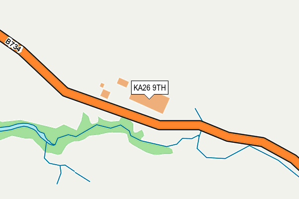
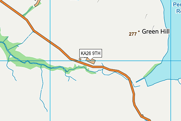
KA26 9TH geodata
| Easting | 225337 |
| Northing | 597000 |
| Latitude | 55.236199 |
| Longitude | -4.748440 |
Where is KA26 9TH?
| Country | Scotland |
| Postcode District | KA26 |
Politics
| Ward | Girvan And South Carrick |
|---|
| Constituency | Ayr, Carrick And Cumnock |
|---|
Transport
Nearest bus stops to KA26 9TH
| Penwhapple Water Works (B734) | Barr | 246m |
| Penwhapple Waterworks (B734) | Barr | 249m |
| Lanes Farm (B734) | Barr | 1,251m |
| Lanes Farm (B734) | Barr | 1,256m |
Broadband
Broadband access in KA26 9TH (2020 data)
| Percentage of properties with Next Generation Access | 0.0% |
| Percentage of properties with Superfast Broadband | 0.0% |
| Percentage of properties with Ultrafast Broadband | 0.0% |
| Percentage of properties with Full Fibre Broadband | 0.0% |
Superfast Broadband is between 30Mbps and 300Mbps
Ultrafast Broadband is > 300Mbps
Broadband speed in KA26 9TH (2019 data)
Download
| Median download speed | 6.4Mbps |
| Average download speed | 6.7Mbps |
| Maximum download speed | 11.11Mbps |
Upload
| Median upload speed | 0.9Mbps |
| Average upload speed | 0.9Mbps |
| Maximum upload speed | 1.21Mbps |
Broadband limitations in KA26 9TH (2020 data)
| Percentage of properties unable to receive 2Mbps | 0.0% |
| Percentage of properties unable to receive 5Mbps | 16.7% |
| Percentage of properties unable to receive 10Mbps | 100.0% |
| Percentage of properties unable to receive 30Mbps | 100.0% |
Deprivation
61.3% of Scottish postcodes are less deprived than
KA26 9TH:
Nearest post box to KA26 9TH
| | Last Collection | |
|---|
| Location | Mon-Fri | Sat | Distance |
|---|
| Old Dailly | 16:00 | 12:15 | 3,598m |
| Post Office | 16:00 | 12:00 | 3,691m |
| Woodside Dailly | 16:00 | 10:15 | 4,579m |
KA26 9TH ITL and KA26 9TH LAU
The below table lists the International Territorial Level (ITL) codes (formerly Nomenclature of Territorial Units for Statistics (NUTS) codes) and Local Administrative Units (LAU) codes for KA26 9TH:
| ITL 1 Code | Name |
|---|
| TLM | Scotland |
| ITL 2 Code | Name |
|---|
| TLM9 | Southern Scotland |
| ITL 3 Code | Name |
|---|
| TLM94 | South Ayrshire |
| LAU 1 Code | Name |
|---|
| S30000024 | South Ayrshire |
KA26 9TH census areas
The below table lists the Census Output Area (OA), Lower Layer Super Output Area (LSOA), and Middle Layer Super Output Area (MSOA) for KA26 9TH:
| Code | Name |
|---|
| OA | S00129867 | |
|---|
| LSOA | S01012419 | Carrick South - 03 |
|---|
| MSOA | S02002329 | Carrick South |
|---|



