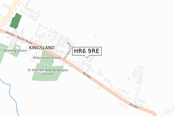
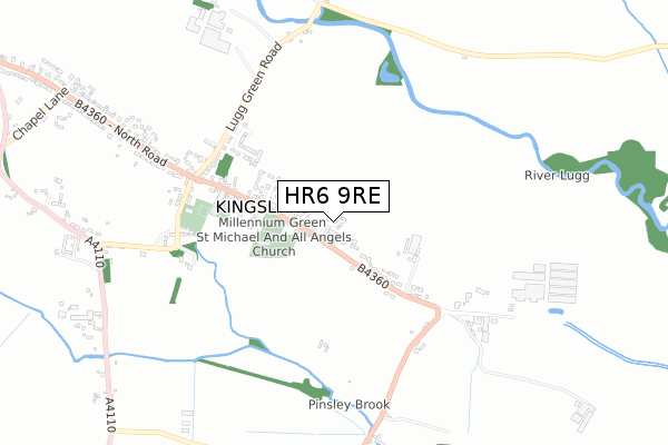
HR6 9RE is located in the Bircher electoral ward, within the unitary authority of Herefordshire, County of and the English Parliamentary constituency of North Herefordshire. The Sub Integrated Care Board (ICB) Location is NHS Herefordshire and Worcestershire ICB - 18C and the police force is West Mercia. This postcode has been in use since October 2017.


GetTheData
Source: OS Open Zoomstack (Ordnance Survey)
Licence: Open Government Licence (requires attribution)
Attribution: Contains OS data © Crown copyright and database right 2024
Source: Open Postcode Geo
Licence: Open Government Licence (requires attribution)
Attribution: Contains OS data © Crown copyright and database right 2024; Contains Royal Mail data © Royal Mail copyright and database right 2024; Source: Office for National Statistics licensed under the Open Government Licence v.3.0
| Easting | 344948 |
| Northing | 261364 |
| Latitude | 52.247699 |
| Longitude | -2.807778 |
GetTheData
Source: Open Postcode Geo
Licence: Open Government Licence
| Country | England |
| Postcode District | HR6 |
| ➜ HR6 open data dashboard ➜ See where HR6 is on a map ➜ Where is Kingsland? | |
GetTheData
Source: Land Registry Price Paid Data
Licence: Open Government Licence
| Ward | Bircher |
| Constituency | North Herefordshire |
GetTheData
Source: ONS Postcode Database
Licence: Open Government Licence
| June 2022 | Violence and sexual offences | On or near Orchard Close | 110m |
| May 2022 | Violence and sexual offences | On or near St Michaels Avenue | 266m |
| April 2022 | Burglary | On or near Orchard Close | 110m |
| ➜ Get more crime data in our Crime section | |||
GetTheData
Source: data.police.uk
Licence: Open Government Licence
| Corners Inn (Longford) | Kingsland | 517m |
| Corners Inn (Longford Road) | Kingsland | 527m |
| Coronation Hall (Unclassified Road) | Kingsland | 569m |
| Corners Inn (North Road) | Kingsland | 571m |
GetTheData
Source: NaPTAN
Licence: Open Government Licence
➜ Broadband speed and availability dashboard for HR6 9RE
| Percentage of properties with Next Generation Access | 100.0% |
| Percentage of properties with Superfast Broadband | 100.0% |
| Percentage of properties with Ultrafast Broadband | 0.0% |
| Percentage of properties with Full Fibre Broadband | 0.0% |
Superfast Broadband is between 30Mbps and 300Mbps
Ultrafast Broadband is > 300Mbps
| Median download speed | 65.7Mbps |
| Average download speed | 58.9Mbps |
| Maximum download speed | 80.00Mbps |
| Median upload speed | 15.5Mbps |
| Average upload speed | 14.6Mbps |
| Maximum upload speed | 20.00Mbps |
| Percentage of properties unable to receive 2Mbps | 0.0% |
| Percentage of properties unable to receive 5Mbps | 0.0% |
| Percentage of properties unable to receive 10Mbps | 0.0% |
| Percentage of properties unable to receive 30Mbps | 0.0% |
➜ Broadband speed and availability dashboard for HR6 9RE
GetTheData
Source: Ofcom
Licence: Ofcom Terms of Use (requires attribution)
GetTheData
Source: ONS Postcode Database
Licence: Open Government Licence


➜ Get more ratings from the Food Standards Agency
GetTheData
Source: Food Standards Agency
Licence: FSA terms & conditions
| Last Collection | |||
|---|---|---|---|
| Location | Mon-Fri | Sat | Distance |
| The Mallards | 15:00 | 08:00 | 4,672m |
| Castlefields | 16:00 | 11:00 | 5,717m |
GetTheData
Source: Dracos
Licence: Creative Commons Attribution-ShareAlike
| Facility | Distance |
|---|---|
| Kingsland Cofe Primary School Kingsland, Leominster Grass Pitches | 434m |
| Kingsland Coronation Hall Kingsland, Leominster Outdoor Tennis Courts, Grass Pitches, Sports Hall | 547m |
| Luctonians Sports Club Kingsland, Leominster Grass Pitches | 1.5km |
GetTheData
Source: Active Places
Licence: Open Government Licence
| School | Phase of Education | Distance |
|---|---|---|
| Kingsland CofE School Kingsland, Leominster, HR6 9QN | Primary | 275m |
| Lucton School Lucton, Leominster, Leominster, HR6 9PN | Not applicable | 3.3km |
| Luston Primary School Westland View, Luston, Leominster, HR6 0EA | Primary | 4km |
GetTheData
Source: Edubase
Licence: Open Government Licence
The below table lists the International Territorial Level (ITL) codes (formerly Nomenclature of Territorial Units for Statistics (NUTS) codes) and Local Administrative Units (LAU) codes for HR6 9RE:
| ITL 1 Code | Name |
|---|---|
| TLG | West Midlands (England) |
| ITL 2 Code | Name |
| TLG1 | Herefordshire, Worcestershire and Warwickshire |
| ITL 3 Code | Name |
| TLG11 | Herefordshire, County of |
| LAU 1 Code | Name |
| E06000019 | Herefordshire, County of |
GetTheData
Source: ONS Postcode Directory
Licence: Open Government Licence
The below table lists the Census Output Area (OA), Lower Layer Super Output Area (LSOA), and Middle Layer Super Output Area (MSOA) for HR6 9RE:
| Code | Name | |
|---|---|---|
| OA | E00168510 | |
| LSOA | E01013999 | Herefordshire 004A |
| MSOA | E02002908 | Herefordshire 004 |
GetTheData
Source: ONS Postcode Directory
Licence: Open Government Licence
| HR6 9QS | 79m | |
| HR6 9QT | 110m | |
| HR6 9AW | Church Green | 191m |
| HR6 9QR | St Michaels Avenue | 253m |
| HR6 9QP | 294m | |
| HR6 9QW | 302m | |
| HR6 9QJ | 337m | |
| HR6 9QN | 369m | |
| HR6 9SN | Boarsfield | 464m |
| HR6 9SL | 501m |
GetTheData
Source: Open Postcode Geo; Land Registry Price Paid Data
Licence: Open Government Licence