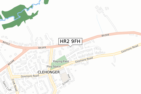
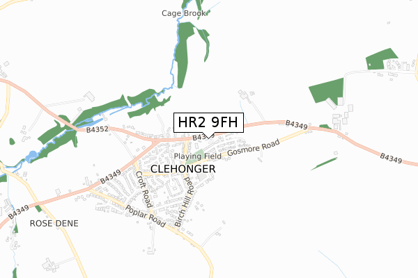
HR2 9FH is located in the Stoney Street electoral ward, within the unitary authority of Herefordshire, County of and the English Parliamentary constituency of Hereford and South Herefordshire. The Sub Integrated Care Board (ICB) Location is NHS Herefordshire and Worcestershire ICB - 18C and the police force is West Mercia. This postcode has been in use since September 2019.


GetTheData
Source: OS Open Zoomstack (Ordnance Survey)
Licence: Open Government Licence (requires attribution)
Attribution: Contains OS data © Crown copyright and database right 2024
Source: Open Postcode Geo
Licence: Open Government Licence (requires attribution)
Attribution: Contains OS data © Crown copyright and database right 2024; Contains Royal Mail data © Royal Mail copyright and database right 2024; Source: Office for National Statistics licensed under the Open Government Licence v.3.0
| Easting | 345253 |
| Northing | 237729 |
| Latitude | 52.035258 |
| Longitude | -2.799498 |
GetTheData
Source: Open Postcode Geo
Licence: Open Government Licence
| Country | England |
| Postcode District | HR2 |
| ➜ HR2 open data dashboard ➜ See where HR2 is on a map ➜ Where is Clehonger? | |
GetTheData
Source: Land Registry Price Paid Data
Licence: Open Government Licence
| Ward | Stoney Street |
| Constituency | Hereford And South Herefordshire |
GetTheData
Source: ONS Postcode Database
Licence: Open Government Licence
1, GLASNANT CLOSE, CLEHONGER, HEREFORD, HR2 9FH 2020 26 MAR £340,000 |
GetTheData
Source: HM Land Registry Price Paid Data
Licence: Contains HM Land Registry data © Crown copyright and database right 2024. This data is licensed under the Open Government Licence v3.0.
| October 2023 | Anti-social behaviour | On or near Birch Hill Road | 294m |
| October 2023 | Violence and sexual offences | On or near Birch Hill Road | 294m |
| June 2022 | Other crime | On or near Gosmore Road | 129m |
| ➜ Get more crime data in our Crime section | |||
GetTheData
Source: data.police.uk
Licence: Open Government Licence
| Seven Stars Ph (B4349) | Clehonger | 138m |
| Birch Hill Road | Clehonger | 143m |
| Birch Hill Road | Clehonger | 154m |
| Main Road (B4349) | Clehonger | 166m |
| Main Road (B4349) | Clehonger | 171m |
GetTheData
Source: NaPTAN
Licence: Open Government Licence
GetTheData
Source: ONS Postcode Database
Licence: Open Government Licence


➜ Get more ratings from the Food Standards Agency
GetTheData
Source: Food Standards Agency
Licence: FSA terms & conditions
| Last Collection | |||
|---|---|---|---|
| Location | Mon-Fri | Sat | Distance |
| Cleohoner P.o. | 16:45 | 11:15 | 269m |
| Eaton Bishop | 16:15 | 10:00 | 1,393m |
| Ruckhall Common | 16:30 | 08:45 | 1,642m |
GetTheData
Source: Dracos
Licence: Creative Commons Attribution-ShareAlike
| Facility | Distance |
|---|---|
| Belmont Lodge And Golf Course (Closed) Belmont, Hereford Golf, Outdoor Tennis Courts | 2.6km |
| Belmont Abbey B4349 From Arkstone Court Road To A465, Clehonger Grass Pitches | 2.8km |
| Belmont Abbey (Closed) Ruckhall Lane, Belmont, Hereford Grass Pitches | 2.8km |
GetTheData
Source: Active Places
Licence: Open Government Licence
| School | Phase of Education | Distance |
|---|---|---|
| Clehonger CofE Primary School Gosmore Road, Clehonger, Hereford, HR2 9SN | Primary | 182m |
| Kingstone and Thruxton Primary School Kingstone, Hereford, HR2 9HJ | Primary | 3.5km |
| Kingstone High School Kingstone, Hereford, HR2 9HJ | Secondary | 3.5km |
GetTheData
Source: Edubase
Licence: Open Government Licence
The below table lists the International Territorial Level (ITL) codes (formerly Nomenclature of Territorial Units for Statistics (NUTS) codes) and Local Administrative Units (LAU) codes for HR2 9FH:
| ITL 1 Code | Name |
|---|---|
| TLG | West Midlands (England) |
| ITL 2 Code | Name |
| TLG1 | Herefordshire, Worcestershire and Warwickshire |
| ITL 3 Code | Name |
| TLG11 | Herefordshire, County of |
| LAU 1 Code | Name |
| E06000019 | Herefordshire, County of |
GetTheData
Source: ONS Postcode Directory
Licence: Open Government Licence
The below table lists the Census Output Area (OA), Lower Layer Super Output Area (LSOA), and Middle Layer Super Output Area (MSOA) for HR2 9FH:
| Code | Name | |
|---|---|---|
| OA | E00071097 | |
| LSOA | E01014080 | Herefordshire 016D |
| MSOA | E02002920 | Herefordshire 016 |
GetTheData
Source: ONS Postcode Directory
Licence: Open Government Licence
| HR2 9SL | 36m | |
| HR2 9EL | 83m | |
| HR2 9RD | Birch Hill Road | 143m |
| HR2 9SN | Gosmore Road | 243m |
| HR2 9RB | Elm Grove | 253m |
| HR2 9RQ | School Lane | 257m |
| HR2 9RA | The Bines | 271m |
| HR2 9RG | Oak Crescent | 322m |
| HR2 9RF | Birch Hill Road | 372m |
| HR2 9TF | 427m |
GetTheData
Source: Open Postcode Geo; Land Registry Price Paid Data
Licence: Open Government Licence