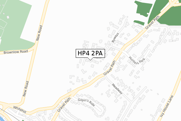
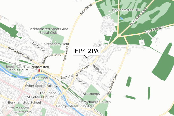
HP4 2PA lies on Shenstone Hill in Berkhamsted. HP4 2PA is located in the Berkhamsted Castle electoral ward, within the local authority district of Dacorum and the English Parliamentary constituency of South West Hertfordshire. The Sub Integrated Care Board (ICB) Location is NHS Hertfordshire and West Essex ICB - 06N and the police force is Hertfordshire. This postcode has been in use since March 1983.


GetTheData
Source: OS Open Zoomstack (Ordnance Survey)
Licence: Open Government Licence (requires attribution)
Attribution: Contains OS data © Crown copyright and database right 2025
Source: Open Postcode Geo
Licence: Open Government Licence (requires attribution)
Attribution: Contains OS data © Crown copyright and database right 2025; Contains Royal Mail data © Royal Mail copyright and database right 2025; Source: Office for National Statistics licensed under the Open Government Licence v.3.0
| Easting | 500035 |
| Northing | 208336 |
| Latitude | 51.764779 |
| Longitude | -0.551831 |
GetTheData
Source: Open Postcode Geo
Licence: Open Government Licence
| Street | Shenstone Hill |
| Town/City | Berkhamsted |
| Country | England |
| Postcode District | HP4 |
➜ See where HP4 is on a map ➜ Where is Berkhamsted? | |
GetTheData
Source: Land Registry Price Paid Data
Licence: Open Government Licence
Elevation or altitude of HP4 2PA as distance above sea level:
| Metres | Feet | |
|---|---|---|
| Elevation | 160m | 525ft |
Elevation is measured from the approximate centre of the postcode, to the nearest point on an OS contour line from OS Terrain 50, which has contour spacing of ten vertical metres.
➜ How high above sea level am I? Find the elevation of your current position using your device's GPS.
GetTheData
Source: Open Postcode Elevation
Licence: Open Government Licence
| Ward | Berkhamsted Castle |
| Constituency | South West Hertfordshire |
GetTheData
Source: ONS Postcode Database
Licence: Open Government Licence
TIBURON, SHENSTONE HILL, BERKHAMSTED, HP4 2PA 2024 1 NOV £1,300,000 |
2018 16 FEB £1,270,000 |
2017 15 SEP £1,450,000 |
ORCHARD COTTAGE, SHENSTONE HILL, BERKHAMSTED, HP4 2PA 2014 29 AUG £980,000 |
ASHRIDGE, 4, SHENSTONE HILL, BERKHAMSTED, HP4 2PA 2009 13 FEB £1,175,000 |
2009 30 JAN £785,000 |
MERRYBELLE, SHENSTONE HILL, BERKHAMSTED, HP4 2PA 2007 16 AUG £1,100,000 |
2005 19 AUG £740,000 |
CARMEL, SHENSTONE HILL, BERKHAMSTED, HP4 2PA 2001 19 OCT £650,000 |
1997 29 AUG £415,000 |
GetTheData
Source: HM Land Registry Price Paid Data
Licence: Contains HM Land Registry data © Crown copyright and database right 2025. This data is licensed under the Open Government Licence v3.0.
| Castle Village (Britwell Drive) | Berkhamsted | 572m |
| Bridgewater Road (Brownlow Road) | Berkhamsted | 631m |
| Bridgewater Road (Brownlow Road) | Berkhamsted | 640m |
| Brownlow Road (Bridgewater Road) | Berkhamsted | 689m |
| Brownlow Road (Bridgewater Road) | Berkhamsted | 707m |
| Berkhamsted Station | 0.7km |
| Hemel Hempstead Station | 4.9km |
| Tring Station | 6.3km |
GetTheData
Source: NaPTAN
Licence: Open Government Licence
| Percentage of properties with Next Generation Access | 100.0% |
| Percentage of properties with Superfast Broadband | 100.0% |
| Percentage of properties with Ultrafast Broadband | 0.0% |
| Percentage of properties with Full Fibre Broadband | 0.0% |
Superfast Broadband is between 30Mbps and 300Mbps
Ultrafast Broadband is > 300Mbps
| Median download speed | 18.5Mbps |
| Average download speed | 23.8Mbps |
| Maximum download speed | 72.65Mbps |
| Median upload speed | 4.7Mbps |
| Average upload speed | 5.9Mbps |
| Maximum upload speed | 17.21Mbps |
| Percentage of properties unable to receive 2Mbps | 0.0% |
| Percentage of properties unable to receive 5Mbps | 0.0% |
| Percentage of properties unable to receive 10Mbps | 0.0% |
| Percentage of properties unable to receive 30Mbps | 0.0% |
GetTheData
Source: Ofcom
Licence: Ofcom Terms of Use (requires attribution)
Estimated total energy consumption in HP4 2PA by fuel type, 2015.
| Consumption (kWh) | 467,251 |
|---|---|
| Meter count | 14 |
| Mean (kWh/meter) | 33,375 |
| Median (kWh/meter) | 29,983 |
| Consumption (kWh) | 100,819 |
|---|---|
| Meter count | 13 |
| Mean (kWh/meter) | 7,755 |
| Median (kWh/meter) | 7,182 |
GetTheData
Source: Postcode level gas estimates: 2015 (experimental)
Source: Postcode level electricity estimates: 2015 (experimental)
Licence: Open Government Licence
GetTheData
Source: ONS Postcode Database
Licence: Open Government Licence


➜ Get more ratings from the Food Standards Agency
GetTheData
Source: Food Standards Agency
Licence: FSA terms & conditions
| Last Collection | |||
|---|---|---|---|
| Location | Mon-Fri | Sat | Distance |
| Hunters Park | 16:45 | 11:30 | 167m |
| Gravel Lane | 17:30 | 11:30 | 571m |
| Castle Village | 16:45 | 09:15 | 573m |
GetTheData
Source: Dracos
Licence: Creative Commons Attribution-ShareAlike
The below table lists the International Territorial Level (ITL) codes (formerly Nomenclature of Territorial Units for Statistics (NUTS) codes) and Local Administrative Units (LAU) codes for HP4 2PA:
| ITL 1 Code | Name |
|---|---|
| TLH | East |
| ITL 2 Code | Name |
| TLH2 | Bedfordshire and Hertfordshire |
| ITL 3 Code | Name |
| TLH23 | Hertfordshire CC |
| LAU 1 Code | Name |
| E07000096 | Dacorum |
GetTheData
Source: ONS Postcode Directory
Licence: Open Government Licence
The below table lists the Census Output Area (OA), Lower Layer Super Output Area (LSOA), and Middle Layer Super Output Area (MSOA) for HP4 2PA:
| Code | Name | |
|---|---|---|
| OA | E00118685 | |
| LSOA | E01023362 | Dacorum 009B |
| MSOA | E02004864 | Dacorum 009 |
GetTheData
Source: ONS Postcode Directory
Licence: Open Government Licence
| HP4 2PG | Headlands Drive | 83m |
| HP4 2PH | Gravel Path | 125m |
| HP4 2PL | Meadway | 244m |
| HP4 2PD | Gilpins Ride | 256m |
| HP4 2PJ | Gravel Path | 256m |
| HP4 2PT | Hunters Park | 287m |
| HP4 2PQ | Gravel Path | 333m |
| HP4 2PB | Millfield | 337m |
| HP4 2PR | Beech Hill Court | 409m |
| HP4 2PN | Meadway | 421m |
GetTheData
Source: Open Postcode Geo; Land Registry Price Paid Data
Licence: Open Government Licence