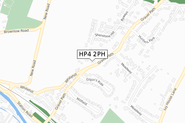
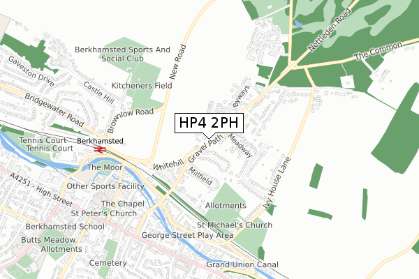
HP4 2PH lies on Gravel Path in Berkhamsted. HP4 2PH is located in the Berkhamsted Castle electoral ward, within the local authority district of Dacorum and the English Parliamentary constituency of South West Hertfordshire. The Sub Integrated Care Board (ICB) Location is NHS Hertfordshire and West Essex ICB - 06N and the police force is Hertfordshire. This postcode has been in use since January 1980.


GetTheData
Source: OS Open Zoomstack (Ordnance Survey)
Licence: Open Government Licence (requires attribution)
Attribution: Contains OS data © Crown copyright and database right 2024
Source: Open Postcode Geo
Licence: Open Government Licence (requires attribution)
Attribution: Contains OS data © Crown copyright and database right 2024; Contains Royal Mail data © Royal Mail copyright and database right 2024; Source: Office for National Statistics licensed under the Open Government Licence v.3.0
| Easting | 499999 |
| Northing | 208216 |
| Latitude | 51.763706 |
| Longitude | -0.552387 |
GetTheData
Source: Open Postcode Geo
Licence: Open Government Licence
| Street | Gravel Path |
| Town/City | Berkhamsted |
| Country | England |
| Postcode District | HP4 |
| ➜ HP4 open data dashboard ➜ See where HP4 is on a map ➜ Where is Berkhamsted? | |
GetTheData
Source: Land Registry Price Paid Data
Licence: Open Government Licence
Elevation or altitude of HP4 2PH as distance above sea level:
| Metres | Feet | |
|---|---|---|
| Elevation | 150m | 492ft |
Elevation is measured from the approximate centre of the postcode, to the nearest point on an OS contour line from OS Terrain 50, which has contour spacing of ten vertical metres.
➜ How high above sea level am I? Find the elevation of your current position using your device's GPS.
GetTheData
Source: Open Postcode Elevation
Licence: Open Government Licence
| Ward | Berkhamsted Castle |
| Constituency | South West Hertfordshire |
GetTheData
Source: ONS Postcode Database
Licence: Open Government Licence
2009 18 JUN £960,000 |
WHITE HILL COTTAGE, GRAVEL PATH, BERKHAMSTED, HP4 2PH 2006 3 AUG £1,155,000 |
2001 19 DEC £875,000 |
2000 12 JUL £799,000 |
FAIRFIELD HOUSE, GRAVEL PATH, BERKHAMSTED, HP4 2PH 2000 10 FEB £750,000 |
WINTON HOUSE, GRAVEL PATH, BERKHAMSTED, HP4 2PH 1999 20 SEP £800,000 |
WINTON HOUSE, GRAVEL PATH, BERKHAMSTED, HP4 2PH 1996 4 OCT £475,000 |
1996 30 JUL £450,000 |
CROPTHORNE COTTAGE, GRAVEL PATH, BERKHAMSTED, HP4 2PH 1995 4 DEC £240,000 |
GetTheData
Source: HM Land Registry Price Paid Data
Licence: Contains HM Land Registry data © Crown copyright and database right 2024. This data is licensed under the Open Government Licence v3.0.
| December 2023 | Criminal damage and arson | On or near Whitehill Court | 408m |
| November 2023 | Vehicle crime | On or near Whitehill Court | 408m |
| November 2023 | Anti-social behaviour | On or near Whitehill Court | 408m |
| ➜ Gravel Path crime map and outcomes | |||
GetTheData
Source: data.police.uk
Licence: Open Government Licence
| Bridgewater Road (Brownlow Road) | Berkhamsted | 592m |
| Bridgewater Road (Brownlow Road) | Berkhamsted | 602m |
| Brownlow Road (Bridgewater Road) | Berkhamsted | 646m |
| Brownlow Road (Bridgewater Road) | Berkhamsted | 664m |
| Berkhamsted Railway Station (Lower Kings Road) | Berkhamsted | 680m |
| Berkhamsted Station | 0.7km |
| Hemel Hempstead Station | 4.9km |
| Tring Station | 6.4km |
GetTheData
Source: NaPTAN
Licence: Open Government Licence
➜ Broadband speed and availability dashboard for HP4 2PH
| Percentage of properties with Next Generation Access | 100.0% |
| Percentage of properties with Superfast Broadband | 100.0% |
| Percentage of properties with Ultrafast Broadband | 0.0% |
| Percentage of properties with Full Fibre Broadband | 0.0% |
Superfast Broadband is between 30Mbps and 300Mbps
Ultrafast Broadband is > 300Mbps
| Median download speed | 74.8Mbps |
| Average download speed | 56.7Mbps |
| Maximum download speed | 80.00Mbps |
| Median upload speed | 20.0Mbps |
| Average upload speed | 14.3Mbps |
| Maximum upload speed | 20.00Mbps |
| Percentage of properties unable to receive 2Mbps | 0.0% |
| Percentage of properties unable to receive 5Mbps | 0.0% |
| Percentage of properties unable to receive 10Mbps | 0.0% |
| Percentage of properties unable to receive 30Mbps | 0.0% |
➜ Broadband speed and availability dashboard for HP4 2PH
GetTheData
Source: Ofcom
Licence: Ofcom Terms of Use (requires attribution)
Estimated total energy consumption in HP4 2PH by fuel type, 2015.
| Consumption (kWh) | 289,430 |
|---|---|
| Meter count | 8 |
| Mean (kWh/meter) | 36,179 |
| Median (kWh/meter) | 37,363 |
| Consumption (kWh) | 110,724 |
|---|---|
| Meter count | 9 |
| Mean (kWh/meter) | 12,303 |
| Median (kWh/meter) | 12,361 |
GetTheData
Source: Postcode level gas estimates: 2015 (experimental)
Source: Postcode level electricity estimates: 2015 (experimental)
Licence: Open Government Licence
GetTheData
Source: ONS Postcode Database
Licence: Open Government Licence


➜ Get more ratings from the Food Standards Agency
GetTheData
Source: Food Standards Agency
Licence: FSA terms & conditions
| Last Collection | |||
|---|---|---|---|
| Location | Mon-Fri | Sat | Distance |
| Hunters Park | 16:45 | 11:30 | 252m |
| Gravel Lane | 17:30 | 11:30 | 453m |
| Bank Mill | 17:15 | 11:30 | 639m |
GetTheData
Source: Dracos
Licence: Creative Commons Attribution-ShareAlike
| Facility | Distance |
|---|---|
| Kitcheners Field Castle Street, Berkhamsted Grass Pitches, Outdoor Tennis Courts | 551m |
| Berkhamsted School (Castle Campus) Castle Street, Berkhamsted Health and Fitness Gym, Sports Hall, Swimming Pool, Artificial Grass Pitch, Studio | 719m |
| Berkhamsted Sports And Social Club Castle Hill, Berkhamsted Grass Pitches | 737m |
GetTheData
Source: Active Places
Licence: Open Government Licence
| School | Phase of Education | Distance |
|---|---|---|
| Swing Gate Infant School and Nursery Swing Gate Lane, Berkhamsted, HP4 2LJ | Primary | 759m |
| Berkhamsted School Overton House, 133 High Street, Berkhamsted, HP4 2DJ | Not applicable | 852m |
| Victoria Church of England Infant and Nursery School Prince Edward Street, Berkhamsted, HP4 3HA | Primary | 994m |
GetTheData
Source: Edubase
Licence: Open Government Licence
The below table lists the International Territorial Level (ITL) codes (formerly Nomenclature of Territorial Units for Statistics (NUTS) codes) and Local Administrative Units (LAU) codes for HP4 2PH:
| ITL 1 Code | Name |
|---|---|
| TLH | East |
| ITL 2 Code | Name |
| TLH2 | Bedfordshire and Hertfordshire |
| ITL 3 Code | Name |
| TLH23 | Hertfordshire CC |
| LAU 1 Code | Name |
| E07000096 | Dacorum |
GetTheData
Source: ONS Postcode Directory
Licence: Open Government Licence
The below table lists the Census Output Area (OA), Lower Layer Super Output Area (LSOA), and Middle Layer Super Output Area (MSOA) for HP4 2PH:
| Code | Name | |
|---|---|---|
| OA | E00118685 | |
| LSOA | E01023362 | Dacorum 009B |
| MSOA | E02004864 | Dacorum 009 |
GetTheData
Source: ONS Postcode Directory
Licence: Open Government Licence
| HP4 2PA | Shenstone Hill | 125m |
| HP4 2PD | Gilpins Ride | 139m |
| HP4 2PG | Headlands Drive | 207m |
| HP4 2PB | Millfield | 212m |
| HP4 2PQ | Gravel Path | 218m |
| HP4 2PL | Meadway | 232m |
| HP4 2PR | Beech Hill Court | 297m |
| HP4 2PJ | Gravel Path | 345m |
| HP4 2PN | Meadway | 346m |
| HP4 2PT | Hunters Park | 353m |
GetTheData
Source: Open Postcode Geo; Land Registry Price Paid Data
Licence: Open Government Licence