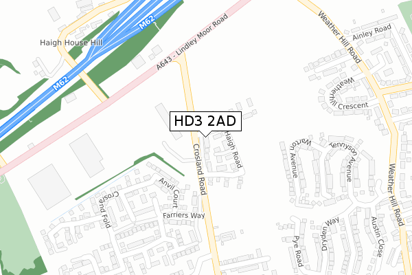
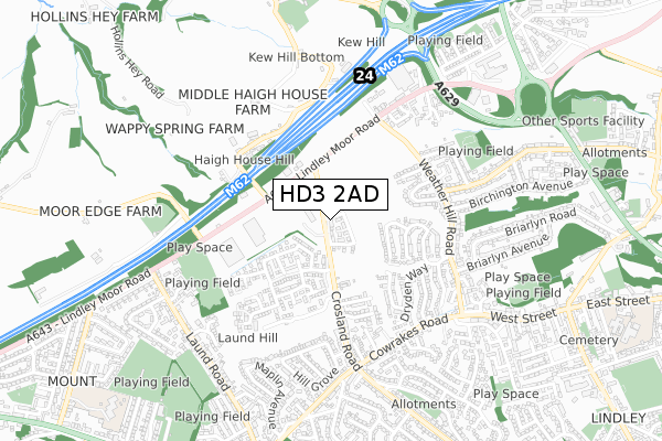
HD3 2AD is located in the Lindley electoral ward, within the metropolitan district of Kirklees and the English Parliamentary constituency of Colne Valley. The Sub Integrated Care Board (ICB) Location is NHS West Yorkshire ICB - X2C4Y and the police force is West Yorkshire. This postcode has been in use since June 2019.


GetTheData
Source: OS Open Zoomstack (Ordnance Survey)
Licence: Open Government Licence (requires attribution)
Attribution: Contains OS data © Crown copyright and database right 2024
Source: Open Postcode Geo
Licence: Open Government Licence (requires attribution)
Attribution: Contains OS data © Crown copyright and database right 2024; Contains Royal Mail data © Royal Mail copyright and database right 2024; Source: Office for National Statistics licensed under the Open Government Licence v.3.0
| Easting | 410791 |
| Northing | 418783 |
| Latitude | 53.665434 |
| Longitude | -1.838164 |
GetTheData
Source: Open Postcode Geo
Licence: Open Government Licence
| Country | England |
| Postcode District | HD3 |
| ➜ HD3 open data dashboard ➜ See where HD3 is on a map ➜ Where is Huddersfield? | |
GetTheData
Source: Land Registry Price Paid Data
Licence: Open Government Licence
| Ward | Lindley |
| Constituency | Colne Valley |
GetTheData
Source: ONS Postcode Database
Licence: Open Government Licence
7, HAIGH WAY, HUDDERSFIELD, HD3 2AD 2022 30 SEP £269,950 |
5, HAIGH WAY, HUDDERSFIELD, HD3 2AD 2022 27 JUN £344,950 |
12, HAIGH WAY, HUDDERSFIELD, HD3 2AD 2020 19 JUN £247,234 |
6, HAIGH WAY, HUDDERSFIELD, HD3 2AD 2020 19 JUN £264,950 |
2, HAIGH WAY, HUDDERSFIELD, HD3 2AD 2019 13 DEC £239,950 |
4, HAIGH WAY, HUDDERSFIELD, HD3 2AD 2019 13 DEC £289,950 |
3, HAIGH WAY, HUDDERSFIELD, HD3 2AD 2019 25 OCT £214,950 |
16, HAIGH WAY, HUDDERSFIELD, HD3 2AD 2019 30 AUG £264,950 |
14, HAIGH WAY, HUDDERSFIELD, HD3 2AD 2019 28 MAY £284,950 |
1, HAIGH WAY, HUDDERSFIELD, HD3 2AD 2019 16 MAY £259,950 |
GetTheData
Source: HM Land Registry Price Paid Data
Licence: Contains HM Land Registry data © Crown copyright and database right 2024. This data is licensed under the Open Government Licence v3.0.
| May 2023 | Other theft | On or near Ainley Close | 449m |
| August 2022 | Burglary | On or near Ainley Close | 449m |
| June 2022 | Shoplifting | On or near Weatherhill Crescent | 382m |
| ➜ Get more crime data in our Crime section | |||
GetTheData
Source: data.police.uk
Licence: Open Government Licence
| Lindley Moor Road | Mount | 385m |
| Weather Hill Rd Weatherhill Crescent (Weather Hill Road) | Birchencliffe | 410m |
| Lindley Moor Road | Mount | 419m |
| Weather Hill Rd Weatherhill Crescent (Weather Hill Road) | Birchencliffe | 420m |
| Haigh House Hill | Blackley | 425m |
| Huddersfield Station | 4km |
| Lockwood Station | 4.2km |
| Brighouse Station | 5.3km |
GetTheData
Source: NaPTAN
Licence: Open Government Licence
| Percentage of properties with Next Generation Access | 100.0% |
| Percentage of properties with Superfast Broadband | 0.0% |
| Percentage of properties with Ultrafast Broadband | 0.0% |
| Percentage of properties with Full Fibre Broadband | 0.0% |
Superfast Broadband is between 30Mbps and 300Mbps
Ultrafast Broadband is > 300Mbps
| Percentage of properties unable to receive 2Mbps | 0.0% |
| Percentage of properties unable to receive 5Mbps | 0.0% |
| Percentage of properties unable to receive 10Mbps | 0.0% |
| Percentage of properties unable to receive 30Mbps | 100.0% |
GetTheData
Source: Ofcom
Licence: Ofcom Terms of Use (requires attribution)
GetTheData
Source: ONS Postcode Database
Licence: Open Government Licence


➜ Get more ratings from the Food Standards Agency
GetTheData
Source: Food Standards Agency
Licence: FSA terms & conditions
| Last Collection | |||
|---|---|---|---|
| Location | Mon-Fri | Sat | Distance |
| Blackley | 17:15 | 08:00 | 914m |
| Thornhill Road | 17:30 | 12:15 | 1,351m |
| Woodman | 17:15 | 11:30 | 1,485m |
GetTheData
Source: Dracos
Licence: Creative Commons Attribution-ShareAlike
| Facility | Distance |
|---|---|
| Heatherleigh Playing Fields Lindley Moor Road, Lindley Moor, Huddersfield Grass Pitches | 505m |
| Outlane Cricket Club Off Old Lindley Road, Huddersfield Grass Pitches | 660m |
| Fern Lea Playing Fields Fern Lea Road, Lindley, Huddersfield Grass Pitches | 745m |
GetTheData
Source: Active Places
Licence: Open Government Licence
| School | Phase of Education | Distance |
|---|---|---|
| Lindley Church of England Infant School Lindley Ce Infant School, East Street, Lindley, Huddersfield, HD3 3NE | Primary | 1.2km |
| Lindley Junior School George Street, Lindley, Huddersfield, HD3 3LY | Primary | 1.2km |
| Moorlands Primary School Moorlands Road, Mount, Huddersfield, HD3 3UH | Primary | 1.2km |
GetTheData
Source: Edubase
Licence: Open Government Licence
The below table lists the International Territorial Level (ITL) codes (formerly Nomenclature of Territorial Units for Statistics (NUTS) codes) and Local Administrative Units (LAU) codes for HD3 2AD:
| ITL 1 Code | Name |
|---|---|
| TLE | Yorkshire and The Humber |
| ITL 2 Code | Name |
| TLE4 | West Yorkshire |
| ITL 3 Code | Name |
| TLE44 | Calderdale and Kirklees |
| LAU 1 Code | Name |
| E08000034 | Kirklees |
GetTheData
Source: ONS Postcode Directory
Licence: Open Government Licence
The below table lists the Census Output Area (OA), Lower Layer Super Output Area (LSOA), and Middle Layer Super Output Area (MSOA) for HD3 2AD:
| Code | Name | |
|---|---|---|
| OA | E00056463 | |
| LSOA | E01011209 | Kirklees 030C |
| MSOA | E02002300 | Kirklees 030 |
GetTheData
Source: ONS Postcode Directory
Licence: Open Government Licence
| HD3 3TB | Lindley Moor Road | 238m |
| HD3 3ZW | Warton Avenue | 244m |
| HD3 3RL | Alderstone Rise | 338m |
| HD3 3ZG | Tennyson Avenue | 345m |
| HD3 3QZ | Weatherhill Crescent | 356m |
| HD3 3ZY | Tennyson Avenue | 370m |
| HD3 3YF | Dryden Way | 394m |
| HD3 3GU | Romsey Close | 395m |
| HD3 3ZP | Bridges Avenue | 413m |
| HD3 3SU | Crosland Road | 415m |
GetTheData
Source: Open Postcode Geo; Land Registry Price Paid Data
Licence: Open Government Licence