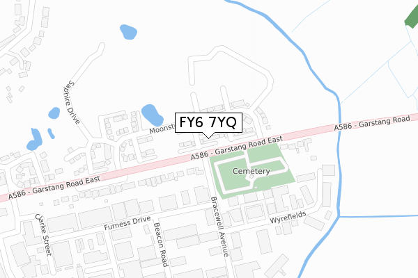
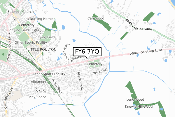
FY6 7YQ is located in the Breck electoral ward, within the local authority district of Wyre and the English Parliamentary constituency of Wyre and Preston North. The Sub Integrated Care Board (ICB) Location is NHS Lancashire and South Cumbria ICB - 02M and the police force is Lancashire. This postcode has been in use since October 2019.


GetTheData
Source: OS Open Zoomstack (Ordnance Survey)
Licence: Open Government Licence (requires attribution)
Attribution: Contains OS data © Crown copyright and database right 2024
Source: Open Postcode Geo
Licence: Open Government Licence (requires attribution)
Attribution: Contains OS data © Crown copyright and database right 2024; Contains Royal Mail data © Royal Mail copyright and database right 2024; Source: Office for National Statistics licensed under the Open Government Licence v.3.0
| Easting | 336243 |
| Northing | 439331 |
| Latitude | 53.846302 |
| Longitude | -2.970550 |
GetTheData
Source: Open Postcode Geo
Licence: Open Government Licence
| Country | England |
| Postcode District | FY6 |
| ➜ FY6 open data dashboard ➜ See where FY6 is on a map ➜ Where is Poulton-le-Fylde? | |
GetTheData
Source: Land Registry Price Paid Data
Licence: Open Government Licence
| Ward | Breck |
| Constituency | Wyre And Preston North |
GetTheData
Source: ONS Postcode Database
Licence: Open Government Licence
| June 2022 | Violence and sexual offences | On or near Bus/Coach Station | 325m |
| May 2022 | Anti-social behaviour | On or near Bracewell Avenue | 211m |
| April 2022 | Anti-social behaviour | On or near Bracewell Avenue | 211m |
| ➜ Get more crime data in our Crime section | |||
GetTheData
Source: data.police.uk
Licence: Open Government Licence
| Bracewell Avenue (Garstang Road East) | Poulton-le-fylde | 63m |
| Bracewell Avenue (Garstang Road East) | Poulton-le-fylde | 64m |
| Moorland Road (Garstang Road East) | Poulton-le-fylde | 576m |
| Moorland Road (Garstang Road East) | Poulton-le-fylde | 672m |
| Hodgson High School (Moorland Road) | Little Poulton | 683m |
| Poulton-le-Fylde Station | 1.3km |
| Layton (Lancs) Station | 4.1km |
GetTheData
Source: NaPTAN
Licence: Open Government Licence
GetTheData
Source: ONS Postcode Database
Licence: Open Government Licence


➜ Get more ratings from the Food Standards Agency
GetTheData
Source: Food Standards Agency
Licence: FSA terms & conditions
| Last Collection | |||
|---|---|---|---|
| Location | Mon-Fri | Sat | Distance |
| Poulton Le Fylde Ind Estate | 17:00 | 11:30 | 442m |
| Mains Lane | 16:00 | 10:30 | 978m |
| Mains La, Little Singleton | 17:15 | 09:30 | 979m |
GetTheData
Source: Dracos
Licence: Creative Commons Attribution-ShareAlike
| Facility | Distance |
|---|---|
| Gymetc. (Poulton Le Fylde) Premier Way, Poulton Industrial Estate, Poulton-le-fylde Swimming Pool, Health and Fitness Gym, Studio | 588m |
| Hodgson Academy Moorland Road, Poulton-le-fylde Sports Hall, Grass Pitches, Studio | 722m |
| Fylde Cricket Club Moorland Road, Poulton-le-fylde Grass Pitches | 1km |
GetTheData
Source: Active Places
Licence: Open Government Licence
| School | Phase of Education | Distance |
|---|---|---|
| Hodgson Academy Moorland Road, Poulton-Le-Fylde, FY6 7EU | Secondary | 722m |
| Brookfield School Fouldrey Avenue, Poulton-le-Fylde, FY6 7HE | Not applicable | 1.1km |
| Poulton-le-Fylde the Breck Primary School Fouldrey Avenue, Poulton-le-Fylde, FY6 7HE | Primary | 1.2km |
GetTheData
Source: Edubase
Licence: Open Government Licence
The below table lists the International Territorial Level (ITL) codes (formerly Nomenclature of Territorial Units for Statistics (NUTS) codes) and Local Administrative Units (LAU) codes for FY6 7YQ:
| ITL 1 Code | Name |
|---|---|
| TLD | North West (England) |
| ITL 2 Code | Name |
| TLD4 | Lancashire |
| ITL 3 Code | Name |
| TLD44 | Lancaster and Wyre |
| LAU 1 Code | Name |
| E07000128 | Wyre |
GetTheData
Source: ONS Postcode Directory
Licence: Open Government Licence
The below table lists the Census Output Area (OA), Lower Layer Super Output Area (LSOA), and Middle Layer Super Output Area (MSOA) for FY6 7YQ:
| Code | Name | |
|---|---|---|
| OA | E00170183 | |
| LSOA | E01025545 | Wyre 013A |
| MSOA | E02005331 | Wyre 013 |
GetTheData
Source: ONS Postcode Directory
Licence: Open Government Licence
| FY6 8JH | Garstang Road East | 157m |
| FY6 8JS | Furness Drive | 255m |
| FY6 8JF | Bracewell Avenue | 264m |
| FY6 8JX | Wyrefields | 281m |
| FY6 7SY | Garstang Road East | 349m |
| FY6 8JE | Beacon Road | 368m |
| FY6 7HY | The Lilacs | 403m |
| FY6 7HL | The Blossoms | 440m |
| FY6 7HX | The Laurels | 440m |
| FY6 8JU | Cocker Avenue | 441m |
GetTheData
Source: Open Postcode Geo; Land Registry Price Paid Data
Licence: Open Government Licence