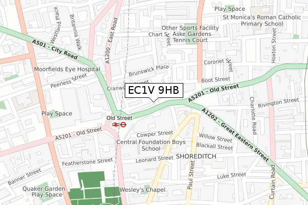
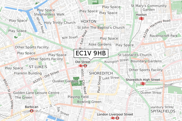
EC1V 9HB is located in the Hoxton West electoral ward, within the London borough of Hackney and the English Parliamentary constituency of Hackney South and Shoreditch. The Sub Integrated Care Board (ICB) Location is NHS North East London ICB - A3A8R and the police force is Metropolitan Police. This postcode has been in use since December 2017.


GetTheData
Source: OS Open Zoomstack (Ordnance Survey)
Licence: Open Government Licence (requires attribution)
Attribution: Contains OS data © Crown copyright and database right 2024
Source: Open Postcode Geo
Licence: Open Government Licence (requires attribution)
Attribution: Contains OS data © Crown copyright and database right 2024; Contains Royal Mail data © Royal Mail copyright and database right 2024; Source: Office for National Statistics licensed under the Open Government Licence v.3.0
| Easting | 532885 |
| Northing | 182555 |
| Latitude | 51.526283 |
| Longitude | -0.085823 |
GetTheData
Source: Open Postcode Geo
Licence: Open Government Licence
| Country | England |
| Postcode District | EC1V |
| ➜ EC1V open data dashboard ➜ See where EC1V is on a map ➜ Where is London? | |
GetTheData
Source: Land Registry Price Paid Data
Licence: Open Government Licence
| Ward | Hoxton West |
| Constituency | Hackney South And Shoreditch |
GetTheData
Source: ONS Postcode Database
Licence: Open Government Licence
| January 2024 | Anti-social behaviour | On or near Theatre/Concert Hall | 246m |
| January 2024 | Robbery | On or near Theatre/Concert Hall | 246m |
| January 2024 | Bicycle theft | On or near Peerless Street | 288m |
| ➜ Get more crime data in our Crime section | |||
GetTheData
Source: data.police.uk
Licence: Open Government Licence
| Shoreditch Fire Station | Shoreditch | 25m |
| Old Street | Old Street | 43m |
| Old Street Roundabout (City Road) | Old Street | 171m |
| Old Street | Old Street | 174m |
| Great Eastern Street (Old Street) | Shoreditch | 181m |
| Old Street Underground Station | Old Street | 141m |
| Moorgate Underground Station | Moorgate | 918m |
| Liverpool Street Underground Station | Liverpool Street | 1,008m |
| Barbican Underground Station | Barbican | 1,076m |
| Bank Underground Station | Bank | 1,447m |
| Old Street Station | 0.2km |
| Shoreditch High Street Station | 0.8km |
| Moorgate Station | 0.9km |
GetTheData
Source: NaPTAN
Licence: Open Government Licence
GetTheData
Source: ONS Postcode Database
Licence: Open Government Licence


➜ Get more ratings from the Food Standards Agency
GetTheData
Source: Food Standards Agency
Licence: FSA terms & conditions
| Last Collection | |||
|---|---|---|---|
| Location | Mon-Fri | Sat | Distance |
| Charles Square | 18:30 | 12:00 | 140m |
| Old Street Branch Office | 18:30 | 12:00 | 262m |
| Paul Street (Epworth St) | 18:30 | 332m | |
GetTheData
Source: Dracos
Licence: Creative Commons Attribution-ShareAlike
| Facility | Distance |
|---|---|
| Central Foundation Boys School Cowper Street, London Health and Fitness Gym, Sports Hall, Artificial Grass Pitch | 114m |
| Gymbox (Old Street) Old Street, London Health and Fitness Gym, Studio | 306m |
| Energie Fitness (Old Street) Bunhill Row, London Health and Fitness Gym, Studio | 362m |
GetTheData
Source: Active Places
Licence: Open Government Licence
| School | Phase of Education | Distance |
|---|---|---|
| Central Foundation Boys' School Cowper Street, City Road, London, EC2A 4SH | Secondary | 114m |
| Workers' Educational Association 4 Luke Street, London, EC2A 4XW | 16 plus | 410m |
| St Luke's CofE Primary School Radnor Street, London, EC1V 3SJ | Primary | 423m |
GetTheData
Source: Edubase
Licence: Open Government Licence
The below table lists the International Territorial Level (ITL) codes (formerly Nomenclature of Territorial Units for Statistics (NUTS) codes) and Local Administrative Units (LAU) codes for EC1V 9HB:
| ITL 1 Code | Name |
|---|---|
| TLI | London |
| ITL 2 Code | Name |
| TLI4 | Inner London - East |
| ITL 3 Code | Name |
| TLI41 | Hackney and Newham |
| LAU 1 Code | Name |
| E09000012 | Hackney |
GetTheData
Source: ONS Postcode Directory
Licence: Open Government Licence
The below table lists the Census Output Area (OA), Lower Layer Super Output Area (LSOA), and Middle Layer Super Output Area (MSOA) for EC1V 9HB:
| Code | Name | |
|---|---|---|
| OA | E00008884 | |
| LSOA | E01001780 | Hackney 027D |
| MSOA | E02000371 | Hackney 027 |
GetTheData
Source: ONS Postcode Directory
Licence: Open Government Licence
| EC1V 9HE | Old Street | 34m |
| EC1V 9HD | Vince Street | 53m |
| EC1V 9DD | Old Street | 63m |
| N1 6HN | Charles Square Estate | 86m |
| EC2A 3JD | Great Eastern Street | 97m |
| EC2A 4AP | Cowper Street | 98m |
| N1 6DZ | Brunswick Place | 101m |
| N1 6EA | Charles Square Estate | 102m |
| EC1V 1JB | City Road | 132m |
| N1 6HL | Charles Square | 133m |
GetTheData
Source: Open Postcode Geo; Land Registry Price Paid Data
Licence: Open Government Licence