E8 9HU maps, stats, and open data
E8 9HU is located in the St Peter's electoral ward, within the London borough of Tower Hamlets and the English Parliamentary constituency of Bethnal Green and Bow. The Sub Integrated Care Board (ICB) Location is NHS North East London ICB - A3A8R and the police force is Metropolitan Police. This postcode has been in use since September 2020.
E8 9HU geodata
| Easting | 534630 |
| Northing | 183318 |
| Latitude | 51.532726 |
| Longitude | -0.060392 |
Where is E8 9HU?
| Country | England |
| Postcode District | E8 |
Politics
| Ward | St Peter's |
|---|
| Constituency | Bethnal Green And Bow |
|---|
Transport
Nearest bus stops to E8 9HU
| Pritchards Road Hackney Road (Hackney Road) | Bethnal Green | 76m |
| Pritchards Road Hackney Road | Bethnal Green | 158m |
| Cambridge Heath Station | Bethnal Green | 165m |
| Cambridge Heath Station | Bethnal Green | 174m |
| Andrews Road | Bethnal Green | 183m |
Nearest underground/metro/tram to E8 9HU
| Bethnal Green Underground Station | Bethnal Green | 701m |
| Whitechapel Underground Station | Whitechapel | 1,470m |
| Stepney Green Underground Station | Stepney Green | 1,543m |
Nearest railway stations to E8 9HU
| Cambridge Heath (London) Station | 0.2km |
| London Fields Station | 1km |
| Bethnal Green Station | 1km |
Deprivation
68.8% of English postcodes are less deprived than
E8 9HU:
Food Standards Agency
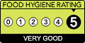
Three nearest food hygiene ratings to E8 9HU (metres)
London Buns
Unit 71 Containerville Studios
16m
RoxyRara Cakes
Pao Pop n Pickles
Unit 50 Containerville
54m
➜ Get more ratings from the Food Standards Agency
Nearest post box to E8 9HU
| | Last Collection | |
|---|
| Location | Mon-Fri | Sat | Distance |
|---|
| 481 Cambridge Heath Road E2 | 18:30 | 12:00 | 229m |
| Goldsmith Row | 18:30 | 11:30 | 308m |
| 328 Hackney Road | 17:00 | 11:30 | 325m |
E8 9HU ITL and E8 9HU LAU
The below table lists the International Territorial Level (ITL) codes (formerly Nomenclature of Territorial Units for Statistics (NUTS) codes) and Local Administrative Units (LAU) codes for E8 9HU:
| ITL 1 Code | Name |
|---|
| TLI | London |
| ITL 2 Code | Name |
|---|
| TLI4 | Inner London - East |
| ITL 3 Code | Name |
|---|
| TLI42 | Tower Hamlets |
| LAU 1 Code | Name |
|---|
| E09000030 | Tower Hamlets |
E8 9HU census areas
The below table lists the Census Output Area (OA), Lower Layer Super Output Area (LSOA), and Middle Layer Super Output Area (MSOA) for E8 9HU:
| Code | Name |
|---|
| OA | E00167245 | |
|---|
| LSOA | E01004202 | Tower Hamlets 005B |
|---|
| MSOA | E02000868 | Tower Hamlets 005 |
|---|
Nearest postcodes to E8 9HU