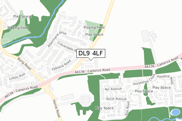
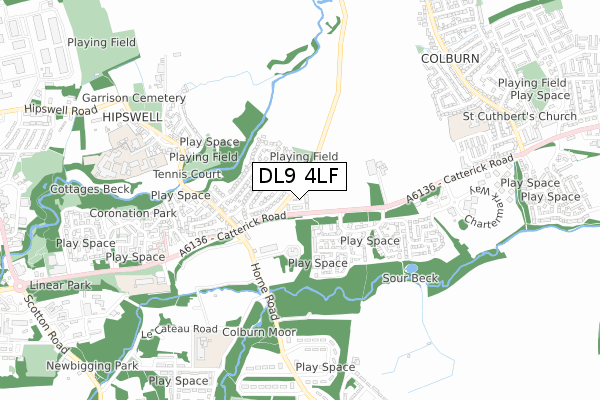
DL9 4LF is located in the Hipswell & Colburn electoral ward, within the unitary authority of North Yorkshire and the English Parliamentary constituency of Richmond (Yorks). The Sub Integrated Care Board (ICB) Location is NHS Humber and North Yorkshire ICB - 42D and the police force is North Yorkshire. This postcode has been in use since November 2017.


GetTheData
Source: OS Open Zoomstack (Ordnance Survey)
Licence: Open Government Licence (requires attribution)
Attribution: Contains OS data © Crown copyright and database right 2024
Source: Open Postcode Geo
Licence: Open Government Licence (requires attribution)
Attribution: Contains OS data © Crown copyright and database right 2024; Contains Royal Mail data © Royal Mail copyright and database right 2024; Source: Office for National Statistics licensed under the Open Government Licence v.3.0
| Easting | 419399 |
| Northing | 497952 |
| Latitude | 54.376715 |
| Longitude | -1.702874 |
GetTheData
Source: Open Postcode Geo
Licence: Open Government Licence
| Country | England |
| Postcode District | DL9 |
| ➜ DL9 open data dashboard ➜ See where DL9 is on a map ➜ Where is Catterick Garrison? | |
GetTheData
Source: Land Registry Price Paid Data
Licence: Open Government Licence
| Ward | Hipswell & Colburn |
| Constituency | Richmond (Yorks) |
GetTheData
Source: ONS Postcode Database
Licence: Open Government Licence
| June 2022 | Violence and sexual offences | On or near Sports/Recreation Area | 90m |
| June 2022 | Violence and sexual offences | On or near Cravendale Road | 138m |
| June 2022 | Violence and sexual offences | On or near Cravendale Road | 138m |
| ➜ Get more crime data in our Crime section | |||
GetTheData
Source: data.police.uk
Licence: Open Government Licence
| Horseshoe Close (A6136) | Colburn | 246m |
| Horseshoe Close (A6136) | Colburn | 248m |
| D'arcy Court (Byng Road) | Hipswell | 307m |
| Hildyard Mews (Byng Road) | Hipswell | 315m |
| Military Hospital (Horne Road) | Hipswell | 318m |
GetTheData
Source: NaPTAN
Licence: Open Government Licence
| Percentage of properties with Next Generation Access | 100.0% |
| Percentage of properties with Superfast Broadband | 100.0% |
| Percentage of properties with Ultrafast Broadband | 100.0% |
| Percentage of properties with Full Fibre Broadband | 100.0% |
Superfast Broadband is between 30Mbps and 300Mbps
Ultrafast Broadband is > 300Mbps
| Percentage of properties unable to receive 2Mbps | 0.0% |
| Percentage of properties unable to receive 5Mbps | 0.0% |
| Percentage of properties unable to receive 10Mbps | 0.0% |
| Percentage of properties unable to receive 30Mbps | 0.0% |
GetTheData
Source: Ofcom
Licence: Ofcom Terms of Use (requires attribution)
GetTheData
Source: ONS Postcode Database
Licence: Open Government Licence


➜ Get more ratings from the Food Standards Agency
GetTheData
Source: Food Standards Agency
Licence: FSA terms & conditions
| Last Collection | |||
|---|---|---|---|
| Location | Mon-Fri | Sat | Distance |
| Hilyard Row, Catterick Garrison | 17:00 | 11:00 | 362m |
| Vimy Barracks, Catterick Garris | 17:00 | 11:15 | 667m |
| Hipswell Road West, Catterick G | 16:00 | 11:00 | 952m |
GetTheData
Source: Dracos
Licence: Creative Commons Attribution-ShareAlike
| Facility | Distance |
|---|---|
| Risedale School Hipswell, Catterick Garrison Sports Hall, Health and Fitness Gym | 805m |
| Colburn Community Primary School Colburn Lane, Catterick Garrison Grass Pitches | 823m |
| Robertson Road Sports Ground Horne Road, Catterick Garrison Artificial Grass Pitch, Grass Pitches | 867m |
GetTheData
Source: Active Places
Licence: Open Government Licence
| School | Phase of Education | Distance |
|---|---|---|
| Catterick Garrison, Le Cateau Community Primary School Brough Road, Catterick Garrison, DL9 4ED | Primary | 693m |
| Cambrai Primary School Catterick Road, Catterick Garrison, DL9 4BZ | Primary | 727m |
| Hipswell Church of England Primary School Hipswell, Catterick Garrison, DL9 4BB | Primary | 727m |
GetTheData
Source: Edubase
Licence: Open Government Licence
The below table lists the International Territorial Level (ITL) codes (formerly Nomenclature of Territorial Units for Statistics (NUTS) codes) and Local Administrative Units (LAU) codes for DL9 4LF:
| ITL 1 Code | Name |
|---|---|
| TLE | Yorkshire and The Humber |
| ITL 2 Code | Name |
| TLE2 | North Yorkshire |
| ITL 3 Code | Name |
| TLE22 | North Yorkshire CC |
| LAU 1 Code | Name |
| E07000166 | Richmondshire |
GetTheData
Source: ONS Postcode Directory
Licence: Open Government Licence
The below table lists the Census Output Area (OA), Lower Layer Super Output Area (LSOA), and Middle Layer Super Output Area (MSOA) for DL9 4LF:
| Code | Name | |
|---|---|---|
| OA | E00171342 | |
| LSOA | E01027750 | Richmondshire 004B |
| MSOA | E02005785 | Richmondshire 004 |
GetTheData
Source: ONS Postcode Directory
Licence: Open Government Licence
| DL9 4EB | Cravendale Road | 128m |
| DL9 4DY | Cravendale Road | 141m |
| DL9 4HA | Albermarle Drive | 146m |
| DL9 4HD | Maple Close | 167m |
| DL9 4GE | Ayr Avenue | 170m |
| DL9 4DZ | Falkland Road | 175m |
| DL9 4EA | Falkland Road | 179m |
| DL9 4EZ | Albermarle Drive | 199m |
| DL9 4DX | Cravendale Road | 204m |
| DL9 4HB | Albermarle Drive | 224m |
GetTheData
Source: Open Postcode Geo; Land Registry Price Paid Data
Licence: Open Government Licence