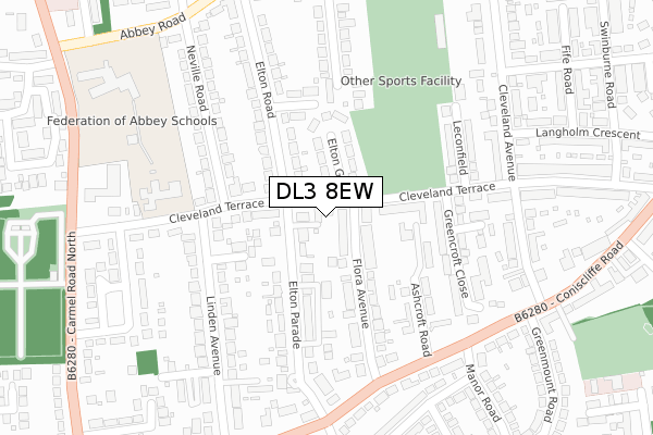
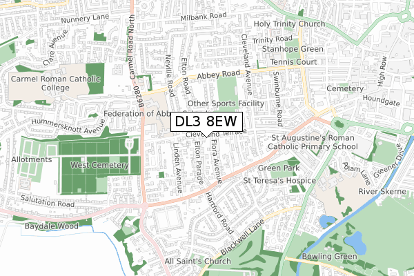
DL3 8EW is located in the Park West electoral ward, within the unitary authority of Darlington and the English Parliamentary constituency of Darlington. The Sub Integrated Care Board (ICB) Location is NHS North East and North Cumbria ICB - 16C and the police force is Durham. This postcode has been in use since April 2019.


GetTheData
Source: OS Open Zoomstack (Ordnance Survey)
Licence: Open Government Licence (requires attribution)
Attribution: Contains OS data © Crown copyright and database right 2024
Source: Open Postcode Geo
Licence: Open Government Licence (requires attribution)
Attribution: Contains OS data © Crown copyright and database right 2024; Contains Royal Mail data © Royal Mail copyright and database right 2024; Source: Office for National Statistics licensed under the Open Government Licence v.3.0
| Easting | 427809 |
| Northing | 514110 |
| Latitude | 54.521535 |
| Longitude | -1.571900 |
GetTheData
Source: Open Postcode Geo
Licence: Open Government Licence
| Country | England |
| Postcode District | DL3 |
| ➜ DL3 open data dashboard ➜ See where DL3 is on a map ➜ Where is Darlington? | |
GetTheData
Source: Land Registry Price Paid Data
Licence: Open Government Licence
| Ward | Park West |
| Constituency | Darlington |
GetTheData
Source: ONS Postcode Database
Licence: Open Government Licence
| January 2024 | Shoplifting | On or near Langholm Crescent | 462m |
| January 2024 | Vehicle crime | On or near Langholm Crescent | 462m |
| December 2023 | Violence and sexual offences | On or near Langholm Crescent | 462m |
| ➜ Get more crime data in our Crime section | |||
GetTheData
Source: data.police.uk
Licence: Open Government Licence
| Greencroft Close (Cleveland Terrace) | West End | 129m |
| Ashcroft Road (Coniscliffe Road) | West End | 268m |
| Hartford Road (Coniscliffe Road) | West End | 294m |
| Greenmount Road (Coniscliffe Road) | West End | 318m |
| Greenmount Road (Coniscliffe Road) | West End | 335m |
| Darlington Station | 1.6km |
| North Road Station | 2km |
GetTheData
Source: NaPTAN
Licence: Open Government Licence
| Percentage of properties with Next Generation Access | 100.0% |
| Percentage of properties with Superfast Broadband | 100.0% |
| Percentage of properties with Ultrafast Broadband | 100.0% |
| Percentage of properties with Full Fibre Broadband | 0.0% |
Superfast Broadband is between 30Mbps and 300Mbps
Ultrafast Broadband is > 300Mbps
| Percentage of properties unable to receive 2Mbps | 0.0% |
| Percentage of properties unable to receive 5Mbps | 0.0% |
| Percentage of properties unable to receive 10Mbps | 0.0% |
| Percentage of properties unable to receive 30Mbps | 0.0% |
GetTheData
Source: Ofcom
Licence: Ofcom Terms of Use (requires attribution)
GetTheData
Source: ONS Postcode Database
Licence: Open Government Licence


➜ Get more ratings from the Food Standards Agency
GetTheData
Source: Food Standards Agency
Licence: FSA terms & conditions
| Last Collection | |||
|---|---|---|---|
| Location | Mon-Fri | Sat | Distance |
| Elton Road | 17:30 | 10:00 | 198m |
| Woodvale | 17:30 | 09:30 | 327m |
| Cleveland Terrace P.o. | 17:30 | 10:00 | 416m |
GetTheData
Source: Dracos
Licence: Creative Commons Attribution-ShareAlike
| Facility | Distance |
|---|---|
| Queen Elizabeth Sixth Form College Playing Fields Abbey Road, Darlington Grass Pitches | 336m |
| Federation Of Abbey Schools Abbey Road, Darlington Sports Hall, Grass Pitches | 399m |
| New Blackwell Tennis Club Carmel Grove, Darlington Outdoor Tennis Courts | 621m |
GetTheData
Source: Active Places
Licence: Open Government Licence
| School | Phase of Education | Distance |
|---|---|---|
| Abbey Infants' School Cleveland Terrace, Darlington, DL3 8JA | Primary | 268m |
| Abbey Junior School Abbey Road, Darlington, DL3 8NN | Primary | 422m |
| St Augustine's Catholic Primary School Beechwood Avenue, St Augustine's RC Primary School, Darlington, DL3 7HP | Primary | 600m |
GetTheData
Source: Edubase
Licence: Open Government Licence
The below table lists the International Territorial Level (ITL) codes (formerly Nomenclature of Territorial Units for Statistics (NUTS) codes) and Local Administrative Units (LAU) codes for DL3 8EW:
| ITL 1 Code | Name |
|---|---|
| TLC | North East (England) |
| ITL 2 Code | Name |
| TLC1 | Tees Valley and Durham |
| ITL 3 Code | Name |
| TLC13 | Darlington |
| LAU 1 Code | Name |
| E06000005 | Darlington |
GetTheData
Source: ONS Postcode Directory
Licence: Open Government Licence
The below table lists the Census Output Area (OA), Lower Layer Super Output Area (LSOA), and Middle Layer Super Output Area (MSOA) for DL3 8EW:
| Code | Name | |
|---|---|---|
| OA | E00062346 | |
| LSOA | E01012360 | Darlington 010C |
| MSOA | E02002568 | Darlington 010 |
GetTheData
Source: ONS Postcode Directory
Licence: Open Government Licence
| DL3 8HR | Cleveland Terrace | 55m |
| DL3 8HX | Cleveland Terrace | 108m |
| DL3 8PF | Flora Avenue | 109m |
| DL3 8HP | Elton Grove | 112m |
| DL3 8PE | Flora Avenue | 122m |
| DL3 8PQ | Elton Parade | 132m |
| DL3 8PR | Sylvan Grove | 146m |
| DL3 8PJ | Elton Parade | 171m |
| DL3 8PD | Ashcroft Road | 184m |
| DL3 8HT | Westbourne Grove | 195m |
GetTheData
Source: Open Postcode Geo; Land Registry Price Paid Data
Licence: Open Government Licence