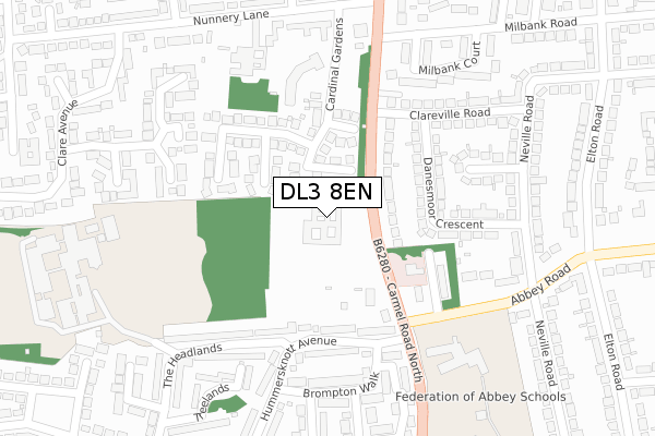
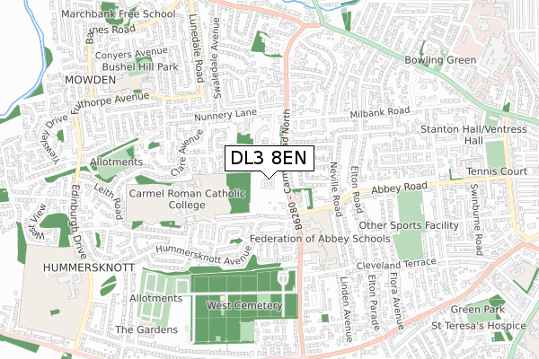
DL3 8EN is located in the Hummersknott electoral ward, within the unitary authority of Darlington and the English Parliamentary constituency of Darlington. The Sub Integrated Care Board (ICB) Location is NHS North East and North Cumbria ICB - 16C and the police force is Durham. This postcode has been in use since February 2019.


GetTheData
Source: OS Open Zoomstack (Ordnance Survey)
Licence: Open Government Licence (requires attribution)
Attribution: Contains OS data © Crown copyright and database right 2024
Source: Open Postcode Geo
Licence: Open Government Licence (requires attribution)
Attribution: Contains OS data © Crown copyright and database right 2024; Contains Royal Mail data © Royal Mail copyright and database right 2024; Source: Office for National Statistics licensed under the Open Government Licence v.3.0
| Easting | 427276 |
| Northing | 514532 |
| Latitude | 54.525357 |
| Longitude | -1.580095 |
GetTheData
Source: Open Postcode Geo
Licence: Open Government Licence
| Country | England |
| Postcode District | DL3 |
| ➜ DL3 open data dashboard ➜ See where DL3 is on a map ➜ Where is Darlington? | |
GetTheData
Source: Land Registry Price Paid Data
Licence: Open Government Licence
| Ward | Hummersknott |
| Constituency | Darlington |
GetTheData
Source: ONS Postcode Database
Licence: Open Government Licence
| December 2023 | Public order | On or near Osborne Close | 380m |
| November 2023 | Other crime | On or near Osborne Close | 380m |
| December 2022 | Anti-social behaviour | On or near Osborne Close | 380m |
| ➜ Get more crime data in our Crime section | |||
GetTheData
Source: data.police.uk
Licence: Open Government Licence
| Clareville Road (Carmel Road North) | West End | 103m |
| Abbey Junior School (Abbey Road) | West End | 219m |
| Abbey Junior School (Abbey Road) | West End | 234m |
| Hummersknott Avenue | Hummersknott | 265m |
| Hummersknott Avenue | Hummersknott | 274m |
| North Road Station | 2.1km |
| Darlington Station | 2.2km |
GetTheData
Source: NaPTAN
Licence: Open Government Licence
| Percentage of properties with Next Generation Access | 100.0% |
| Percentage of properties with Superfast Broadband | 100.0% |
| Percentage of properties with Ultrafast Broadband | 100.0% |
| Percentage of properties with Full Fibre Broadband | 0.0% |
Superfast Broadband is between 30Mbps and 300Mbps
Ultrafast Broadband is > 300Mbps
| Percentage of properties unable to receive 2Mbps | 0.0% |
| Percentage of properties unable to receive 5Mbps | 0.0% |
| Percentage of properties unable to receive 10Mbps | 0.0% |
| Percentage of properties unable to receive 30Mbps | 0.0% |
GetTheData
Source: Ofcom
Licence: Ofcom Terms of Use (requires attribution)
GetTheData
Source: ONS Postcode Database
Licence: Open Government Licence


➜ Get more ratings from the Food Standards Agency
GetTheData
Source: Food Standards Agency
Licence: FSA terms & conditions
| Last Collection | |||
|---|---|---|---|
| Location | Mon-Fri | Sat | Distance |
| St Clares, Hummerskott Road | 17:30 | 10:00 | 218m |
| Carmel Road | 17:30 | 10:00 | 478m |
| Elton Road | 17:30 | 10:00 | 502m |
GetTheData
Source: Dracos
Licence: Creative Commons Attribution-ShareAlike
| Facility | Distance |
|---|---|
| Federation Of Abbey Schools Abbey Road, Darlington Sports Hall, Grass Pitches | 286m |
| Carmel College The Headlands, Darlington Health and Fitness Gym, Grass Pitches, Sports Hall, Artificial Grass Pitch | 398m |
| Mowden Infant School Bushel Hill Drive, Darlington Grass Pitches | 720m |
GetTheData
Source: Active Places
Licence: Open Government Licence
| School | Phase of Education | Distance |
|---|---|---|
| Abbey Junior School Abbey Road, Darlington, DL3 8NN | Primary | 283m |
| Carmel College The Headlands, Darlington, DL3 8RW | Secondary | 400m |
| Abbey Infants' School Cleveland Terrace, Darlington, DL3 8JA | Primary | 459m |
GetTheData
Source: Edubase
Licence: Open Government Licence
The below table lists the International Territorial Level (ITL) codes (formerly Nomenclature of Territorial Units for Statistics (NUTS) codes) and Local Administrative Units (LAU) codes for DL3 8EN:
| ITL 1 Code | Name |
|---|---|
| TLC | North East (England) |
| ITL 2 Code | Name |
| TLC1 | Tees Valley and Durham |
| ITL 3 Code | Name |
| TLC13 | Darlington |
| LAU 1 Code | Name |
| E06000005 | Darlington |
GetTheData
Source: ONS Postcode Directory
Licence: Open Government Licence
The below table lists the Census Output Area (OA), Lower Layer Super Output Area (LSOA), and Middle Layer Super Output Area (MSOA) for DL3 8EN:
| Code | Name | |
|---|---|---|
| OA | E00062217 | |
| LSOA | E01012337 | Darlington 011B |
| MSOA | E02002569 | Darlington 011 |
GetTheData
Source: ONS Postcode Directory
Licence: Open Government Licence
| DL3 8RH | Carmel Road North | 109m |
| DL3 8SD | Cardinal Gardens | 132m |
| DL3 8RJ | Carmel Road North | 138m |
| DL3 8RL | Hummersknott Avenue | 173m |
| DL3 8NJ | Danesmoor Crescent | 178m |
| DL3 8NW | Spruce Grove | 202m |
| DL3 8RN | Hummersknott Avenue | 204m |
| DL3 8NH | Breck Road | 249m |
| DL3 8RT | Brompton Walk | 251m |
| DL3 8SA | Rowan Court | 265m |
GetTheData
Source: Open Postcode Geo; Land Registry Price Paid Data
Licence: Open Government Licence