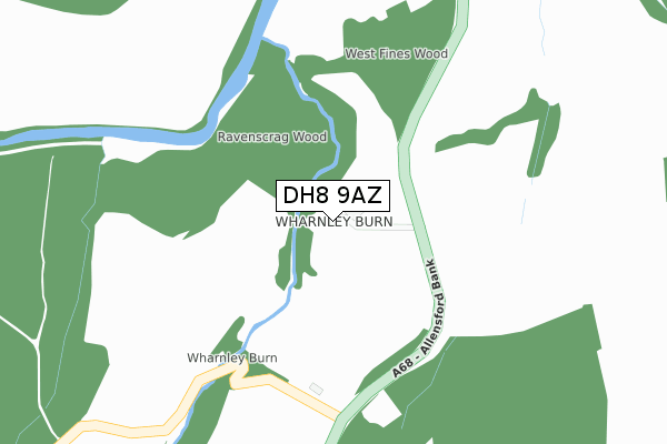
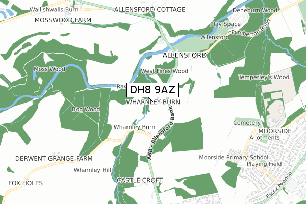
DH8 9AZ is located in the South Tynedale electoral ward, within the unitary authority of Northumberland and the English Parliamentary constituency of Hexham. The Sub Integrated Care Board (ICB) Location is NHS North East and North Cumbria ICB - 00L and the police force is Northumbria. This postcode has been in use since November 2018.


GetTheData
Source: OS Open Zoomstack (Ordnance Survey)
Licence: Open Government Licence (requires attribution)
Attribution: Contains OS data © Crown copyright and database right 2024
Source: Open Postcode Geo
Licence: Open Government Licence (requires attribution)
Attribution: Contains OS data © Crown copyright and database right 2024; Contains Royal Mail data © Royal Mail copyright and database right 2024; Source: Office for National Statistics licensed under the Open Government Licence v.3.0
| Easting | 407319 |
| Northing | 555122 |
| Latitude | 54.890795 |
| Longitude | -1.887435 |
GetTheData
Source: Open Postcode Geo
Licence: Open Government Licence
| Country | England |
| Postcode District | DH8 |
| ➜ DH8 open data dashboard ➜ See where DH8 is on a map | |
GetTheData
Source: Land Registry Price Paid Data
Licence: Open Government Licence
| Ward | South Tynedale |
| Constituency | Hexham |
GetTheData
Source: ONS Postcode Database
Licence: Open Government Licence
| Percentage of properties with Next Generation Access | 100.0% |
| Percentage of properties with Superfast Broadband | 0.0% |
| Percentage of properties with Ultrafast Broadband | 0.0% |
| Percentage of properties with Full Fibre Broadband | 0.0% |
Superfast Broadband is between 30Mbps and 300Mbps
Ultrafast Broadband is > 300Mbps
| Percentage of properties unable to receive 2Mbps | 0.0% |
| Percentage of properties unable to receive 5Mbps | 100.0% |
| Percentage of properties unable to receive 10Mbps | 100.0% |
| Percentage of properties unable to receive 30Mbps | 100.0% |
GetTheData
Source: Ofcom
Licence: Ofcom Terms of Use (requires attribution)
GetTheData
Source: ONS Postcode Database
Licence: Open Government Licence
| Last Collection | |||
|---|---|---|---|
| Location | Mon-Fri | Sat | Distance |
| East Law | 16:15 | 11:30 | 2,588m |
| Shotley Bridge Post Office | 16:00 | 12:00 | 2,916m |
| Snows Greenroad | 16:00 | 12:00 | 3,116m |
GetTheData
Source: Dracos
Licence: Creative Commons Attribution-ShareAlike
| Facility | Distance |
|---|---|
| Whittonstall First School Whittonstall, Consett Grass Pitches | 2km |
| Shotley Bridge Cricket Club The Spa Gardens, Consett Grass Pitches | 2.5km |
| Snods Edge Sports Field B6278 Carterway Heads To Burnmill Bank, Shotley Bridge Grass Pitches | 2.6km |
GetTheData
Source: Active Places
Licence: Open Government Licence
| School | Phase of Education | Distance |
|---|---|---|
| Whittonstall First School Whittonstall, Consett, DH8 9JN | Primary | 2km |
| Ebchester CofE Primary School Shaw Lane, Ebchester, Consett, DH8 0QB | Primary | 3.1km |
| Shotley Bridge Primary School Benfieldside Road, Shotley Bridge, Consett, DH8 0SQ | Primary | 3.2km |
GetTheData
Source: Edubase
Licence: Open Government Licence
The below table lists the International Territorial Level (ITL) codes (formerly Nomenclature of Territorial Units for Statistics (NUTS) codes) and Local Administrative Units (LAU) codes for DH8 9AZ:
| ITL 1 Code | Name |
|---|---|
| TLC | North East (England) |
| ITL 2 Code | Name |
| TLC2 | Northumberland, and Tyne and Wear |
| ITL 3 Code | Name |
| TLC21 | Northumberland |
| LAU 1 Code | Name |
| E06000057 | Northumberland |
GetTheData
Source: ONS Postcode Directory
Licence: Open Government Licence
The below table lists the Census Output Area (OA), Lower Layer Super Output Area (LSOA), and Middle Layer Super Output Area (MSOA) for DH8 9AZ:
| Code | Name | |
|---|---|---|
| OA | E00139993 | |
| LSOA | E01027506 | Northumberland 039D |
| MSOA | E02005732 | Northumberland 039 |
GetTheData
Source: ONS Postcode Directory
Licence: Open Government Licence
| DH8 9LH | 745m | |
| DH8 9JE | 1161m | |
| DH8 9JP | 1764m | |
| DH8 9LJ | 1786m | |
| DH8 9JD | 1795m | |
| DH8 9JB | Newlands Haugh Cottages | 1867m |
| DH8 9JS | 1933m | |
| DH8 9JU | Anvil Court | 2012m |
| DH8 9JN | 2024m | |
| DH8 9JA | 2064m |
GetTheData
Source: Open Postcode Geo; Land Registry Price Paid Data
Licence: Open Government Licence