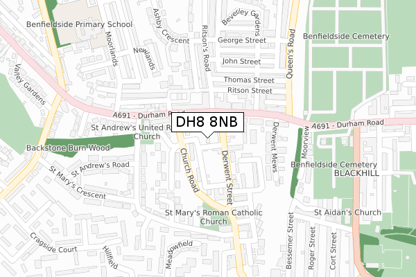
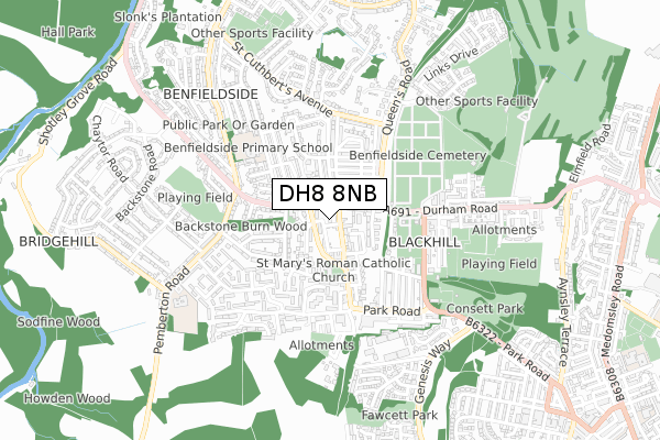
DH8 8NB is located in the Consett North electoral ward, within the unitary authority of County Durham and the English Parliamentary constituency of North West Durham. The Sub Integrated Care Board (ICB) Location is NHS North East and North Cumbria ICB - 84H and the police force is Durham. This postcode has been in use since September 2019.


GetTheData
Source: OS Open Zoomstack (Ordnance Survey)
Licence: Open Government Licence (requires attribution)
Attribution: Contains OS data © Crown copyright and database right 2024
Source: Open Postcode Geo
Licence: Open Government Licence (requires attribution)
Attribution: Contains OS data © Crown copyright and database right 2024; Contains Royal Mail data © Royal Mail copyright and database right 2024; Source: Office for National Statistics licensed under the Open Government Licence v.3.0
| Easting | 409804 |
| Northing | 551751 |
| Latitude | 54.860460 |
| Longitude | -1.848808 |
GetTheData
Source: Open Postcode Geo
Licence: Open Government Licence
| Country | England |
| Postcode District | DH8 |
| ➜ DH8 open data dashboard ➜ See where DH8 is on a map ➜ Where is Consett? | |
GetTheData
Source: Land Registry Price Paid Data
Licence: Open Government Licence
| Ward | Consett North |
| Constituency | North West Durham |
GetTheData
Source: ONS Postcode Database
Licence: Open Government Licence
| December 2023 | Violence and sexual offences | On or near Culzean Court | 351m |
| November 2023 | Vehicle crime | On or near Parking Area | 61m |
| November 2023 | Anti-social behaviour | On or near Parking Area | 61m |
| ➜ Get more crime data in our Crime section | |||
GetTheData
Source: data.police.uk
Licence: Open Government Licence
| St Andrews Church (A691) | Blackhill | 76m |
| Durham Road (A691) | Blackhill | 89m |
| Celluware Factory (Derwent Street) | Blackhill | 126m |
| St Andrews Church (A691) | Blackhill | 145m |
| Celluware Factory (Church Street) | Blackhill | 147m |
GetTheData
Source: NaPTAN
Licence: Open Government Licence
| Percentage of properties with Next Generation Access | 100.0% |
| Percentage of properties with Superfast Broadband | 100.0% |
| Percentage of properties with Ultrafast Broadband | 0.0% |
| Percentage of properties with Full Fibre Broadband | 0.0% |
Superfast Broadband is between 30Mbps and 300Mbps
Ultrafast Broadband is > 300Mbps
| Percentage of properties unable to receive 2Mbps | 0.0% |
| Percentage of properties unable to receive 5Mbps | 0.0% |
| Percentage of properties unable to receive 10Mbps | 0.0% |
| Percentage of properties unable to receive 30Mbps | 0.0% |
GetTheData
Source: Ofcom
Licence: Ofcom Terms of Use (requires attribution)
GetTheData
Source: ONS Postcode Database
Licence: Open Government Licence


➜ Get more ratings from the Food Standards Agency
GetTheData
Source: Food Standards Agency
Licence: FSA terms & conditions
| Last Collection | |||
|---|---|---|---|
| Location | Mon-Fri | Sat | Distance |
| Queens Road | 16:15 | 12:00 | 426m |
| Barley Mill Road, Bridgehill | 16:00 | 11:45 | 708m |
| St Cuthberts, Benfieldside Road | 16:15 | 12:00 | 838m |
GetTheData
Source: Dracos
Licence: Creative Commons Attribution-ShareAlike
| Facility | Distance |
|---|---|
| Benfieldside Primary School Moorlands, Consett Grass Pitches | 391m |
| Highgate Pemberton Road, Consett Grass Pitches | 454m |
| Consett & District Cricket Club Hope Street, Blackhill Grass Pitches | 585m |
GetTheData
Source: Active Places
Licence: Open Government Licence
| School | Phase of Education | Distance |
|---|---|---|
| Benfieldside Primary School Moorlands, Blackhill, Consett, DH8 0JX | Primary | 375m |
| St Mary's Catholic Primary School, Blackhill Pemberton Road, Blackhill, Consett, DH8 8JD | Primary | 655m |
| Delta Independent School Parliament Street, Consett, DH8 5DH | Not applicable | 1.1km |
GetTheData
Source: Edubase
Licence: Open Government Licence
The below table lists the International Territorial Level (ITL) codes (formerly Nomenclature of Territorial Units for Statistics (NUTS) codes) and Local Administrative Units (LAU) codes for DH8 8NB:
| ITL 1 Code | Name |
|---|---|
| TLC | North East (England) |
| ITL 2 Code | Name |
| TLC1 | Tees Valley and Durham |
| ITL 3 Code | Name |
| TLC14 | Durham |
| LAU 1 Code | Name |
| E06000047 | County Durham |
GetTheData
Source: ONS Postcode Directory
Licence: Open Government Licence
The below table lists the Census Output Area (OA), Lower Layer Super Output Area (LSOA), and Middle Layer Super Output Area (MSOA) for DH8 8NB:
| Code | Name | |
|---|---|---|
| OA | E00104668 | |
| LSOA | E01020631 | County Durham 014B |
| MSOA | E02004305 | County Durham 014 |
GetTheData
Source: ONS Postcode Directory
Licence: Open Government Licence
| DH8 8LU | Derwent Street | 33m |
| DH8 8RX | Durham Road | 49m |
| DH8 8NT | Church Road | 52m |
| DH8 8RR | Durham Road | 88m |
| DH8 8PX | St Andrews Close | 100m |
| DH8 0BA | 104m | |
| DH8 8LR | Derwent Street | 106m |
| DH8 0AR | Ritson Street | 111m |
| DH8 8NP | Durham Road | 114m |
| DH8 8PW | Bellswood Court | 115m |
GetTheData
Source: Open Postcode Geo; Land Registry Price Paid Data
Licence: Open Government Licence