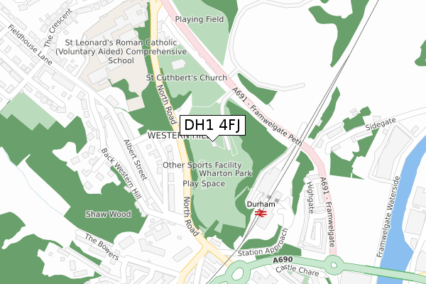
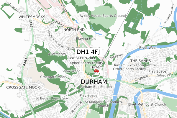
DH1 4FJ is located in the Elvet and Gilesgate electoral ward, within the unitary authority of County Durham and the English Parliamentary constituency of City of Durham. The Sub Integrated Care Board (ICB) Location is NHS North East and North Cumbria ICB - 84H and the police force is Durham. This postcode has been in use since January 2018.


GetTheData
Source: OS Open Zoomstack (Ordnance Survey)
Licence: Open Government Licence (requires attribution)
Attribution: Contains OS data © Crown copyright and database right 2024
Source: Open Postcode Geo
Licence: Open Government Licence (requires attribution)
Attribution: Contains OS data © Crown copyright and database right 2024; Contains Royal Mail data © Royal Mail copyright and database right 2024; Source: Office for National Statistics licensed under the Open Government Licence v.3.0
| Easting | 426869 |
| Northing | 542949 |
| Latitude | 54.780744 |
| Longitude | -1.583785 |
GetTheData
Source: Open Postcode Geo
Licence: Open Government Licence
| Country | England |
| Postcode District | DH1 |
| ➜ DH1 open data dashboard ➜ See where DH1 is on a map ➜ Where is Durham? | |
GetTheData
Source: Land Registry Price Paid Data
Licence: Open Government Licence
| Ward | Elvet And Gilesgate |
| Constituency | City Of Durham |
GetTheData
Source: ONS Postcode Database
Licence: Open Government Licence
| January 2024 | Violence and sexual offences | On or near The Crescent | 441m |
| January 2024 | Anti-social behaviour | On or near Parking Area | 490m |
| January 2024 | Criminal damage and arson | On or near Parking Area | 490m |
| ➜ Get more crime data in our Crime section | |||
GetTheData
Source: data.police.uk
Licence: Open Government Licence
| County Hospital - North Road (North Road) | Durham | 75m |
| County Hospital - North Road (North Road) | Durham | 217m |
| Railway Station Bus Stop (Station Approach) | Durham | 233m |
| St Leonards School (North Road) | Durham | 268m |
| County Hospital - Sutton Street (Sutton Street) | Durham | 278m |
| Durham Station | 0.2km |
GetTheData
Source: NaPTAN
Licence: Open Government Licence
GetTheData
Source: ONS Postcode Database
Licence: Open Government Licence


➜ Get more ratings from the Food Standards Agency
GetTheData
Source: Food Standards Agency
Licence: FSA terms & conditions
| Last Collection | |||
|---|---|---|---|
| Location | Mon-Fri | Sat | Distance |
| Western Hill | 17:30 | 12:00 | 191m |
| Durham Station | 17:00 | 12:00 | 207m |
| Flass Street | 17:15 | 12:00 | 335m |
GetTheData
Source: Dracos
Licence: Creative Commons Attribution-ShareAlike
| Facility | Distance |
|---|---|
| St Leonards Catholic School Football Pitch Framwelgate Peth, Durham Grass Pitches | 287m |
| St Leonard's Catholic School North End, Durham Health and Fitness Gym, Sports Hall | 365m |
| Pace Health Club (Durham) Frankland Lane, Durham Health and Fitness Gym, Swimming Pool | 420m |
GetTheData
Source: Active Places
Licence: Open Government Licence
| School | Phase of Education | Distance |
|---|---|---|
| St Leonard's Catholic School, Durham North End, Durham, DH1 4NG | Secondary | 365m |
| Durham Sixth Form Centre Providence Row, The Sands, Durham, DH1 1SG | 16 plus | 687m |
| The Independent Grammar School:Durham Claypath, Durham, DH1 1RH | Not applicable | 742m |
GetTheData
Source: Edubase
Licence: Open Government Licence
The below table lists the International Territorial Level (ITL) codes (formerly Nomenclature of Territorial Units for Statistics (NUTS) codes) and Local Administrative Units (LAU) codes for DH1 4FJ:
| ITL 1 Code | Name |
|---|---|
| TLC | North East (England) |
| ITL 2 Code | Name |
| TLC1 | Tees Valley and Durham |
| ITL 3 Code | Name |
| TLC14 | Durham |
| LAU 1 Code | Name |
| E06000047 | County Durham |
GetTheData
Source: ONS Postcode Directory
Licence: Open Government Licence
The below table lists the Census Output Area (OA), Lower Layer Super Output Area (LSOA), and Middle Layer Super Output Area (MSOA) for DH1 4FJ:
| Code | Name | |
|---|---|---|
| OA | E00105060 | |
| LSOA | E01020702 | County Durham 033B |
| MSOA | E02004315 | County Durham 033 |
GetTheData
Source: ONS Postcode Directory
Licence: Open Government Licence
| DH1 4RR | North Road | 88m |
| DH1 4UF | North Road | 96m |
| DH1 4RP | Princes Street | 133m |
| DH1 4RW | Victoria Terrace | 162m |
| DH1 4RJ | Albert Street | 168m |
| DH1 4RL | Albert Street | 196m |
| DH1 4RN | West Terrace | 202m |
| DH1 4RE | Parkside | 239m |
| DH1 4RG | Back Western Hill | 252m |
| DH1 4NH | St Leonards | 255m |
GetTheData
Source: Open Postcode Geo; Land Registry Price Paid Data
Licence: Open Government Licence