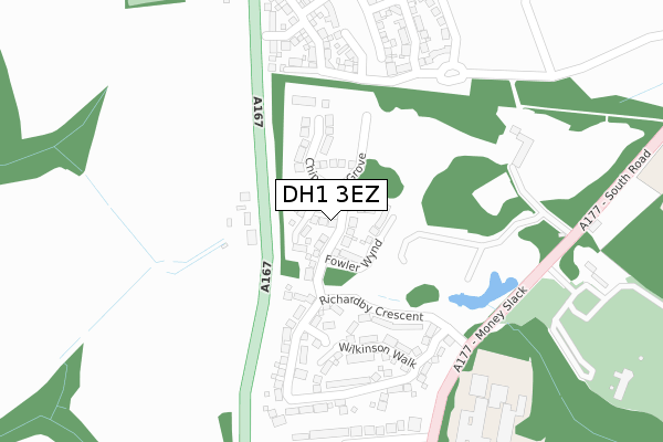
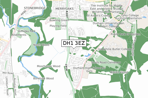
DH1 3EZ is located in the Neville's Cross electoral ward, within the unitary authority of County Durham and the English Parliamentary constituency of City of Durham. The Sub Integrated Care Board (ICB) Location is NHS North East and North Cumbria ICB - 84H and the police force is Durham. This postcode has been in use since February 2019.


GetTheData
Source: OS Open Zoomstack (Ordnance Survey)
Licence: Open Government Licence (requires attribution)
Attribution: Contains OS data © Crown copyright and database right 2024
Source: Open Postcode Geo
Licence: Open Government Licence (requires attribution)
Attribution: Contains OS data © Crown copyright and database right 2024; Contains Royal Mail data © Royal Mail copyright and database right 2024; Source: Office for National Statistics licensed under the Open Government Licence v.3.0
| Easting | 426472 |
| Northing | 540522 |
| Latitude | 54.758956 |
| Longitude | -1.590177 |
GetTheData
Source: Open Postcode Geo
Licence: Open Government Licence
| Country | England |
| Postcode District | DH1 |
| ➜ DH1 open data dashboard ➜ See where DH1 is on a map ➜ Where is Durham? | |
GetTheData
Source: Land Registry Price Paid Data
Licence: Open Government Licence
| Ward | Neville's Cross |
| Constituency | City Of Durham |
GetTheData
Source: ONS Postcode Database
Licence: Open Government Licence
2023 31 JAN £410,000 |
2022 6 JAN £565,000 |
2021 29 OCT £485,000 |
17, FOWLER WYND, DURHAM, DH1 3EZ 2021 17 MAY £412,995 |
2020 31 JUL £368,000 |
1, FOWLER WYND, DURHAM, DH1 3EZ 2020 19 JUN £504,995 |
12, FOWLER WYND, DURHAM, DH1 3EZ 2020 28 FEB £499,995 |
2, FOWLER WYND, DURHAM, DH1 3EZ 2019 31 OCT £389,995 |
2019 23 SEP £499,995 |
19, FOWLER WYND, DURHAM, DH1 3EZ 2019 13 SEP £359,995 |
GetTheData
Source: HM Land Registry Price Paid Data
Licence: Contains HM Land Registry data © Crown copyright and database right 2024. This data is licensed under the Open Government Licence v3.0.
| June 2022 | Violence and sexual offences | On or near Blaidwood Drive | 377m |
| June 2022 | Criminal damage and arson | On or near Blaidwood Drive | 377m |
| May 2022 | Criminal damage and arson | On or near Cedar Drive | 400m |
| ➜ Get more crime data in our Crime section | |||
GetTheData
Source: data.police.uk
Licence: Open Government Licence
| Elvet Moor Farm (A167) | Durham | 163m |
| Elvet Moor Farm (A167) | Durham | 182m |
| Mount Oswald (A177 South Road) | Durham | 281m |
| High School (A177 South Road) | Durham | 338m |
| High School (A177 South Road) | Durham | 405m |
| Durham Station | 2.3km |
GetTheData
Source: NaPTAN
Licence: Open Government Licence
| Percentage of properties with Next Generation Access | 100.0% |
| Percentage of properties with Superfast Broadband | 94.4% |
| Percentage of properties with Ultrafast Broadband | 94.4% |
| Percentage of properties with Full Fibre Broadband | 94.4% |
Superfast Broadband is between 30Mbps and 300Mbps
Ultrafast Broadband is > 300Mbps
| Percentage of properties unable to receive 2Mbps | 0.0% |
| Percentage of properties unable to receive 5Mbps | 0.0% |
| Percentage of properties unable to receive 10Mbps | 0.0% |
| Percentage of properties unable to receive 30Mbps | 5.6% |
GetTheData
Source: Ofcom
Licence: Ofcom Terms of Use (requires attribution)
GetTheData
Source: ONS Postcode Database
Licence: Open Government Licence


➜ Get more ratings from the Food Standards Agency
GetTheData
Source: Food Standards Agency
Licence: FSA terms & conditions
| Last Collection | |||
|---|---|---|---|
| Location | Mon-Fri | Sat | Distance |
| St Oswalds Drive | 16:15 | 10:15 | 323m |
| Park House Road | 17:15 | 11:30 | 629m |
| Dickens Wynd | 17:15 | 12:00 | 640m |
GetTheData
Source: Dracos
Licence: Creative Commons Attribution-ShareAlike
| Facility | Distance |
|---|---|
| Mount Oswald Manor Golf Course (Closed) South Road, Durham Golf | 301m |
| Durham High School For Girls South Road, Durham Sports Hall, Grass Pitches, Studio, Artificial Grass Pitch | 348m |
| Lowes Barn Park Deyncourt, Durham Grass Pitches | 528m |
GetTheData
Source: Active Places
Licence: Open Government Licence
| School | Phase of Education | Distance |
|---|---|---|
| Durham High School for Girls Farewell Hall, South Road, Durham, DH1 3TB | Not applicable | 348m |
| Langley Moor Primary School Brandon Lane, Langley Moor, Durham, DH7 8LL | Primary | 1.3km |
| Langley Moor Nursery School Brandon Lane, Langley Moor, Durham, DH7 8LL | Nursery | 1.4km |
GetTheData
Source: Edubase
Licence: Open Government Licence
The below table lists the International Territorial Level (ITL) codes (formerly Nomenclature of Territorial Units for Statistics (NUTS) codes) and Local Administrative Units (LAU) codes for DH1 3EZ:
| ITL 1 Code | Name |
|---|---|
| TLC | North East (England) |
| ITL 2 Code | Name |
| TLC1 | Tees Valley and Durham |
| ITL 3 Code | Name |
| TLC14 | Durham |
| LAU 1 Code | Name |
| E06000047 | County Durham |
GetTheData
Source: ONS Postcode Directory
Licence: Open Government Licence
The below table lists the Census Output Area (OA), Lower Layer Super Output Area (LSOA), and Middle Layer Super Output Area (MSOA) for DH1 3EZ:
| Code | Name | |
|---|---|---|
| OA | E00105105 | |
| LSOA | E01020713 | County Durham 033E |
| MSOA | E02004315 | County Durham 033 |
GetTheData
Source: ONS Postcode Directory
Licence: Open Government Licence
| DH1 3UX | Wilkinson Walk | 182m |
| DH1 3TY | Richardby Crescent | 218m |
| DH1 3TE | St Oswalds Drive | 294m |
| DH1 3TF | Cedar Drive | 402m |
| DH1 3TD | Blaidwood Drive | 428m |
| DH1 3QB | Deyncourt | 463m |
| DH1 3PU | Douglas Gardens | 482m |
| DH1 3QD | Kings Grove | 491m |
| DH1 3QE | Rokeby Square | 547m |
| DH1 3QX | Nickleby Chare | 569m |
GetTheData
Source: Open Postcode Geo; Land Registry Price Paid Data
Licence: Open Government Licence